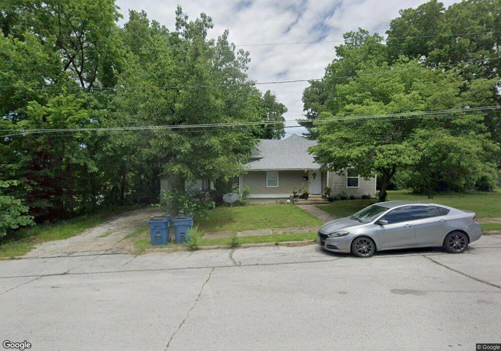
1111 Poplar St Carthage, MO 64836
Estimated Value: $104,057 - $146,000
3
Beds
1
Bath
1,200
Sq Ft
$110/Sq Ft
Est. Value
About This Home
This home is located at 1111 Poplar St, Carthage, MO 64836 and is currently estimated at $131,764, approximately $109 per square foot. 1111 Poplar St is a home located in Jasper County with nearby schools including Carthage High School, Victory Academy, and St. Ann's Catholic School.
Ownership History
Date
Name
Owned For
Owner Type
Purchase Details
Closed on
Aug 28, 2006
Sold by
Aegis Mortgage Corp
Bought by
Johnson Todd and Johnson Linda Ann
Current Estimated Value
Purchase Details
Closed on
Jun 23, 2006
Sold by
Welch Leroy Bruce
Bought by
Aegis Mortgage Corp
Purchase Details
Closed on
Jan 20, 2005
Sold by
Welch Leroy Bruce and White Pamela Sue
Bought by
Welch Leroy Bruce
Purchase Details
Closed on
Jan 6, 2005
Sold by
Welch Leroy Bruce and White Pamela Sue
Bought by
Welch Leroy Bruce
Purchase Details
Closed on
Dec 7, 2004
Sold by
Welch Leroy Bruce
Bought by
Snowballs Trust
Create a Home Valuation Report for This Property
The Home Valuation Report is an in-depth analysis detailing your home's value as well as a comparison with similar homes in the area
Home Values in the Area
Average Home Value in this Area
Purchase History
| Date | Buyer | Sale Price | Title Company |
|---|---|---|---|
| Johnson Todd | -- | Fatco | |
| Aegis Mortgage Corp | $44,527 | None Available | |
| Welch Leroy Bruce | -- | -- | |
| Welch Leroy Bruce | -- | -- | |
| Welch Leroy Bruce | -- | -- | |
| Snowballs Trust | -- | -- |
Source: Public Records
Tax History
| Year | Tax Paid | Tax Assessment Tax Assessment Total Assessment is a certain percentage of the fair market value that is determined by local assessors to be the total taxable value of land and additions on the property. | Land | Improvement |
|---|---|---|---|---|
| 2025 | $556 | $12,170 | $1,540 | $10,630 |
| 2024 | $556 | $10,800 | $1,540 | $9,260 |
| 2023 | $556 | $10,800 | $1,540 | $9,260 |
| 2022 | $543 | $10,580 | $1,540 | $9,040 |
| 2021 | $537 | $10,580 | $1,540 | $9,040 |
| 2020 | $425 | $8,030 | $1,540 | $6,490 |
| 2019 | $426 | $8,030 | $1,540 | $6,490 |
| 2018 | $425 | $8,030 | $0 | $0 |
| 2016 | $425 | $8,030 | $0 | $0 |
Source: Public Records
Map
Nearby Homes
- 827 W Chestnut St
- 1101 Oak St
- 1018 Olive St
- 802 Oak St
- 1107 Ash St
- 1143 S Case St
- 431 S Orner St
- 1206 Douglas Ct
- 1324 W Central Ave
- 514 Poplar St
- 714 Pine St
- 424 Walnut St
- 703 W Central Tract 2
- 1615 W Budlong St
- 831 Rombauer Ave
- 1500 Robertson Ave
- 1112 S Garrison Ave
- 1135 S Maple St
- 1131 Lyon St
- 414 Pine St
- 1039 Poplar St
- 1106 W Chestnut St
- 1102 W Chestnut St
- 1100 Poplar St
- 1038 W Chestnut St
- 1035 Poplar St
- 1106 Poplar St
- 1034 W Chestnut St
- 1122 Poplar St
- 1031 Poplar St
- 1030 W Chestnut St
- 1101 W Chestnut St
- 1101 W Chestnut St Unit 2
- 1128 Poplar St
- 1032 Poplar St
- 1109 W Chestnut St
- 1101 Center St
- 1021 Poplar St
- 1026 Poplar St
- 1024 W Chestnut St
Your Personal Tour Guide
Ask me questions while you tour the home.