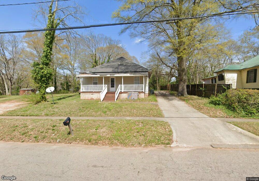
1111 Troup St Lagrange, GA 30240
Estimated Value: $38,071 - $164,000
4
Beds
3
Baths
1,909
Sq Ft
$52/Sq Ft
Est. Value
About This Home
This home is located at 1111 Troup St, Lagrange, GA 30240 and is currently estimated at $99,018, approximately $51 per square foot. 1111 Troup St is a home located in Troup County with nearby schools including Berta Weathersbee Elementary School, Whitesville Road Elementary School, and Rosemont Elementary School.
Ownership History
Date
Name
Owned For
Owner Type
Purchase Details
Closed on
Jun 5, 2018
Sold by
Integrity First Llc
Bought by
Blue Green Properties Llc
Current Estimated Value
Purchase Details
Closed on
Apr 4, 2003
Sold by
Greyfeild Resources
Bought by
Integrity First Llc
Purchase Details
Closed on
Oct 28, 1998
Sold by
Viola Myhand
Bought by
Greyfeild Resources
Purchase Details
Closed on
Oct 9, 1996
Sold by
Myhand
Bought by
Viola Myhand
Purchase Details
Closed on
Aug 2, 1982
Bought by
Myhand
Purchase Details
Closed on
Sep 1, 1981
Purchase Details
Closed on
Jan 1, 1972
Purchase Details
Closed on
Jan 1, 1955
Create a Home Valuation Report for This Property
The Home Valuation Report is an in-depth analysis detailing your home's value as well as a comparison with similar homes in the area
Purchase History
| Date | Buyer | Sale Price | Title Company |
|---|---|---|---|
| Blue Green Properties Llc | $19,900 | -- | |
| Integrity First Llc | $7,500 | -- | |
| Greyfeild Resources | -- | -- | |
| Viola Myhand | -- | -- | |
| Myhand | -- | -- | |
| -- | -- | -- | |
| -- | $4,500 | -- | |
| -- | -- | -- |
Source: Public Records
Tax History
| Year | Tax Paid | Tax Assessment Tax Assessment Total Assessment is a certain percentage of the fair market value that is determined by local assessors to be the total taxable value of land and additions on the property. | Land | Improvement |
|---|---|---|---|---|
| 2025 | $1,299 | $47,640 | $2,320 | $45,320 |
| 2024 | $1,035 | $37,960 | $2,320 | $35,640 |
| 2023 | $996 | $36,520 | $2,320 | $34,200 |
| 2022 | $940 | $33,680 | $2,320 | $31,360 |
| 2021 | $851 | $28,200 | $2,320 | $25,880 |
| 2020 | $702 | $23,280 | $2,720 | $20,560 |
| 2019 | $783 | $25,960 | $2,320 | $23,640 |
| 2018 | $785 | $26,020 | $2,380 | $23,640 |
| 2017 | $785 | $26,020 | $2,380 | $23,640 |
| 2016 | $760 | $25,203 | $2,380 | $22,823 |
| 2015 | $795 | $26,308 | $2,308 | $24,000 |
| 2014 | $796 | $26,308 | $2,308 | $24,000 |
| 2013 | -- | $26,308 | $2,308 | $24,000 |
Source: Public Records
Map
Nearby Homes
- 1308 Forrest Ave
- 205 Grady St
- 1304 Forrest Ave
- 1405 Forrest Ave
- 1402 Forrest Ave
- 1520 Brownwood Ave
- 1808 Murphy Ave
- 900 B N Pkwy
- 109 Garfield St
- 102 Crown St Unit LOT 1
- 101 Crown St Unit LOT 5
- 1308 Park Ave
- 202 Parker Ln
- 1205 Park Ave
- 610 Wilburn Ave
- 608 Wilburn Ave
- 1311 Juniper St
- 517 Jefferson St
- 1300 Murphy Ave
- 812 Elm St
Your Personal Tour Guide
Ask me questions while you tour the home.