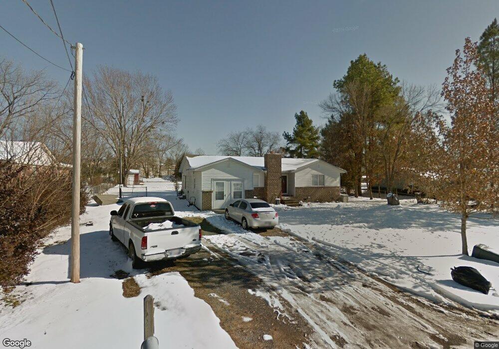
1111 Turpin Ln Tahlequah, OK 74464
Estimated Value: $154,971 - $197,000
3
Beds
2
Baths
1,348
Sq Ft
$134/Sq Ft
Est. Value
About This Home
This home is located at 1111 Turpin Ln, Tahlequah, OK 74464 and is currently estimated at $180,243, approximately $133 per square foot. 1111 Turpin Ln is a home located in Cherokee County with nearby schools including Greenwood Elementary School, Cherokee Elementary School, and Tahlequah Middle School.
Ownership History
Date
Name
Owned For
Owner Type
Purchase Details
Closed on
Nov 2, 2018
Sold by
Carey Katherine
Bought by
Dirteater Randy and Dirteater Ryan
Current Estimated Value
Home Financials for this Owner
Home Financials are based on the most recent Mortgage that was taken out on this home.
Original Mortgage
$47,807
Interest Rate
6%
Mortgage Type
Future Advance Clause Open End Mortgage
Purchase Details
Closed on
May 18, 2011
Sold by
Secretary Of Hsng And Urban Development
Bought by
Carey Katherine
Create a Home Valuation Report for This Property
The Home Valuation Report is an in-depth analysis detailing your home's value as well as a comparison with similar homes in the area
Home Values in the Area
Average Home Value in this Area
Purchase History
| Date | Buyer | Sale Price | Title Company |
|---|---|---|---|
| Dirteater Randy | $45,000 | Green Country Abstract And T | |
| Carey Katherine | -- | Heartland Title And Closing |
Source: Public Records
Mortgage History
| Date | Status | Borrower | Loan Amount |
|---|---|---|---|
| Closed | Dirteater Randy | $47,807 |
Source: Public Records
Tax History Compared to Growth
Tax History
| Year | Tax Paid | Tax Assessment Tax Assessment Total Assessment is a certain percentage of the fair market value that is determined by local assessors to be the total taxable value of land and additions on the property. | Land | Improvement |
|---|---|---|---|---|
| 2025 | $493 | $5,457 | $1,375 | $4,082 |
| 2024 | $493 | $5,198 | $1,375 | $3,823 |
| 2023 | $493 | $4,950 | $1,375 | $3,575 |
| 2022 | $459 | $4,950 | $1,375 | $3,575 |
| 2021 | $461 | $4,950 | $1,375 | $3,575 |
| 2020 | $469 | $4,950 | $1,375 | $3,575 |
| 2019 | $465 | $4,950 | $1,375 | $3,575 |
| 2018 | $364 | $4,830 | $1,375 | $3,455 |
| 2017 | $350 | $4,690 | $1,375 | $3,315 |
| 2016 | $339 | $4,553 | $1,375 | $3,178 |
| 2015 | $218 | $4,421 | $1,375 | $3,046 |
| 2014 | $218 | $3,319 | $227 | $3,092 |
Source: Public Records
Map
Nearby Homes
- TBD W Fox St
- Tbd Unit West Fox Street Tahl
- 1104 Chase Ave
- 1025 W Fox St
- 1700 Stickross Mountain Rd
- 509 W 2nd St
- 902 S Mission Ave
- 1500 Stickross Mountain Rd
- 516 W Fox St
- 813 W Choctaw St
- 807 W Choctaw St
- 513 S State Ave
- 1871 Stickross Mountain Rd
- 802 S College Ave
- 821 S College Ave
- 0 W Choctaw St
- 510 S Cherokee Ave
- 811 Winsor Place
- 761 Winsor Place
- 777 Winsor Place