11111 Frontier Rd Camden, MI 49232
Estimated Value: $57,298 - $138,000
--
Bed
1
Bath
1,006
Sq Ft
$87/Sq Ft
Est. Value
About This Home
This home is located at 11111 Frontier Rd, Camden, MI 49232 and is currently estimated at $87,325, approximately $86 per square foot. 11111 Frontier Rd is a home with nearby schools including Camden-Frontier K-8 School and Camden-Frontier High School.
Ownership History
Date
Name
Owned For
Owner Type
Purchase Details
Closed on
Jan 3, 2008
Sold by
The Charles O Schmucker Trust
Bought by
Wyse Ned and Wyse Debra
Current Estimated Value
Purchase Details
Closed on
Jul 11, 1997
Sold by
Schmucker Charles O and Mary Ann
Bought by
Schmucker, Charles O & Mary Ann Tr
Purchase Details
Closed on
Apr 26, 1995
Sold by
Schmucker Mary Ann
Bought by
Schmucker Charles and Mary Ann
Purchase Details
Closed on
Apr 10, 1995
Sold by
Curth Mary Edna
Bought by
Schmucker Mary Ann
Purchase Details
Closed on
Mar 6, 1990
Sold by
Curth Mary Edna
Bought by
Curth Mary Edna and Schmucker Mary A
Create a Home Valuation Report for This Property
The Home Valuation Report is an in-depth analysis detailing your home's value as well as a comparison with similar homes in the area
Home Values in the Area
Average Home Value in this Area
Purchase History
| Date | Buyer | Sale Price | Title Company |
|---|---|---|---|
| Wyse Ned | $30,000 | None Available | |
| Schmucker, Charles O & Mary Ann Tr | -- | -- | |
| Schmucker Charles | -- | -- | |
| Schmucker Mary Ann | -- | -- | |
| Curth Mary Edna | -- | -- |
Source: Public Records
Tax History Compared to Growth
Tax History
| Year | Tax Paid | Tax Assessment Tax Assessment Total Assessment is a certain percentage of the fair market value that is determined by local assessors to be the total taxable value of land and additions on the property. | Land | Improvement |
|---|---|---|---|---|
| 2025 | $88 | $6,500 | $0 | $0 |
| 2024 | $20 | $5,600 | $0 | $0 |
| 2023 | $565 | $5,000 | $0 | $0 |
| 2022 | $545 | $17,900 | $0 | $0 |
| 2021 | $545 | $15,600 | $0 | $0 |
| 2020 | $260 | $15,100 | $0 | $0 |
| 2019 | $523 | $17,600 | $0 | $0 |
| 2018 | $506 | $15,400 | $0 | $0 |
| 2017 | $480 | $15,800 | $0 | $0 |
| 2016 | $475 | $12,500 | $0 | $0 |
| 2015 | $129 | $12,500 | $0 | $0 |
| 2013 | -- | $11,990 | $0 | $0 |
| 2012 | $122 | $11,180 | $0 | $0 |
Source: Public Records
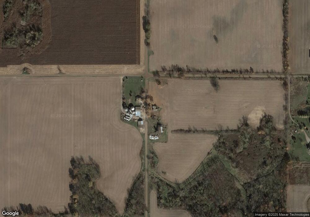
Map
Nearby Homes
- 11794 Clark Rd
- 9791 S Hillsdale Rd
- 5311 E Burt Rd
- 12471 Crampton Rd
- 1687 Dimmers Rd
- 0 Crampton Rd Unit 25049757
- 13551 Hillsdale Rd
- 0 V L Dimmers Rd
- 13791 E Diane Dr
- 13857 E Diane Dr
- 14165 Crampton Rd
- 7400 S Hillsdale Rd
- 4002 & 4014 Meadowlawn Dr
- 14600 W Diane Dr
- 14621 Laura Ln
- 14401 Woodbridge Rd
- 4324 Oak Glen Dr
- 14667 Roberts Ct
- 4610 Wynnewood Dr
- 7410 Cambria Rd
- 0 Frontier Rd
- 1711 E Burt Rd
- 2261 E Burt Rd
- 2260 E Burt Rd
- 2331 E Burt Rd
- 11340 Frontier Rd
- 11080 Frontier Rd
- 10651 Frontier Rd
- 1551 E Burt Rd
- 0 E Burt Rd
- 11250 Clark Rd
- 11300 Clark Rd
- 11438 Clark Rd
- 1311 E Burt Rd
- 10800 Clark Rd
- 11200 Clark Rd
- 0 Clark Rd
- 10900 Clark Rd
- 10489 Frontier Rd
- 11151 Clark Rd