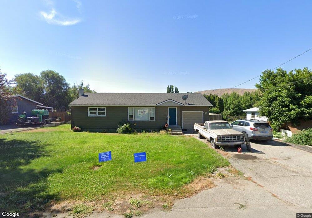
1112 1st St SE East Wenatchee, WA 98802
Estimated Value: $364,430 - $490,000
2
Beds
2
Baths
960
Sq Ft
$441/Sq Ft
Est. Value
About This Home
This home is located at 1112 1st St SE, East Wenatchee, WA 98802 and is currently estimated at $423,608, approximately $441 per square foot. 1112 1st St SE is a home located in Douglas County with nearby schools including Grant Elementary School, Clovis Point Intermediate School, and Eastmont Junior High School.
Ownership History
Date
Name
Owned For
Owner Type
Purchase Details
Closed on
Apr 16, 2007
Sold by
Willingham Susan
Bought by
Port Angela A
Current Estimated Value
Home Financials for this Owner
Home Financials are based on the most recent Mortgage that was taken out on this home.
Original Mortgage
$173,000
Outstanding Balance
$104,312
Interest Rate
6.1%
Mortgage Type
New Conventional
Estimated Equity
$319,296
Create a Home Valuation Report for This Property
The Home Valuation Report is an in-depth analysis detailing your home's value as well as a comparison with similar homes in the area
Home Values in the Area
Average Home Value in this Area
Purchase History
| Date | Buyer | Sale Price | Title Company |
|---|---|---|---|
| Port Angela A | $19,900 | None Available |
Source: Public Records
Mortgage History
| Date | Status | Borrower | Loan Amount |
|---|---|---|---|
| Open | Port Angela A | $173,000 |
Source: Public Records
Tax History Compared to Growth
Tax History
| Year | Tax Paid | Tax Assessment Tax Assessment Total Assessment is a certain percentage of the fair market value that is determined by local assessors to be the total taxable value of land and additions on the property. | Land | Improvement |
|---|---|---|---|---|
| 2025 | $260 | $293,700 | $100,000 | $193,700 |
| 2024 | $2,885 | $325,300 | $100,000 | $225,300 |
| 2023 | $3,107 | $305,400 | $100,000 | $205,400 |
| 2022 | $3,185 | $290,800 | $80,000 | $210,800 |
| 2021 | $3,276 | $290,800 | $80,000 | $210,800 |
| 2020 | $2,986 | $276,000 | $72,000 | $204,000 |
| 2018 | $2,604 | $213,200 | $60,000 | $153,200 |
| 2017 | $2,043 | $213,200 | $60,000 | $153,200 |
| 2016 | $1,850 | $179,500 | $60,000 | $119,500 |
| 2015 | $1,791 | $165,800 | $60,000 | $105,800 |
| 2014 | -- | $153,900 | $60,000 | $93,900 |
| 2013 | -- | $151,200 | $60,000 | $91,200 |
Source: Public Records
Map
Nearby Homes
- 128 N June Ave
- 1598 Tedford St SE
- 182 S Keller Ave
- 211 S Pace Dr Unit 30
- 1102 Carolyn St
- 17 S Lombard Ave
- 322 N Kentucky Ave Unit A&B
- 369 S Kentucky Ave
- 539 S Joseph Ave
- 475 N Kansas Ave
- 582 S Joseph Ave
- 251 Rimrock Way
- 100 Simon St SE Unit 40
- 1548 S Kelvin Ct
- 972 Highline Dr
- 1981 Grant Rd
- 1580 S Kelvin Ct
- 651 S Juli Ave
- 39 Mandolin Ave
- 646 N Gale Place
- 1106 1st St SE
- 1120 1st St SE
- 1113 2nd St SE
- 1115 2nd St SE
- 1130 1st St SE
- 1104 1st St SE
- 1111 1st St SE
- 1111 2nd St SE
- 1115 1st St SE
- 1119 2nd St SE
- 85 S Iowa Ave
- 1127 1st St SE
- 1238 1st St SE
- 1102 1st St SE
- 1109 2nd St SE
- 1123 2nd St SE
- 83 S Iowa Ave
- 1137 1st St SE
- 1110 Tedford St SE
- 107 S Iowa Ave