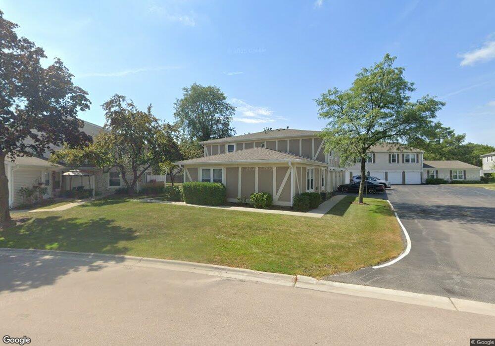
1112 Brunswick Harbor Unit 43 Schaumburg, IL 60193
South Schaumburg NeighborhoodEstimated Value: $240,185 - $263,000
2
Beds
--
Bath
1,000
Sq Ft
$255/Sq Ft
Est. Value
About This Home
This home is located at 1112 Brunswick Harbor Unit 43, Schaumburg, IL 60193 and is currently estimated at $255,296, approximately $255 per square foot. 1112 Brunswick Harbor Unit 43 is a home located in Cook County with nearby schools including Michael Collins Elementary School, Robert Frost Junior High School, and J B Conant High School.
Ownership History
Date
Name
Owned For
Owner Type
Purchase Details
Closed on
May 20, 1994
Sold by
Rainbolt Lisa R and Parwell Lisa R
Bought by
Huege Linda L
Current Estimated Value
Home Financials for this Owner
Home Financials are based on the most recent Mortgage that was taken out on this home.
Original Mortgage
$80,000
Interest Rate
8.58%
Create a Home Valuation Report for This Property
The Home Valuation Report is an in-depth analysis detailing your home's value as well as a comparison with similar homes in the area
Home Values in the Area
Average Home Value in this Area
Purchase History
| Date | Buyer | Sale Price | Title Company |
|---|---|---|---|
| Huege Linda L | $89,500 | -- |
Source: Public Records
Mortgage History
| Date | Status | Borrower | Loan Amount |
|---|---|---|---|
| Closed | Huege Linda L | $80,000 |
Source: Public Records
Tax History Compared to Growth
Tax History
| Year | Tax Paid | Tax Assessment Tax Assessment Total Assessment is a certain percentage of the fair market value that is determined by local assessors to be the total taxable value of land and additions on the property. | Land | Improvement |
|---|---|---|---|---|
| 2024 | $2,695 | $15,590 | $646 | $14,944 |
| 2023 | $2,562 | $15,590 | $646 | $14,944 |
| 2022 | $2,562 | $15,590 | $646 | $14,944 |
| 2021 | $2,388 | $13,874 | $352 | $13,522 |
| 2020 | $2,469 | $13,874 | $352 | $13,522 |
| 2019 | $2,478 | $15,416 | $352 | $15,064 |
| 2018 | $2,253 | $10,944 | $293 | $10,651 |
| 2017 | $2,236 | $10,944 | $293 | $10,651 |
| 2016 | $2,333 | $10,944 | $293 | $10,651 |
| 2015 | $2,010 | $9,341 | $264 | $9,077 |
| 2014 | $2,004 | $9,341 | $264 | $9,077 |
| 2013 | $1,935 | $9,341 | $264 | $9,077 |
Source: Public Records
Map
Nearby Homes
- 286 Nantucket Harbor Unit 601
- 1078 Newport Harbor Unit 6101
- 1100 Boston Harbor Unit 7004
- 1205 Laurel Ln
- 421 E Wise Rd
- 1323 S Roselle Rd
- 731 Highpoint Ct
- 1420 Indian Hill Dr
- 13 W Monterey Ave
- 620 S Point Dr
- 717 Tipperary Ct Unit 1C
- 733 Limerick Ln Unit 7333D
- 712 Tipperary Ct Unit 1C
- 711 Tipperary Ct Unit 2D
- 211 Steeple Bush Ln Unit 10343
- 205 Steeple Bush Ln Unit 10444
- 727 Killarney Ct Unit 2D
- 134 Lunt Ave
- 826 Thornton Ct Unit 2AL
- 629 Derry Ct Unit 1A
- 1116 Brunswick Harbor Unit 43
- 1116 Brunswick Harbor
- 1114 Brunswick Harbor Unit 43
- 1118 Brunswick Harbor Unit 43
- 1119 Brunswick Harbor Unit 44
- 1113 Brunswick Harbor Unit 44
- 1105 Brunswick Harbor Unit 45
- 1115 Brunswick Harbor Unit 44
- 1117 Brunswick Harbor Unit 44
- 1126 Brunswick Harbor Unit 42
- 1120 Brunswick Harbor Unit 42
- 1124 Brunswick Harbor Unit 42
- 1124 Brunswick Harbor Unit 1124
- 1108 Brunswick Harbor Unit 41
- 1122 Brunswick Harbor Unit 42
- 1104 Brunswick Harbor Unit 41
- 1106 Brunswick Harbor Unit 41
- 1110 Brunswick Harbor Unit 41
- 1110 Brunswick Harbor Unit 1110
- 1110 Brunswick Harbor Unit 4101