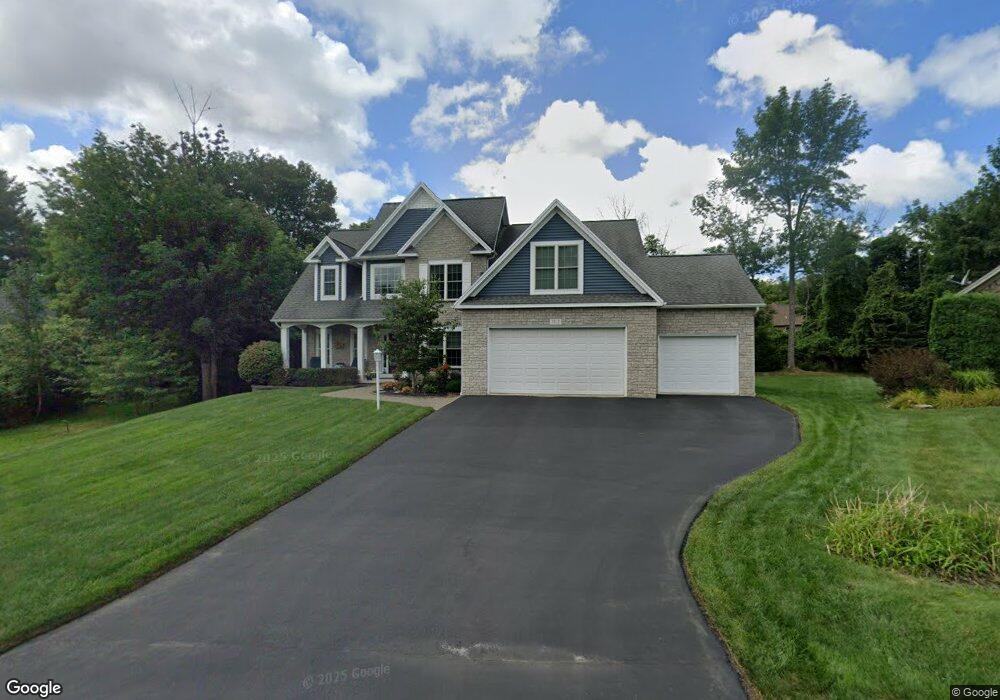
1112 Canopy Trail Webster, NY 14580
Estimated Value: $521,000 - $698,048
3
Beds
3
Baths
3,125
Sq Ft
$208/Sq Ft
Est. Value
About This Home
This home is located at 1112 Canopy Trail, Webster, NY 14580 and is currently estimated at $649,512, approximately $207 per square foot. 1112 Canopy Trail is a home located in Monroe County with nearby schools including Schlegel Road Elementary School, Willink Middle School, and Thomas High School.
Ownership History
Date
Name
Owned For
Owner Type
Purchase Details
Closed on
Dec 16, 2008
Sold by
Krautwurst Brothers Inc
Bought by
Wahl Robert T and Wahl Renee K
Current Estimated Value
Purchase Details
Closed on
Aug 30, 2005
Sold by
Krautwurst Bros Inc
Bought by
Wahl Robert
Home Financials for this Owner
Home Financials are based on the most recent Mortgage that was taken out on this home.
Original Mortgage
$39,000
Interest Rate
5.84%
Mortgage Type
Credit Line Revolving
Create a Home Valuation Report for This Property
The Home Valuation Report is an in-depth analysis detailing your home's value as well as a comparison with similar homes in the area
Home Values in the Area
Average Home Value in this Area
Purchase History
| Date | Buyer | Sale Price | Title Company |
|---|---|---|---|
| Wahl Robert T | -- | None Available | |
| Wahl Robert | $354,575 | Steven Donsky |
Source: Public Records
Mortgage History
| Date | Status | Borrower | Loan Amount |
|---|---|---|---|
| Previous Owner | Wahl Robert | $39,000 |
Source: Public Records
Tax History Compared to Growth
Tax History
| Year | Tax Paid | Tax Assessment Tax Assessment Total Assessment is a certain percentage of the fair market value that is determined by local assessors to be the total taxable value of land and additions on the property. | Land | Improvement |
|---|---|---|---|---|
| 2024 | $15,555 | $342,200 | $32,100 | $310,100 |
| 2023 | $15,112 | $342,200 | $32,100 | $310,100 |
| 2022 | $15,497 | $342,200 | $32,100 | $310,100 |
| 2021 | $15,358 | $342,200 | $32,100 | $310,100 |
| 2020 | $14,509 | $342,200 | $32,100 | $310,100 |
| 2019 | $13,301 | $342,200 | $32,100 | $310,100 |
| 2018 | $13,836 | $342,200 | $32,100 | $310,100 |
| 2017 | $13,190 | $342,200 | $32,100 | $310,100 |
| 2016 | $13,301 | $342,200 | $32,100 | $310,100 |
| 2015 | -- | $342,200 | $32,100 | $310,100 |
| 2014 | -- | $342,200 | $32,100 | $310,100 |
Source: Public Records
Map
Nearby Homes
- 230 Phillips Rd
- 255 Gallant Fox Ln
- 1440 Chigwell Ln N
- 331 Phillips Rd
- 1406 Creeks Edge Dr
- 1404 Creeks Edge Dr
- 1402 Creeks Edge Dr
- 224 Mill Stream Run
- 1202 Lake Point Dr
- 1206 Lake Point Dr
- 357 Coastal View Dr
- 1437 Fieldcrest Dr
- 1435 Water Cress Dr
- 1080 Sagebrook Way
- 441 Thyme Dr
- 242 Woodsview Dr
- 1625 Bridgeboro Dr
- 357 Anna Cir
- 1228 Stockbridge Rd
- Aviano Plan at Aberdeen Estates
- 1110 Canopy Trail
- 1108 Canopy Trail
- 1116 Canopy Trail
- 1390 Silverheel Run
- 1388 Silverheel Run
- 1106 Canopy Trail
- 1104 Canopy Trail
- 1107 Canopy Trail
- 1105 Canopy Trail
- 1386 Silverheel Run
- 1102 Canopy Trail
- 1103 Canopy Trail
- 265 Gallant Fox Ln
- 267 Gallant Fox Ln
- 1109 Canopy Trail
- 269 Gallant Fox Ln
- 1382 Silverheel Run
- 1118 Canopy Trail
- 1100 Canopy Trail
- 1384 Silverheel Run