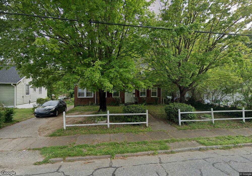
1112 Cedrow Dr High Point, NC 27260
Greater High Point NeighborhoodEstimated Value: $186,000 - $239,000
3
Beds
2
Baths
1,806
Sq Ft
$117/Sq Ft
Est. Value
About This Home
This home is located at 1112 Cedrow Dr, High Point, NC 27260 and is currently estimated at $211,603, approximately $117 per square foot. 1112 Cedrow Dr is a home located in Guilford County with nearby schools including Montlieu Academy of Technology, Welborn Academy of Science & Technology, and T.W. Andrews High School.
Ownership History
Date
Name
Owned For
Owner Type
Purchase Details
Closed on
Oct 3, 2008
Sold by
Residential Funding Real Estate Holdings
Bought by
Cross & Company Inc
Current Estimated Value
Home Financials for this Owner
Home Financials are based on the most recent Mortgage that was taken out on this home.
Original Mortgage
$58,826
Interest Rate
6.45%
Mortgage Type
Purchase Money Mortgage
Purchase Details
Closed on
Sep 30, 2008
Sold by
Residential Funding Company Llc
Bought by
Residential Funding Real Estate Holdings
Home Financials for this Owner
Home Financials are based on the most recent Mortgage that was taken out on this home.
Original Mortgage
$58,826
Interest Rate
6.45%
Mortgage Type
Purchase Money Mortgage
Purchase Details
Closed on
Sep 29, 2008
Sold by
Residential Funding Company Llc
Bought by
Residential Funding Real Estate Holdings
Home Financials for this Owner
Home Financials are based on the most recent Mortgage that was taken out on this home.
Original Mortgage
$58,826
Interest Rate
6.45%
Mortgage Type
Purchase Money Mortgage
Purchase Details
Closed on
Jul 24, 2008
Sold by
Mitchell Catherine
Bought by
Residential Funding Co Llc
Purchase Details
Closed on
Dec 22, 2005
Sold by
T&S Investment Property Inc
Bought by
Mitchell Catherine
Home Financials for this Owner
Home Financials are based on the most recent Mortgage that was taken out on this home.
Original Mortgage
$112,500
Interest Rate
8.39%
Mortgage Type
Fannie Mae Freddie Mac
Purchase Details
Closed on
Sep 12, 2005
Sold by
Household Realty Corp
Bought by
T & S Investment Property Inc
Home Financials for this Owner
Home Financials are based on the most recent Mortgage that was taken out on this home.
Original Mortgage
$78,000
Interest Rate
5.77%
Mortgage Type
Purchase Money Mortgage
Purchase Details
Closed on
Aug 9, 2005
Sold by
Avent Margaret P
Bought by
Household Realty Corp
Home Financials for this Owner
Home Financials are based on the most recent Mortgage that was taken out on this home.
Original Mortgage
$78,000
Interest Rate
5.77%
Mortgage Type
Purchase Money Mortgage
Create a Home Valuation Report for This Property
The Home Valuation Report is an in-depth analysis detailing your home's value as well as a comparison with similar homes in the area
Home Values in the Area
Average Home Value in this Area
Purchase History
| Date | Buyer | Sale Price | Title Company |
|---|---|---|---|
| Cross & Company Inc | $57,000 | None Available | |
| Residential Funding Real Estate Holdings | -- | None Available | |
| Residential Funding Real Estate Holdings | -- | None Available | |
| Residential Funding Co Llc | $50,400 | None Available | |
| Mitchell Catherine | $125,000 | None Available | |
| T & S Investment Property Inc | $60,000 | None Available | |
| Household Realty Corp | $46,448 | None Available |
Source: Public Records
Mortgage History
| Date | Status | Borrower | Loan Amount |
|---|---|---|---|
| Previous Owner | Cross & Company Inc | $58,826 | |
| Previous Owner | Mitchell Catherine | $112,500 | |
| Previous Owner | T & S Investment Property Inc | $78,000 |
Source: Public Records
Tax History
| Year | Tax Paid | Tax Assessment Tax Assessment Total Assessment is a certain percentage of the fair market value that is determined by local assessors to be the total taxable value of land and additions on the property. | Land | Improvement |
|---|---|---|---|---|
| 2025 | $1,787 | $129,700 | $18,000 | $111,700 |
| 2024 | $1,787 | $129,700 | $18,000 | $111,700 |
| 2023 | $1,787 | $129,700 | $18,000 | $111,700 |
| 2022 | $1,748 | $129,700 | $18,000 | $111,700 |
| 2021 | $1,192 | $86,500 | $10,000 | $76,500 |
| 2020 | $1,192 | $86,500 | $10,000 | $76,500 |
| 2019 | $1,192 | $86,500 | $0 | $0 |
| 2018 | $1,186 | $86,500 | $0 | $0 |
| 2017 | $1,192 | $86,500 | $0 | $0 |
| 2016 | $1,168 | $83,300 | $0 | $0 |
| 2015 | $1,175 | $83,300 | $0 | $0 |
| 2014 | $1,195 | $83,300 | $0 | $0 |
Source: Public Records
Map
Nearby Homes
- 2209 Gable Way
- 1136 Montlieu Ave
- 1005 Gordon St
- 1007 Gordon St
- 1120 Carolina St
- 1606 Boundary Ave
- 1604 Boundary Ave
- 1602 Boundary Ave
- 1012 Meadowbrook Blvd
- 1508 Boundary Ave
- 828 Circle Dr
- 1707 Brockett Ave
- 1702 Brockett Ave
- 2507 E Lexington Ave
- 1445 Bailey Cir
- 1519 Mcguinn Dr
- 1308 Boundary Ave
- 205 Beach St
- 513 Saunders Place Unit A & B
- 511 Saunders Place Unit A & B
- 1110 Cedrow Dr
- 1114 Cedrow Dr
- 1116 Cedrow Dr
- 1108 Cedrow Dr
- 1113 Dartmouth Ave
- 1111 Dartmouth Ave
- 1109 Dartmouth Ave
- 1118 Cedrow Dr
- 1115 Dartmouth Ave
- 1104 Cedrow Dr
- 1113 Cedrow Dr
- 1111 Cedrow Dr
- 1115 Cedrow Dr
- 1107 Dartmouth Ave
- 1120 Cedrow Dr
- 1109 Cedrow Dr
- 1117 Dartmouth Ave
- 1119 Cedrow Dr
- 1107 Cedrow Dr
- 600 Arlington St
Your Personal Tour Guide
Ask me questions while you tour the home.