Estimated Value: $144,000 - $163,000
3
Beds
1
Bath
1,209
Sq Ft
$124/Sq Ft
Est. Value
About This Home
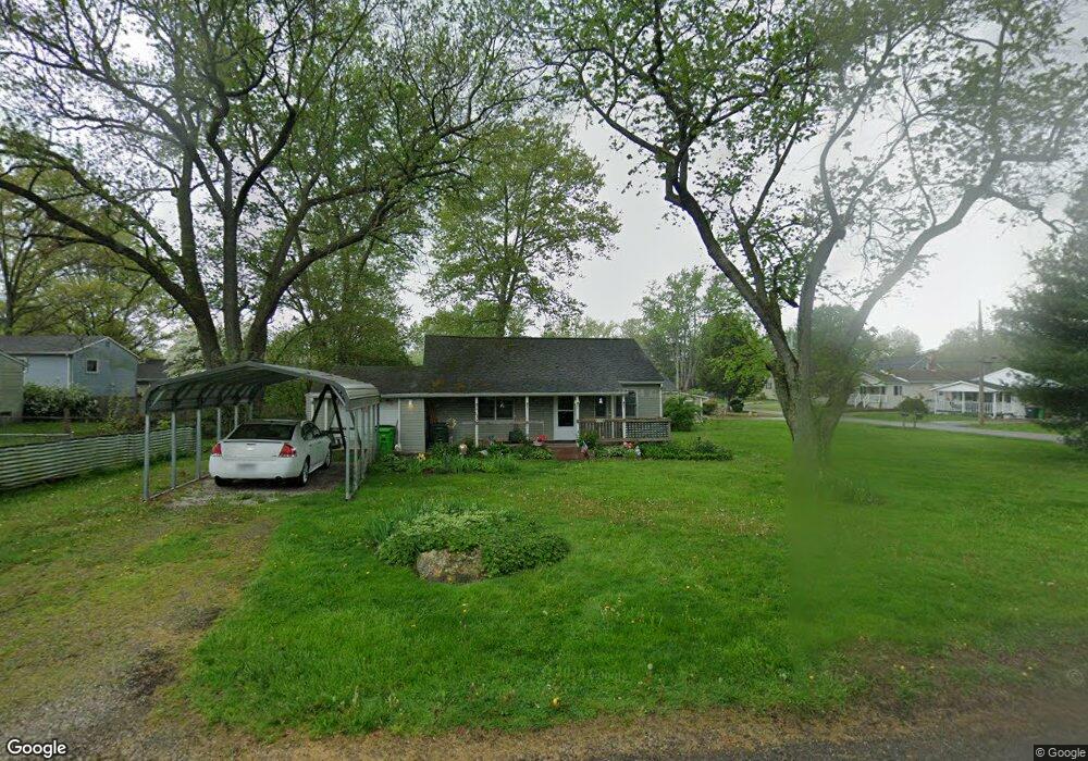
This home is located at 1112 Danforth Rd, Akron, OH 44312 and is currently estimated at $149,766, approximately $123 per square foot. 1112 Danforth Rd is a home located in Summit County with nearby schools including Springfield High School, Summit Academy Akron Elementary School, and Hatton Community Learning Center.
Ownership History
Date
Name
Owned For
Owner Type
Purchase Details
Closed on
Nov 10, 2004
Sold by
Alaska Seaboard Partners Lp
Bought by
Wyatt Greg
Current Estimated Value
Purchase Details
Closed on
Sep 2, 2003
Sold by
Malicoat Perry M
Bought by
Alaska Seaboard Partners Lp
Purchase Details
Closed on
Apr 19, 1999
Sold by
Hammelman Gregory J and Hammelman Cheryl L
Bought by
Malicoat Perry M and Malicoat Kristy L
Home Financials for this Owner
Home Financials are based on the most recent Mortgage that was taken out on this home.
Original Mortgage
$41,600
Interest Rate
7.17%
Create a Home Valuation Report for This Property
The Home Valuation Report is an in-depth analysis detailing your home's value as well as a comparison with similar homes in the area
Home Values in the Area
Average Home Value in this Area
Purchase History
| Date | Buyer | Sale Price | Title Company |
|---|---|---|---|
| Wyatt Greg | $31,000 | Attorneys Title | |
| Alaska Seaboard Partners Lp | $50,000 | -- | |
| Malicoat Perry M | $68,552 | -- |
Source: Public Records
Mortgage History
| Date | Status | Borrower | Loan Amount |
|---|---|---|---|
| Previous Owner | Malicoat Perry M | $41,600 |
Source: Public Records
Tax History
| Year | Tax Paid | Tax Assessment Tax Assessment Total Assessment is a certain percentage of the fair market value that is determined by local assessors to be the total taxable value of land and additions on the property. | Land | Improvement |
|---|---|---|---|---|
| 2024 | $1,790 | $35,767 | $10,486 | $25,281 |
| 2023 | $1,790 | $35,767 | $10,486 | $25,281 |
| 2022 | $1,266 | $22,449 | $6,433 | $16,016 |
| 2021 | $1,278 | $22,449 | $6,433 | $16,016 |
| 2020 | $1,259 | $22,450 | $6,430 | $16,020 |
| 2019 | $1,490 | $24,510 | $6,110 | $18,400 |
| 2018 | $1,468 | $24,510 | $6,110 | $18,400 |
| 2017 | $1,425 | $24,510 | $6,110 | $18,400 |
| 2016 | $1,439 | $22,880 | $6,110 | $16,770 |
| 2015 | $1,425 | $22,880 | $6,110 | $16,770 |
| 2014 | $1,309 | $22,880 | $6,110 | $16,770 |
| 2013 | $1,318 | $22,880 | $6,110 | $16,770 |
Source: Public Records
Map
Nearby Homes
- 2688 Meadow Dr
- 2740 Chelsea Dr
- 2721 Meadow Dr
- 1357 Shanafelt Ave
- 2809 McElwain Rd
- 2643 Monroe St
- 1376 Catherine Avenue Extension
- 2941 Old Home Rd
- 1463 4th St
- 2510 South St
- 2719 Mohican Blvd
- 3068 Somerset Dr Unit 38
- V/L Sanitarium Rd
- 1054 Crestline Dr
- 3194 Castleton Ct
- 1010 Crestline Dr
- 2804 Osage Ave
- 1083 Reeves Ct
- 994 Bookman Ave
- 117 Wilpark Dr
- 2702 Chelsea Dr
- 1130 Danforth Rd
- 2715 Michaels Dr
- 2709 Michaels Dr
- 2720 Chelsea Dr
- 2698 Chelsea Dr
- 2703 Michaels Dr
- 2731 Michaels Dr
- 2701 Chelsea Dr
- 2695 Michaels Dr
- 1100 Danforth Rd
- 11004 Danforth Rd
- 1104 Danforth Rd
- 2688 Chelsea Dr
- 2697 Chelsea Dr
- 2689 Michaels Dr
- 2680 2684 Chelsea Dr
- 2680 Chelsea Dr Unit 2684
- 2693 Chelsea Dr
- 2729 Chelsea Dr
Your Personal Tour Guide
Ask me questions while you tour the home.