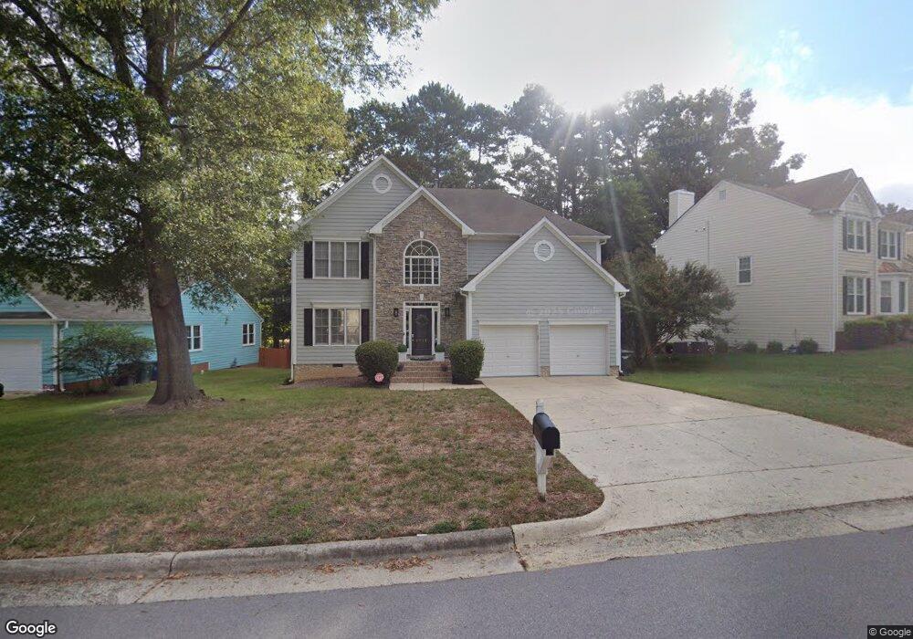
1112 Gunston Ln Durham, NC 27703
Eastern Durham NeighborhoodEstimated Value: $432,000 - $475,000
3
Beds
3
Baths
2,072
Sq Ft
$217/Sq Ft
Est. Value
About This Home
This home is located at 1112 Gunston Ln, Durham, NC 27703 and is currently estimated at $449,318, approximately $216 per square foot. 1112 Gunston Ln is a home located in Durham County with nearby schools including Oak Grove Elementary, John W Neal Middle School, and Southern School of Energy & Sustainability.
Ownership History
Date
Name
Owned For
Owner Type
Purchase Details
Closed on
Jan 31, 2006
Sold by
Blackman Barbara S
Bought by
Wallace Karmisha R
Current Estimated Value
Home Financials for this Owner
Home Financials are based on the most recent Mortgage that was taken out on this home.
Original Mortgage
$175,000
Outstanding Balance
$98,576
Interest Rate
6.21%
Mortgage Type
Fannie Mae Freddie Mac
Estimated Equity
$350,742
Purchase Details
Closed on
Sep 20, 2001
Sold by
Hodakowski Jeffrey M and Hodakowski Christine S
Bought by
Blackman Barbara S
Home Financials for this Owner
Home Financials are based on the most recent Mortgage that was taken out on this home.
Original Mortgage
$143,000
Interest Rate
6.89%
Create a Home Valuation Report for This Property
The Home Valuation Report is an in-depth analysis detailing your home's value as well as a comparison with similar homes in the area
Home Values in the Area
Average Home Value in this Area
Purchase History
| Date | Buyer | Sale Price | Title Company |
|---|---|---|---|
| Wallace Karmisha R | $175,000 | None Available | |
| Blackman Barbara S | $179,000 | -- |
Source: Public Records
Mortgage History
| Date | Status | Borrower | Loan Amount |
|---|---|---|---|
| Open | Wallace Karmisha R | $175,000 | |
| Previous Owner | Blackman Barbara S | $143,000 |
Source: Public Records
Tax History Compared to Growth
Tax History
| Year | Tax Paid | Tax Assessment Tax Assessment Total Assessment is a certain percentage of the fair market value that is determined by local assessors to be the total taxable value of land and additions on the property. | Land | Improvement |
|---|---|---|---|---|
| 2025 | $4,352 | $439,010 | $63,268 | $375,742 |
| 2024 | $3,541 | $253,820 | $46,200 | $207,620 |
| 2023 | $3,325 | $253,820 | $46,200 | $207,620 |
| 2022 | $3,249 | $253,820 | $46,200 | $207,620 |
| 2021 | $3,233 | $253,820 | $46,200 | $207,620 |
| 2020 | $3,157 | $253,820 | $46,200 | $207,620 |
| 2019 | $3,157 | $253,820 | $46,200 | $207,620 |
| 2018 | $2,961 | $218,259 | $33,880 | $184,379 |
| 2017 | $2,939 | $218,259 | $33,880 | $184,379 |
| 2016 | $2,840 | $218,259 | $33,880 | $184,379 |
| 2015 | $2,722 | $196,624 | $36,698 | $159,926 |
| 2014 | $2,722 | $196,624 | $36,698 | $159,926 |
Source: Public Records
Map
Nearby Homes
- 715 Southshore Pkwy
- 615 Southshore Pkwy
- 16 Vestrial Ln
- 128 Leacroft Way
- 537 Crossview Ln
- 503 Bellmeade Bay Dr
- 1 Kings Grant Ct
- 519 Keith St
- 622 Sherron Rd
- 610 Sherron Rd
- 2117 Fletchers Ridge Dr
- 301 Sylvias Ct
- 208 Lick Creek Ln
- 1107 High Fox Dr
- 6 Dawson Ct
- 1104 Constellation Cir
- 1100 Constellation Cir
- 1062 Constellation Cir
- 30 Plumleaf Ln
- 1013 Blackthorn Ln
- 1108 Gunston Ln
- 1116 Gunston Ln
- 1108 Gunstone Ln
- 5 Cameroons Place
- 7 Cameroons Place
- 1104 Gunston Ln
- 1113 Gunston Ln
- 1 Dalidary Ct
- 1115 Gunston Ln
- 1111 Gunston Ln
- 1100 Gunston Ln
- 3 Cameroons Place
- 709 Southshore Pkwy
- 9 Cameroons Place
- 1103 Gunston Ln
- 1101 Nichols Farm Dr
- 711 Southshore Pkwy
- 1 Cameroons Place
- 4 Dalidary Ct
- 2 Lakeridge Cove