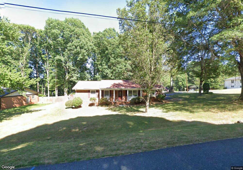
1112 Harvest Cir Asheboro, NC 27203
Estimated Value: $196,446 - $238,000
--
Bed
2
Baths
1,305
Sq Ft
$168/Sq Ft
Est. Value
About This Home
This home is located at 1112 Harvest Cir, Asheboro, NC 27203 and is currently estimated at $219,112, approximately $167 per square foot. 1112 Harvest Cir is a home located in Randolph County with nearby schools including Charles W. McCrary Elementary School, North Asheboro Middle School, and Asheboro High School.
Ownership History
Date
Name
Owned For
Owner Type
Purchase Details
Closed on
Aug 22, 1991
Bought by
Kindschi Stephen R Kindschi Jean
Current Estimated Value
Create a Home Valuation Report for This Property
The Home Valuation Report is an in-depth analysis detailing your home's value as well as a comparison with similar homes in the area
Home Values in the Area
Average Home Value in this Area
Purchase History
| Date | Buyer | Sale Price | Title Company |
|---|---|---|---|
| Kindschi Stephen R Kindschi Jean | $73,000 | -- |
Source: Public Records
Tax History Compared to Growth
Tax History
| Year | Tax Paid | Tax Assessment Tax Assessment Total Assessment is a certain percentage of the fair market value that is determined by local assessors to be the total taxable value of land and additions on the property. | Land | Improvement |
|---|---|---|---|---|
| 2025 | $1,204 | $153,320 | $25,580 | $127,740 |
| 2024 | $1,176 | $153,320 | $25,580 | $127,740 |
| 2023 | $1,176 | $153,320 | $25,580 | $127,740 |
| 2022 | $1,042 | $112,090 | $22,280 | $89,810 |
| 2021 | $1,042 | $112,090 | $22,280 | $89,810 |
| 2020 | $1,025 | $112,090 | $22,280 | $89,810 |
| 2019 | $1,025 | $112,090 | $22,280 | $89,810 |
| 2018 | $866 | $91,940 | $18,980 | $72,960 |
| 2016 | $843 | $91,935 | $18,980 | $72,955 |
| 2015 | $845 | $91,935 | $18,980 | $72,955 |
| 2014 | -- | $89,493 | $20,870 | $68,623 |
Source: Public Records
Map
Nearby Homes
- 0 E Allred St Unit 1125495
- 575 Twain Dr
- 455 Brookwood Dr
- 933 Bay Leaf Ct
- 1249 Eton Ave
- 1650 Meadowbrook Rd
- 00 Hillsdale Dr
- 1319 E Allred St
- 405 Saunders Dr
- 1537 Humble St
- 0 English St
- 443 E Pritchard St
- 307 Old Liberty Rd
- 1356 Ridgewood Cir
- 00 E Presnell St
- 1335 Robins Nest Dr
- 410 Millikan Dr
- 000 W Presnell St
- 0 Robins Nest Dr
- 1646 Johnnys Way Rd
- 1120 Harvest Cir
- 825 E Allred St
- 1107 Harvest Cir
- 1113 Harvest Cir
- 812 E Allred St
- 1019 Ingram Dr
- 1136 Harvest Cir
- 1125 Harvest Cir
- 1349 Keystone Dr
- 1005 Ingram Dr
- 1037 Ingram Dr
- 830 E Allred St
- 1345 Keystone Dr
- 1206 Harvest Cir
- 1328 Keystone Dr
- 733 E Allred St
- 1049 Ingram Dr
- 1335 Keystone Dr
- 840 E Allred St
- 1401 Harvest Cir