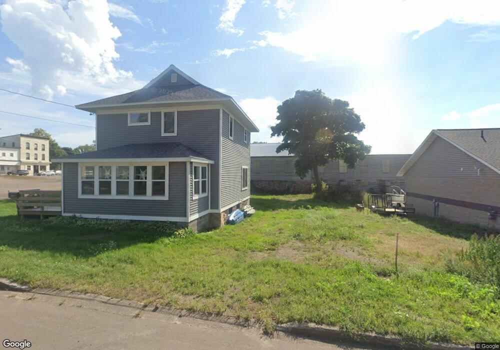
1112 Ingot St Hancock, MI 49930
Estimated Value: $109,615 - $212,000
3
Beds
1
Bath
1,248
Sq Ft
$138/Sq Ft
Est. Value
About This Home
This home is located at 1112 Ingot St, Hancock, MI 49930 and is currently estimated at $172,154, approximately $137 per square foot. 1112 Ingot St is a home located in Houghton County with nearby schools including Barkell Elementary School and Hancock Middle/High School.
Ownership History
Date
Name
Owned For
Owner Type
Purchase Details
Closed on
Dec 30, 2020
Sold by
Superior Sand & Gravel Inc
Bought by
Monticello David P
Current Estimated Value
Home Financials for this Owner
Home Financials are based on the most recent Mortgage that was taken out on this home.
Original Mortgage
$44,000
Outstanding Balance
$39,263
Interest Rate
2.7%
Mortgage Type
Construction
Estimated Equity
$132,891
Purchase Details
Closed on
Nov 6, 1997
Sold by
Ollanketo Laurel
Create a Home Valuation Report for This Property
The Home Valuation Report is an in-depth analysis detailing your home's value as well as a comparison with similar homes in the area
Home Values in the Area
Average Home Value in this Area
Purchase History
| Date | Buyer | Sale Price | Title Company |
|---|---|---|---|
| Monticello David P | $40,000 | Keweenaw Title Agcy | |
| -- | $41,500 | -- |
Source: Public Records
Mortgage History
| Date | Status | Borrower | Loan Amount |
|---|---|---|---|
| Open | Monticello David P | $44,000 |
Source: Public Records
Tax History
| Year | Tax Paid | Tax Assessment Tax Assessment Total Assessment is a certain percentage of the fair market value that is determined by local assessors to be the total taxable value of land and additions on the property. | Land | Improvement |
|---|---|---|---|---|
| 2025 | $1,906 | $48,447 | $0 | $0 |
| 2024 | $18 | $41,897 | $0 | $0 |
| 2023 | $1,774 | $36,311 | $0 | $0 |
| 2022 | $1,890 | $32,782 | $0 | $0 |
| 2021 | $1,821 | $28,676 | $0 | $0 |
| 2020 | $1,966 | $31,578 | $0 | $0 |
| 2019 | $1,941 | $35,052 | $0 | $0 |
| 2018 | $1,855 | $37,193 | $0 | $0 |
| 2017 | $1,792 | $37,282 | $0 | $0 |
| 2016 | -- | $42,181 | $0 | $0 |
| 2015 | -- | $42,181 | $0 | $0 |
| 2014 | -- | $40,559 | $0 | $0 |
Source: Public Records
Map
Nearby Homes
- 1035 Ethel Ave
- Lot 49 Crestwood Dr
- Lot 54 Maplewood Glade
- Lot 51 Maplewood Glade
- Lot 52 Maplewood Glade
- Lot 53 Maplewood Glade
- 1115 Summit St
- 900 3rd St
- 515 Emma Ave
- Unit 4 Greenway Dr Unit 4
- TBD A W Sharon Ave
- Unit 6 Greenway Dr
- TBD W Sharon Ave
- TBD Off Cedar St
- TBD Green Acres Rd
- 726 N Lincoln Dr
- TBD A B C Navy Stream
- 22089 River Trail
- TBD Ingot and Us41
- 19575 Ingot St
Your Personal Tour Guide
Ask me questions while you tour the home.