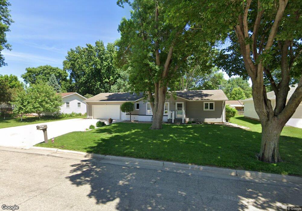
1112 N Carol St Luverne, MN 56156
Estimated Value: $312,000 - $1,118,522
4
Beds
3
Baths
2,432
Sq Ft
$215/Sq Ft
Est. Value
About This Home
This home is located at 1112 N Carol St, Luverne, MN 56156 and is currently estimated at $522,881, approximately $215 per square foot. 1112 N Carol St is a home located in Rock County with nearby schools including Luverne Elementary School and Luverne Senior High School.
Ownership History
Date
Name
Owned For
Owner Type
Purchase Details
Closed on
Oct 21, 2021
Sold by
Olson David Mark and Olson Joanne K
Bought by
Sankey Lesley and Sankey Loreen
Current Estimated Value
Home Financials for this Owner
Home Financials are based on the most recent Mortgage that was taken out on this home.
Original Mortgage
$475,000
Outstanding Balance
$401,637
Interest Rate
2.8%
Mortgage Type
Credit Line Revolving
Estimated Equity
$121,244
Purchase Details
Closed on
Jul 23, 2015
Sold by
Meyer David R and Meyer Vicky S
Bought by
Sankey Lesley and Sankey Loreen
Create a Home Valuation Report for This Property
The Home Valuation Report is an in-depth analysis detailing your home's value as well as a comparison with similar homes in the area
Home Values in the Area
Average Home Value in this Area
Purchase History
We collect this data history from publicly available records. To have your information removed, we recommend requesting removal directly through your county’s website.
| Date | Buyer | Sale Price | Title Company |
|---|---|---|---|
| Sankey Lesley | $1,135,252 | None Available | |
| Sankey Lesley | $189,000 | -- |
Source: Public Records
Mortgage History
We collect this data history from publicly available records. To have your information removed, we recommend requesting removal directly through your county’s website.
| Date | Status | Borrower | Loan Amount |
|---|---|---|---|
| Open | Sankey Lesley | $475,000 |
Source: Public Records
Tax History
| Year | Tax Paid | Tax Assessment Tax Assessment Total Assessment is a certain percentage of the fair market value that is determined by local assessors to be the total taxable value of land and additions on the property. | Land | Improvement |
|---|---|---|---|---|
| 2025 | $2,708 | $281,500 | $13,400 | $268,100 |
| 2024 | $2,708 | $256,900 | $11,500 | $245,400 |
| 2023 | $2,546 | $241,400 | $11,500 | $229,900 |
| 2022 | $2,356 | $212,700 | $7,500 | $205,200 |
| 2021 | $2,100 | $198,900 | $7,500 | $191,400 |
| 2020 | $2,052 | $181,900 | $7,500 | $174,400 |
| 2019 | $1,914 | $178,700 | $7,500 | $171,200 |
| 2018 | $1,752 | $170,600 | $7,500 | $163,100 |
| 2017 | $1,452 | $156,000 | $7,500 | $148,500 |
| 2016 | $1,340 | $139,600 | $6,800 | $132,800 |
| 2015 | $1,278 | $0 | $0 | $0 |
| 2014 | -- | $0 | $0 | $0 |
Source: Public Records
Map
Nearby Homes
- 1021 N Jackson St
- 101 E Virginia St
- 210 E Oakland Ave
- 503 Britz Dr
- 500 Brandenburg St
- 1411 Evergreen Dr
- 612 Britz Dr
- 201 E Adams Ave
- 721 Britz Dr
- 106 E Christensen Dr
- 742 N Freeman Ave
- 808 N Oakley St
- 1123 Elmhurst Ave
- 1115 Elmhurst Ave
- 1305 N Kniss Ave
- 210 W Adams Ave
- 1009 Elmwood Ave
- 631 N Cedar St
- 1002 Linden St
- 410 E Dodge St
- 1113 N Carol St
- 1111 N Carol St
- 1115 N Carol St
- 1112 N Cedar St
- 1114 N Cedar St
- 1110 N Cedar St
- 204 E Fairway Dr
- 1109 N Carol St
- 1114 N Carol St
- 1110 N Carol St
- 1108 N Cedar St
- 1116 N Cedar St
- 300 E Fairway Dr
- 1108 N Carol St
- 1105 N Carol St
- 1107 N Spring St
- 1106 N Carol St
- 1106 N Cedar St
- 1113 N Cedar St
- 1105 N Spring St
Your Personal Tour Guide
Ask me questions while you tour the home.