Estimated Value: $127,302 - $164,000
2
Beds
2
Baths
1,065
Sq Ft
$138/Sq Ft
Est. Value
About This Home
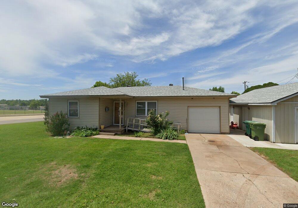
This home is located at 1112 S 2nd St, Yukon, OK 73099 and is currently estimated at $147,076, approximately $138 per square foot. 1112 S 2nd St is a home with nearby schools including Myers Elementary School, Independence Elementary School, and Yukon Middle School.
Ownership History
Date
Name
Owned For
Owner Type
Purchase Details
Closed on
Jun 7, 2016
Sold by
Graham Dale K Veterans Corner
Bought by
Roberts John
Current Estimated Value
Home Financials for this Owner
Home Financials are based on the most recent Mortgage that was taken out on this home.
Original Mortgage
$234,000
Outstanding Balance
$186,782
Interest Rate
3.66%
Estimated Equity
-$39,706
Purchase Details
Closed on
Jul 24, 1996
Sold by
Briggs Charles E and Briggs Beth C
Purchase Details
Closed on
May 9, 1989
Purchase Details
Closed on
Dec 22, 1988
Purchase Details
Closed on
Oct 1, 1986
Create a Home Valuation Report for This Property
The Home Valuation Report is an in-depth analysis detailing your home's value as well as a comparison with similar homes in the area
Home Values in the Area
Average Home Value in this Area
Purchase History
| Date | Buyer | Sale Price | Title Company |
|---|---|---|---|
| Roberts John | -- | -- | |
| -- | -- | -- | |
| -- | -- | -- | |
| -- | $48,800 | -- | |
| -- | $40,000 | -- |
Source: Public Records
Mortgage History
| Date | Status | Borrower | Loan Amount |
|---|---|---|---|
| Open | Roberts John | $234,000 | |
| Closed | Roberts John | -- |
Source: Public Records
Tax History Compared to Growth
Tax History
| Year | Tax Paid | Tax Assessment Tax Assessment Total Assessment is a certain percentage of the fair market value that is determined by local assessors to be the total taxable value of land and additions on the property. | Land | Improvement |
|---|---|---|---|---|
| 2024 | $742 | $8,088 | $1,379 | $6,709 |
| 2023 | $742 | $7,853 | $1,361 | $6,492 |
| 2022 | $721 | $7,623 | $1,342 | $6,281 |
| 2021 | $699 | $7,402 | $1,313 | $6,089 |
| 2020 | $667 | $7,186 | $1,264 | $5,922 |
| 2019 | $647 | $6,977 | $1,264 | $5,713 |
| 2018 | $626 | $6,774 | $1,264 | $5,510 |
| 2017 | $605 | $6,577 | $1,264 | $5,313 |
| 2016 | $585 | $6,577 | $1,264 | $5,313 |
| 2015 | $553 | $6,199 | $1,264 | $4,935 |
| 2014 | $553 | $6,019 | $1,264 | $4,755 |
Source: Public Records
Map
Nearby Homes
- 117 Asbill Ave
- 1005 S 3rd St
- 11200 SW 32nd St
- 501 Queensboro Place
- 1308 Holly Ave
- 0 Landon Ln
- 508 Kingston Dr
- 608 Queensboro Place
- 414 Yukon Ave
- 10401 NW 33rd St
- 11020 SW 34th Terrace
- 201 Vine St
- 114 Larry Ave
- 502 Walnut Ave
- 616 Kingston Dr
- 3608 Northover Ridge Dr
- 3509 Sawtooth Ridge Dr
- 14512 Rochefort Ln
- 14524 Giverny Ln
- 14500 Giverny Ln