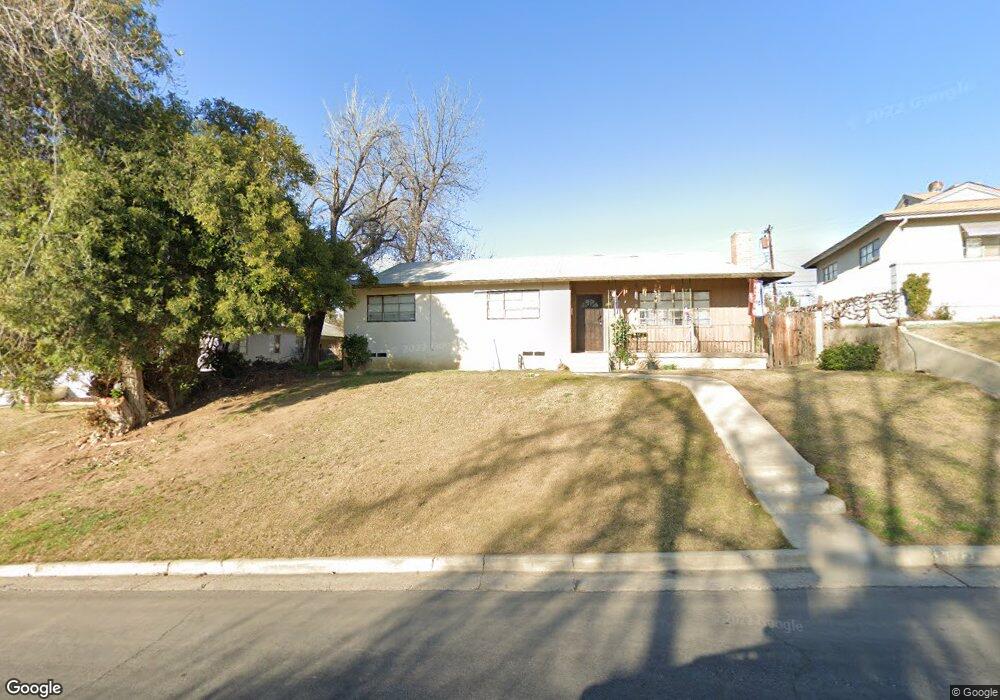
1112 W Point Dr Bakersfield, CA 93305
College Heights NeighborhoodEstimated Value: $231,000 - $326,000
3
Beds
1
Bath
1,179
Sq Ft
$240/Sq Ft
Est. Value
About This Home
This home is located at 1112 W Point Dr, Bakersfield, CA 93305 and is currently estimated at $282,586, approximately $239 per square foot. 1112 W Point Dr is a home located in Kern County with nearby schools including Myra A. Noble Elementary School, Washington Middle School, and East Bakersfield High School.
Ownership History
Date
Name
Owned For
Owner Type
Purchase Details
Closed on
Jul 23, 2001
Sold by
Henry Kimberly L and Henry Brent
Bought by
Cardenas Gina Luree
Current Estimated Value
Home Financials for this Owner
Home Financials are based on the most recent Mortgage that was taken out on this home.
Original Mortgage
$78,764
Outstanding Balance
$30,265
Interest Rate
7.1%
Mortgage Type
FHA
Estimated Equity
$252,321
Purchase Details
Closed on
Apr 17, 1996
Sold by
Chmiel Florence and Enriquez Florence
Bought by
Leff Kimberly L
Home Financials for this Owner
Home Financials are based on the most recent Mortgage that was taken out on this home.
Original Mortgage
$69,964
Interest Rate
7.97%
Mortgage Type
FHA
Create a Home Valuation Report for This Property
The Home Valuation Report is an in-depth analysis detailing your home's value as well as a comparison with similar homes in the area
Home Values in the Area
Average Home Value in this Area
Purchase History
| Date | Buyer | Sale Price | Title Company |
|---|---|---|---|
| Cardenas Gina Luree | $79,500 | Stewart Title | |
| Leff Kimberly L | $70,000 | American Title Co |
Source: Public Records
Mortgage History
| Date | Status | Borrower | Loan Amount |
|---|---|---|---|
| Open | Cardenas Gina Luree | $78,764 | |
| Previous Owner | Leff Kimberly L | $69,964 |
Source: Public Records
Tax History
| Year | Tax Paid | Tax Assessment Tax Assessment Total Assessment is a certain percentage of the fair market value that is determined by local assessors to be the total taxable value of land and additions on the property. | Land | Improvement |
|---|---|---|---|---|
| 2025 | $2,062 | $117,417 | $32,488 | $84,929 |
| 2024 | $2,014 | $115,115 | $31,851 | $83,264 |
| 2023 | $2,014 | $112,859 | $31,227 | $81,632 |
| 2022 | $1,960 | $110,647 | $30,615 | $80,032 |
| 2021 | $1,856 | $108,478 | $30,015 | $78,463 |
| 2020 | $1,821 | $107,367 | $29,708 | $77,659 |
| 2019 | $1,785 | $107,367 | $29,708 | $77,659 |
| 2018 | $1,746 | $103,200 | $28,555 | $74,645 |
| 2017 | $1,735 | $101,178 | $27,996 | $73,182 |
| 2016 | $1,605 | $99,196 | $27,448 | $71,748 |
| 2015 | $1,593 | $97,707 | $27,036 | $70,671 |
| 2014 | $1,542 | $95,794 | $26,507 | $69,287 |
Source: Public Records
Map
Nearby Homes
- 3213 Bucknell St
- 3012 Fordham St
- 3117 Haley St
- 917 Stanford Ct
- 909 Oberlin Ct
- 3013 Cornell St
- 2904 Cornell St
- 2804 Haley St
- 1207 Columbus St
- 2713 Haley St
- 2709 Haley St
- 925 Radcliffe Ave
- 1217 Crawford St
- 2800 Pomona St
- 1801 University Ave
- 1218 Water St
- 2927 Skyline Blvd
- 700 Hillcrest Dr
- 940 Water St
- 1236 Jeffrey St
- 1116 W Point Dr
- 1108 W Point Dr
- 1120 W Point Dr
- 1113 Vanderbilt Dr
- 1201 Vanderbilt Dr
- 1109 Vanderbilt Dr
- 1205 Vanderbilt Dr
- 1124 W Point Dr
- 1100 W Point Dr
- 1113 W Point Dr
- 1117 W Point Dr
- 1109 W Point Dr
- 1209 Vanderbilt Dr
- 1123 W Point Dr
- 1105 W Point Dr
- 1213 Vanderbilt Dr
- 1101 W Point Dr
- 1200 Duke Dr
- 3112 Dartmouth St
- 1200 W Point Dr
Your Personal Tour Guide
Ask me questions while you tour the home.