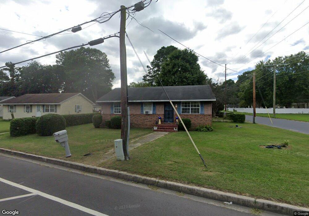
1112 West Rd Salisbury, MD 21801
North Salisbury NeighborhoodEstimated Value: $120,000 - $162,000
--
Bed
1
Bath
1,026
Sq Ft
$132/Sq Ft
Est. Value
About This Home
This home is located at 1112 West Rd, Salisbury, MD 21801 and is currently estimated at $135,224, approximately $131 per square foot. 1112 West Rd is a home located in Wicomico County with nearby schools including Charles H. Chipman Elementary School, Glen Avenue Elementary School, and Salisbury Middle School.
Ownership History
Date
Name
Owned For
Owner Type
Purchase Details
Closed on
Sep 5, 2019
Sold by
Jlc Properties Llc
Bought by
Condon G Roland
Current Estimated Value
Purchase Details
Closed on
Aug 27, 2013
Sold by
Lloyd Condon Janice G
Bought by
Jlc Properties Llc
Purchase Details
Closed on
Jun 29, 1999
Sold by
Ocwen Federal Bank Fsb
Bought by
Lloyd Condon G and Lloyd Janice G
Create a Home Valuation Report for This Property
The Home Valuation Report is an in-depth analysis detailing your home's value as well as a comparison with similar homes in the area
Home Values in the Area
Average Home Value in this Area
Purchase History
| Date | Buyer | Sale Price | Title Company |
|---|---|---|---|
| Condon G Roland | -- | None Available | |
| Jlc Properties Llc | -- | None Available | |
| Lloyd Condon G | $25,500 | -- | |
| Ocwen Federal Bank Fsb | $30,000 | -- |
Source: Public Records
Mortgage History
| Date | Status | Borrower | Loan Amount |
|---|---|---|---|
| Closed | Lloyd Condon G | -- |
Source: Public Records
Tax History Compared to Growth
Tax History
| Year | Tax Paid | Tax Assessment Tax Assessment Total Assessment is a certain percentage of the fair market value that is determined by local assessors to be the total taxable value of land and additions on the property. | Land | Improvement |
|---|---|---|---|---|
| 2025 | $893 | $106,067 | $0 | $0 |
| 2024 | $893 | $93,133 | $0 | $0 |
| 2023 | $800 | $80,200 | $14,100 | $66,100 |
| 2022 | $758 | $74,433 | $0 | $0 |
| 2021 | $702 | $68,667 | $0 | $0 |
| 2020 | $649 | $62,900 | $14,100 | $48,800 |
| 2019 | $633 | $60,467 | $0 | $0 |
| 2018 | $645 | $58,033 | $0 | $0 |
| 2017 | $591 | $55,600 | $0 | $0 |
| 2016 | -- | $55,600 | $0 | $0 |
| 2015 | $833 | $55,600 | $0 | $0 |
| 2014 | $833 | $66,400 | $0 | $0 |
Source: Public Records
Map
Nearby Homes
- 1201 Kiowa Ave
- 0 Morris St
- 1107 Mineola Ave
- 1103 Tuscola Ave
- 1109 Shawnee Ave
- 0 Queen Ave Unit MDWC2006982
- 29007 Adventist Dr
- 735 N Westover Dr
- 731 N Westover Dr
- 0 N Delano Ave Unit MDWC2010148
- 29015 Adventist Dr
- 822 Mersey Ln
- 830 Mersey Ln
- 832 Mersey Ln
- 834 Mersey Ln
- 842 Mersey Ln
- 809 Mersey Ln
- 902 Lake St
- 665 West Rd
- 650 Suffolk Ct