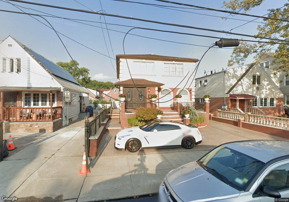
11121 132nd St South Ozone Park, NY 11420
South Ozone Park NeighborhoodEstimated Value: $839,668 - $1,163,000
--
Bed
--
Bath
2,150
Sq Ft
$486/Sq Ft
Est. Value
About This Home
This home is located at 11121 132nd St, South Ozone Park, NY 11420 and is currently estimated at $1,045,917, approximately $486 per square foot. 11121 132nd St is a home located in Queens County with nearby schools including P.S. 155, J.H.S. 226 Virgil I. Grisson, and Al-Ihsan Academy.
Ownership History
Date
Name
Owned For
Owner Type
Purchase Details
Closed on
Nov 27, 2018
Sold by
Low Ashkeaka
Bought by
Low Ashkeaka and Roopram Darshanan
Current Estimated Value
Purchase Details
Closed on
Dec 23, 2003
Sold by
Scott Amanda H
Bought by
Low Ashleaka
Home Financials for this Owner
Home Financials are based on the most recent Mortgage that was taken out on this home.
Original Mortgage
$465,500
Interest Rate
5.65%
Mortgage Type
Purchase Money Mortgage
Create a Home Valuation Report for This Property
The Home Valuation Report is an in-depth analysis detailing your home's value as well as a comparison with similar homes in the area
Home Values in the Area
Average Home Value in this Area
Purchase History
| Date | Buyer | Sale Price | Title Company |
|---|---|---|---|
| Low Ashkeaka | -- | -- | |
| Low Ashleaka | $490,000 | -- |
Source: Public Records
Mortgage History
| Date | Status | Borrower | Loan Amount |
|---|---|---|---|
| Previous Owner | Low Ashleaka | $465,500 |
Source: Public Records
Tax History Compared to Growth
Tax History
| Year | Tax Paid | Tax Assessment Tax Assessment Total Assessment is a certain percentage of the fair market value that is determined by local assessors to be the total taxable value of land and additions on the property. | Land | Improvement |
|---|---|---|---|---|
| 2025 | $7,397 | $38,616 | $6,962 | $31,654 |
| 2024 | $7,397 | $36,826 | $6,235 | $30,591 |
| 2023 | $7,397 | $36,826 | $6,132 | $30,694 |
| 2022 | $6,950 | $53,820 | $10,200 | $43,620 |
| 2021 | $6,912 | $50,400 | $10,200 | $40,200 |
| 2020 | $6,812 | $51,780 | $10,200 | $41,580 |
| 2019 | $6,420 | $57,060 | $10,200 | $46,860 |
| 2018 | $6,256 | $30,688 | $6,901 | $23,787 |
| 2017 | $5,914 | $29,012 | $7,179 | $21,833 |
| 2016 | $5,472 | $29,012 | $7,179 | $21,833 |
| 2015 | $3,301 | $26,817 | $10,239 | $16,578 |
| 2014 | $3,301 | $25,574 | $10,985 | $14,589 |
Source: Public Records
Map
Nearby Homes
- 111-17 133rd St
- 109-49 132nd St
- 134-01 Linden Blvd
- 11143 130th St
- 11406 135th St
- 109-41 132nd St
- 114-33 133rd St
- 109-35 131st St
- 11409 135th St
- 114-39 134th St
- 10922 132nd St
- 114-29 130th St
- 111-41 128th St
- 11455 131st St
- 11158 128th St
- 131-16 115th Ave
- 114-50 130th St
- 132-11 109th Ave
- 114-09 127th St
- 107-47 132nd St
- 11123 132nd St
- 11117 132nd St
- 11127 132nd St
- 11127 132nd St
- 11111 132nd St
- 11129 132nd St
- 11129 132nd St
- 11120 133rd St
- 11124 133rd St
- 11126 133rd St
- 11116 133rd St
- 11120 133rd St
- 11133 132nd St
- 11128 133rd St
- 11112 133rd St
- 11112 133rd St
- 11112 133rd St Unit 1
- 11135 132nd St
- 13202 111th Ave
- 11130 133rd St