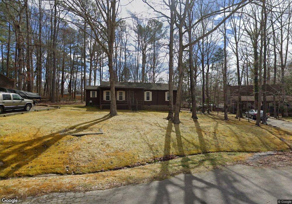
11121 Alanthus Rd Midlothian, VA 23112
Estimated Value: $299,000 - $334,000
3
Beds
2
Baths
1,184
Sq Ft
$267/Sq Ft
Est. Value
About This Home
This home is located at 11121 Alanthus Rd, Midlothian, VA 23112 and is currently estimated at $315,911, approximately $266 per square foot. 11121 Alanthus Rd is a home located in Chesterfield County with nearby schools including Thelma Crenshaw Elementary School, Bailey Bridge Middle School, and Manchester High.
Ownership History
Date
Name
Owned For
Owner Type
Purchase Details
Closed on
May 28, 2010
Sold by
Thompson Brian C
Bought by
Hall Donald
Current Estimated Value
Purchase Details
Closed on
Apr 24, 2007
Sold by
Guy Barry
Bought by
Thompson Brian
Home Financials for this Owner
Home Financials are based on the most recent Mortgage that was taken out on this home.
Original Mortgage
$165,000
Interest Rate
6.18%
Mortgage Type
New Conventional
Create a Home Valuation Report for This Property
The Home Valuation Report is an in-depth analysis detailing your home's value as well as a comparison with similar homes in the area
Home Values in the Area
Average Home Value in this Area
Purchase History
| Date | Buyer | Sale Price | Title Company |
|---|---|---|---|
| Hall Donald | $161,000 | -- | |
| Thompson Brian | $165,000 | -- |
Source: Public Records
Mortgage History
| Date | Status | Borrower | Loan Amount |
|---|---|---|---|
| Previous Owner | Thompson Brian | $165,000 |
Source: Public Records
Tax History
| Year | Tax Paid | Tax Assessment Tax Assessment Total Assessment is a certain percentage of the fair market value that is determined by local assessors to be the total taxable value of land and additions on the property. | Land | Improvement |
|---|---|---|---|---|
| 2025 | $2,416 | $268,600 | $60,000 | $208,600 |
| 2024 | $2,416 | $256,000 | $53,000 | $203,000 |
| 2023 | $2,191 | $240,800 | $51,000 | $189,800 |
| 2022 | $2,097 | $227,900 | $48,000 | $179,900 |
| 2021 | $1,938 | $201,400 | $45,000 | $156,400 |
| 2020 | $1,698 | $178,700 | $45,000 | $133,700 |
| 2019 | $1,606 | $169,000 | $44,000 | $125,000 |
| 2018 | $1,468 | $154,500 | $42,000 | $112,500 |
| 2017 | $1,432 | $149,200 | $42,000 | $107,200 |
| 2016 | $1,364 | $142,100 | $42,000 | $100,100 |
| 2015 | $1,336 | $139,200 | $42,000 | $97,200 |
| 2014 | $1,259 | $131,100 | $42,000 | $89,100 |
Source: Public Records
Map
Nearby Homes
- 4519 Bexwood Dr
- 5101 Blossomwood Cir
- 4507 Parrish Branch Rd
- 5108 Oakforest Dr
- 5107 Morning Dove Mews
- 5212 Rollingway Rd
- 5124 Rollingway Rd
- 10508 Rollingway Ct
- 10912 Genito Square Dr
- 4124 Jefferson Ridge Dr
- 11803 New Forest Ct
- 4917 Bailey Woods Ln
- 10383 Qualla Trace Dr
- 5324 Sandy Ridge Ct
- 10376 Qualla Trace Dr
- 10370 Qualla Trace Dr
- 11418 Parrish Creek Ln
- 10344 Qualla Trace Dr
- 5430 Solaris Dr
- 10339 Qualla Trace Dr
- 11119 Alanthus Rd
- 11123 Alanthus Rd
- 11111 Alanthus Rd
- 11110 Sunfield Dr
- 11125 Alanthus Rd
- 11128 Sunfield Dr
- 11120 Alanthus Rd
- 11118 Alanthus Rd
- 4608 Overlea Dr
- 11124 Alanthus Rd
- 4616 Overlea Dr
- 11122 Alanthus Rd
- 4600 Overlea Dr
- 11110 Alanthus Rd
- 4624 Overlea Dr
- 11210 Sunfield Ct
- 4524 Overlea Dr
- 11200 Sunfield Ct
- 11220 Sunfield Ct
- 4503 Sunfield Place