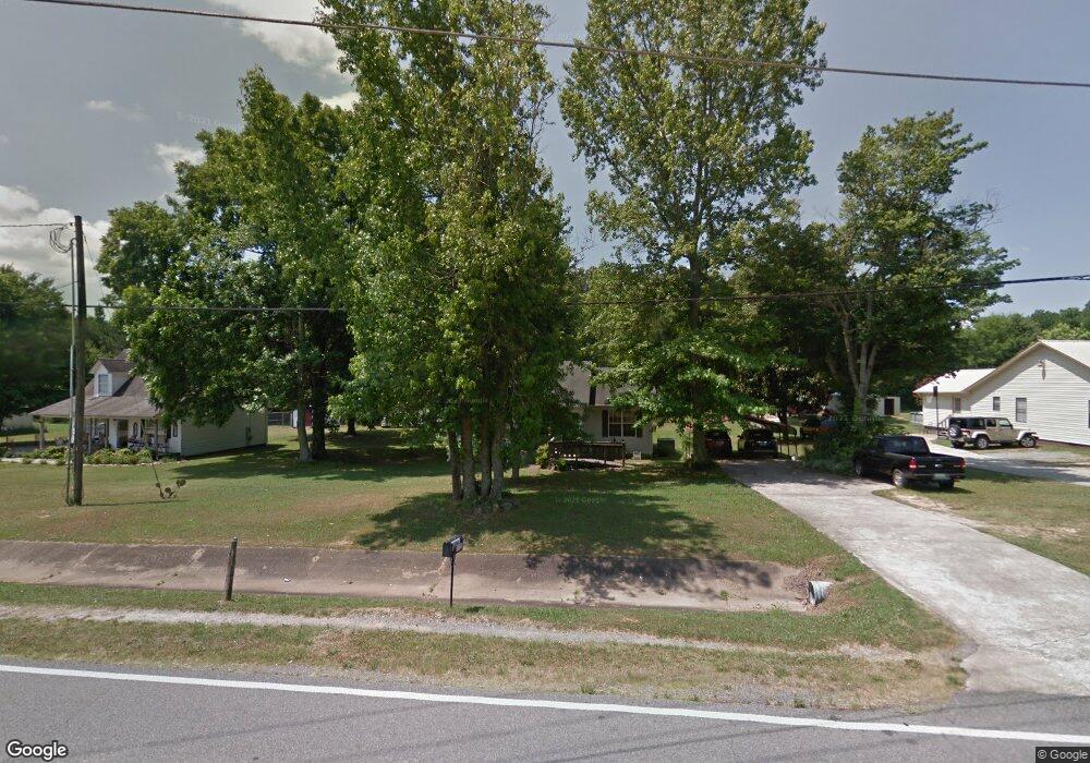
11121 Union Grove Rd Union Grove, AL 35175
Estimated Value: $124,151 - $214,000
--
Bed
--
Bath
1,214
Sq Ft
$135/Sq Ft
Est. Value
About This Home
This home is located at 11121 Union Grove Rd, Union Grove, AL 35175 and is currently estimated at $163,288, approximately $134 per square foot. 11121 Union Grove Rd is a home located in Marshall County with nearby schools including Brindlee Mountain Primary School, Brindlee Mountain Elementary School, and Brindlee Mt Middle School.
Ownership History
Date
Name
Owned For
Owner Type
Purchase Details
Closed on
Mar 24, 2021
Sold by
Mcdonald Angie and Mcdonald Howard
Bought by
Mcdonald Angela M
Current Estimated Value
Home Financials for this Owner
Home Financials are based on the most recent Mortgage that was taken out on this home.
Original Mortgage
$57,000
Interest Rate
3.1%
Mortgage Type
Purchase Money Mortgage
Purchase Details
Closed on
Aug 5, 2020
Sold by
Mcdonald Howard
Bought by
Mcdonald Angie
Purchase Details
Closed on
Jul 17, 2009
Sold by
Scott Virginia A
Bought by
Mcdonald Howard and Mcdonald Angie
Create a Home Valuation Report for This Property
The Home Valuation Report is an in-depth analysis detailing your home's value as well as a comparison with similar homes in the area
Home Values in the Area
Average Home Value in this Area
Purchase History
| Date | Buyer | Sale Price | Title Company |
|---|---|---|---|
| Mcdonald Angela M | $12,500 | Mortgage Connect Lp | |
| Mcdonald Angie | -- | None Available | |
| Mcdonald Howard | $1,000 | None Available |
Source: Public Records
Mortgage History
| Date | Status | Borrower | Loan Amount |
|---|---|---|---|
| Previous Owner | Mcdonald Angela M | $57,000 |
Source: Public Records
Tax History Compared to Growth
Tax History
| Year | Tax Paid | Tax Assessment Tax Assessment Total Assessment is a certain percentage of the fair market value that is determined by local assessors to be the total taxable value of land and additions on the property. | Land | Improvement |
|---|---|---|---|---|
| 2024 | $303 | $9,500 | $0 | $0 |
| 2023 | $303 | $8,980 | $0 | $0 |
| 2022 | $272 | $8,660 | $0 | $0 |
| 2021 | $246 | $7,960 | $0 | $0 |
| 2020 | $217 | $7,200 | $0 | $0 |
| 2017 | $249 | $6,560 | $0 | $0 |
| 2015 | -- | $7,240 | $0 | $0 |
| 2014 | -- | $7,240 | $0 | $0 |
Source: Public Records
Map
Nearby Homes
- 588 Mount Olive Church Rd
- 10470 Union Grove Rd
- 1041 Greenbriar Cove Rd
- 14298 Highway 231
- 141 Old Silo Rd
- 463 Hickory Cir
- 402 Greenbriar Cove Rd
- 256 Greenbriar Cove Rd
- 3903 Highway 231
- 18 Parker Rd
- Lot 106 & 107 Creekwood Dr
- 1 Bettinger Mountain Rd
- 35 ACRES Pine Ridge Rd
- 865 Quarry Rd
- 128 Savannah Cir
- 8324 Union Grove Rd
- Lot 43 Savannah Cir
- 295 N Ridge Dr
- 1812 Pine Ridge Rd
- 234 Prince Cir
- 11111 Union Grove Rd
- 11141 Union Grove Rd
- 11159 Union Grove Rd
- 11101 Union Grove Rd
- 129 Jameson Cir
- 11081 Union Grove Rd
- 28 King Dr
- 97 Jameson Cir
- 0 King Rd
- 11246 Union Grove Rd
- 10991 Union Grove Rd
- 639 Mount Olive Church Rd
- 11260 Union Grove Rd
- 1320 Union Grove Rd
- 631 Mount Olive Church Rd
- 279 King Dr
- 633 Mount Olive Church Rd
- 515 Mount Olive Church Rd
- 10867 Union Grove Rd
- 327 King Dr