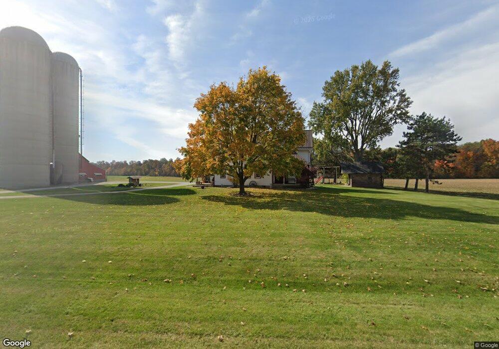
11123 State Route 29 New Knoxville, OH 45871
Estimated Value: $233,490 - $418,000
4
Beds
2
Baths
2,142
Sq Ft
$151/Sq Ft
Est. Value
About This Home
This home is located at 11123 State Route 29, New Knoxville, OH 45871 and is currently estimated at $322,373, approximately $150 per square foot. 11123 State Route 29 is a home located in Auglaize County with nearby schools including New Knoxville Elementary School and Holy Rosary Elementary School.
Ownership History
Date
Name
Owned For
Owner Type
Purchase Details
Closed on
Mar 11, 2021
Sold by
Henschen Thomas and Thomas Henschen Living Trust
Bought by
Henschen Thomas and Henschen Marlene
Current Estimated Value
Purchase Details
Closed on
Oct 22, 2002
Sold by
Henschen Thomas C
Bought by
Henschen Thomas & Marlene K Trustees
Create a Home Valuation Report for This Property
The Home Valuation Report is an in-depth analysis detailing your home's value as well as a comparison with similar homes in the area
Home Values in the Area
Average Home Value in this Area
Purchase History
| Date | Buyer | Sale Price | Title Company |
|---|---|---|---|
| Henschen Thomas | -- | None Available | |
| Henschen Thomas | -- | None Listed On Document | |
| Henschen Thomas | -- | None Available | |
| Henschen Thomas & Marlene K Trustees | -- | -- |
Source: Public Records
Tax History Compared to Growth
Tax History
| Year | Tax Paid | Tax Assessment Tax Assessment Total Assessment is a certain percentage of the fair market value that is determined by local assessors to be the total taxable value of land and additions on the property. | Land | Improvement |
|---|---|---|---|---|
| 2024 | $3,431 | $51,240 | $12,090 | $39,150 |
| 2023 | $1,497 | $51,240 | $12,090 | $39,150 |
| 2022 | $1,658 | $44,060 | $10,080 | $33,980 |
| 2021 | $1,672 | $44,060 | $10,080 | $33,980 |
| 2020 | $847 | $44,059 | $10,077 | $33,982 |
| 2019 | $1,438 | $37,471 | $8,540 | $28,931 |
| 2018 | $1,437 | $37,471 | $8,540 | $28,931 |
| 2017 | $1,439 | $37,471 | $8,540 | $28,931 |
| 2016 | $1,422 | $37,860 | $8,131 | $29,729 |
| 2015 | $1,388 | $37,860 | $8,131 | $29,729 |
| 2014 | $1,392 | $37,860 | $8,131 | $29,729 |
| 2013 | $1,648 | $37,860 | $8,131 | $29,729 |
Source: Public Records
Map
Nearby Homes
- 101 Saxony Dr
- 103 Saxony Dr
- 107 S Mill St
- 0 Saxony Unit 1032555
- 8937 Wiefenbach Rd
- 116 Meadowbrook Ln
- 0 S Beech St
- 200 N Knoxville Ave Unit 7
- 408 S Vine St
- 1015 Columbia St
- 403 S Vine St
- 602 Weston St
- 216 Beech St
- 105 Maple St
- 437 Woodward St
- 125 Beech St
- 811 Columbia St
- 911 Cleveland Ave
- 712 Columbia St
- 520 Oil St
- 11252 State Route 29
- 06620 Schultz Rd
- 10892 State Route 29
- 11262 State Route 29
- 10703 State Route 29
- 06795 Holtkamp Rd
- 06883 Holtkamp Rd
- 06990 Holtkamp Rd
- 06044 Schultz Rd
- 11278 Glynwood New Knoxville Rd
- 0 E Shelby Rd Unit 289908
- 0 E Shelby Rd
- 11049 E Shelby Rd
- 10935 E Shelby Rd
- 11860 State Route 29
- 11874 State Route 29
- 06874 Clover Leaf Rd
- 0 Moulton Angle Rd
- 06495 Clover Leaf Rd
- 06799 Clover Leaf Rd