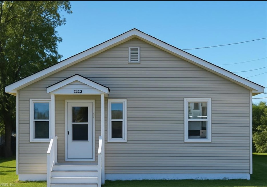
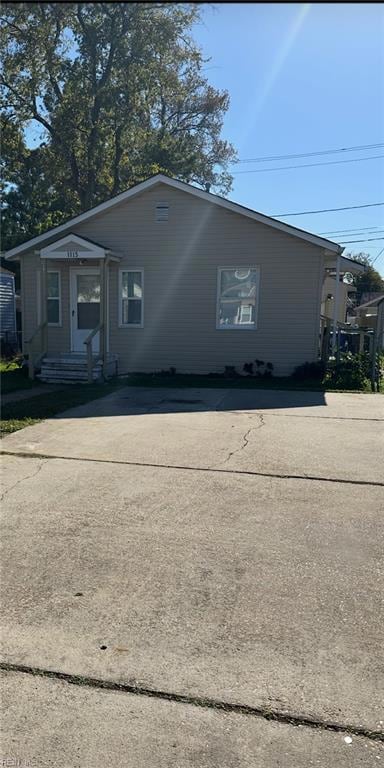
1113 Matthew Henson St Norfolk, VA 23505
Titustown NeighborhoodEstimated payment $1,275/month
Highlights
- Attic
- Cottage
- Porch
- No HOA
- Breakfast Area or Nook
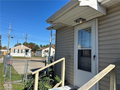
- Property is Fully Fenced
About This Home
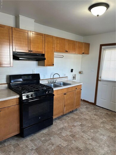
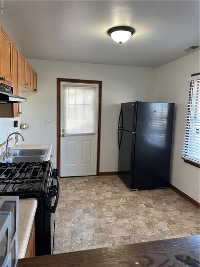
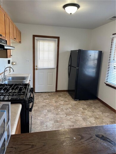
This freshly painted two-bedroom, one-bath home offers easy one-level living with a bright and inviting feel. Enjoy the updated kitchen, newer roof, and water heater for added peace of mind. The fenced in yard provides great outdoor space, complete with a large storage shed for all your tools and equipment. With two convenient parking spaces and charming curb appeal, this move-in-ready home is a wonderful opportunity you don't want to miss!
Home Details
Home Type
- Single Family
Est. Annual Taxes
- $1,717
Year Built
- Built in 1945
Lot Details
- Property is Fully Fenced
- Property is zoned R-8
Parking
- 2 Car Parking Spaces
Home Design
- Cottage
- Bungalow
- Asphalt Shingled Roof
- Vinyl Siding
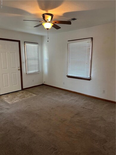
Interior Spaces
- 672 Sq Ft Home
- 1-Story Property
- Crawl Space
- Scuttle Attic Hole
- Washer and Dryer Hookup
Kitchen
- Breakfast Area or Nook
- Gas Range
Flooring
- Carpet
- Vinyl
Bedrooms and Bathrooms
- 2 Bedrooms
- 1 Full Bathroom
Outdoor Features
- Porch
Schools
- Camp Allen Elementary School
- Blair Middle School
- Granby High School
Utilities
- Heat Pump System
- Electric Water Heater
Community Details
- No Home Owners Association
- Titustown Subdivision
Map
Home Values in the Area
Average Home Value in this Area
Tax History
| Year | Tax Paid | Tax Assessment Tax Assessment Total Assessment is a certain percentage of the fair market value that is determined by local assessors to be the total taxable value of land and additions on the property. | Land | Improvement |
|---|---|---|---|---|
| 2025 | $1,745 | $139,600 | $46,500 | $93,100 |
| 2024 | $1,601 | $130,200 | $46,500 | $83,700 |
| 2023 | $1,491 | $119,300 | $46,500 | $72,800 |
| 2022 | $1,269 | $101,500 | $31,900 | $69,600 |
| 2021 | $1,230 | $98,400 | $26,600 | $71,800 |
| 2020 | $1,223 | $97,800 | $26,000 | $71,800 |
| 2019 | $1,149 | $91,900 | $23,500 | $68,400 |
| 2018 | $1,130 | $90,400 | $23,500 | $66,900 |
| 2017 | $1,033 | $89,800 | $22,000 | $67,800 |
| 2016 | $975 | $87,000 | $17,000 | $70,000 |
| 2015 | $990 | $87,000 | $17,000 | $70,000 |
| 2014 | $990 | $87,000 | $17,000 | $70,000 |
Property History
| Date | Event | Price | List to Sale | Price per Sq Ft |
|---|---|---|---|---|
| 11/13/2025 11/13/25 | For Sale | $215,000 | -- | $320 / Sq Ft |
Purchase History
| Date | Type | Sale Price | Title Company |
|---|---|---|---|
| Warranty Deed | $35,000 | Attorney |
Mortgage History
| Date | Status | Loan Amount | Loan Type |
|---|---|---|---|
| Open | $30,000 | Purchase Money Mortgage |
Source: Real Estate Information Network (REIN)
MLS Number: 10609878
APN: 37744045
Disclaimer: Certain information contained herein is derived from information provided by parties other than Homes.com. All information provided is deemed reliable, but is not guaranteed to be accurate and should be independently verified.
![]() The listings data displayed on this medium comes in part from the Real Estate Information Network, Inc. (REIN) and has been authorized by participating listing Broker Members of REIN for display. REIN's listings are based upon Data submitted by its Broker Members, and REIN therefore makes no representation or warranty regarding the accuracy of the Data. All users of REIN's listings database should confirm the accuracy of the listing information directly with the listing agent.
The listings data displayed on this medium comes in part from the Real Estate Information Network, Inc. (REIN) and has been authorized by participating listing Broker Members of REIN for display. REIN's listings are based upon Data submitted by its Broker Members, and REIN therefore makes no representation or warranty regarding the accuracy of the Data. All users of REIN's listings database should confirm the accuracy of the listing information directly with the listing agent.
Copyright 2025 REIN. REIN's listings Data and information is protected under federal copyright laws. Federal law prohibits, among other acts, the unauthorized copying or alteration of, or preparation of derivative works from, all or any part of copyrighted materials, including certain compilations of Data and information. COPYRIGHT VIOLATORS MAY BE SUBJECT TO SEVERE FINES AND PENALTIES UNDER FEDERAL LAW.
REIN updates its listings on a daily basis.
Some listings may be duplicated in the search results due to the co-mingling of listings from more than one multiple listing service. Should there be different listing information between the duplicated listings; user is advised to verify the accuracy of the listing information before making any financial decisions.
Some or all of the listings (or listings Data) represented in this application have been enhanced with Data not provided by REIN. The enhancements are as follows: mapping, demographics, and economics. The source of these enhancements are: GreatSchools, CoStar, Google, Walk Score, How Loud, Collateral Analytics, Black Knight, First American, and Quantarium.
This application does not include information on all of the properties available for sale at this time.
- 1112 Matthew Henson St
- 7720 Dunfield Place Unit 3
- 1334 Milton St
- 7454 Diven St
- 604 Timothy Ave
- 7803 Ruthven Rd
- 530 Birmingham Ave
- 7405 Colony Point Rd
- 1521 W Little Creek Rd
- 537 Timothy Ave
- 535 Timothy Ave
- 7320 Glenroie Ave Unit 4G
- 7320 Glenroie Ave Unit 2G
- 7320 Glenroie Ave Unit 10E
- 7320 Glenroie Ave Unit 2L
- 7320 Glenroie Ave Unit 10F
- 7320 Glenroie Ave Unit 5G
- 7320 Glenroie Ave Unit 4L
- 7320 Glenroie Ave Unit 8E
- 1330 Laurel Crescent
- 7704 Enfield Ave
- 7701 Enfield Ave
- 1325 W Little Creek Rd
- 7703 Major Ave
- 837 Lex St
- 1111 Charleston St
- 901 W Little Creek Rd
- 7872 Ogden Ave
- 1453 W Little Creek Rd
- 1482 Meads Rd
- 553 Timothy Ave
- 1612 W Little Creek Rd
- 7320 Glenroie Ave Unit 4L
- 502 Grantham Rd
- 7420 Hampton Blvd Unit D-4
- 7433 Hampton Blvd
- 7411 Hampton Blvd
- 416 N Shore Rd
- 408 W Little Creek Rd
- 549 Westport St
