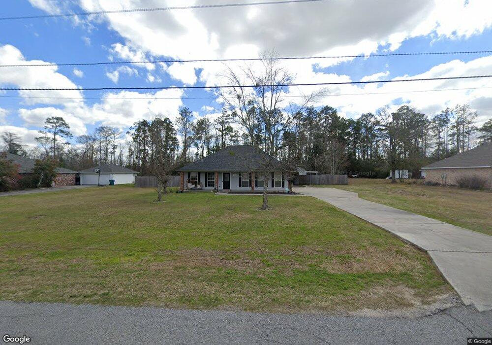
1113 Tomahawk Dr Lake Charles, LA 70611
Moss Bluff NeighborhoodEstimated Value: $219,780 - $265,000
3
Beds
2
Baths
1,711
Sq Ft
$139/Sq Ft
Est. Value
About This Home
This home is located at 1113 Tomahawk Dr, Lake Charles, LA 70611 and is currently estimated at $238,195, approximately $139 per square foot. 1113 Tomahawk Dr is a home located in Calcasieu Parish with nearby schools including Graham & Parks Alternative Public School, Moss Bluff Elementary School, and Putnam Avenue Upper School.
Ownership History
Date
Name
Owned For
Owner Type
Purchase Details
Closed on
Feb 8, 2024
Sold by
Morgan Marie Yvonne
Bought by
Augustine Justin Trey and Lebleu Augustine Alyse
Current Estimated Value
Purchase Details
Closed on
Aug 23, 2010
Sold by
Swift Virgil Ray and Swift Diana Marie
Bought by
Morgan Marie Yvonne
Home Financials for this Owner
Home Financials are based on the most recent Mortgage that was taken out on this home.
Original Mortgage
$130,160
Interest Rate
4.54%
Mortgage Type
New Conventional
Create a Home Valuation Report for This Property
The Home Valuation Report is an in-depth analysis detailing your home's value as well as a comparison with similar homes in the area
Home Values in the Area
Average Home Value in this Area
Purchase History
| Date | Buyer | Sale Price | Title Company |
|---|---|---|---|
| Augustine Justin Trey | -- | None Listed On Document | |
| Morgan Marie Yvonne | $165,000 | None Available |
Source: Public Records
Mortgage History
| Date | Status | Borrower | Loan Amount |
|---|---|---|---|
| Previous Owner | Morgan Marie Yvonne | $130,160 |
Source: Public Records
Tax History Compared to Growth
Tax History
| Year | Tax Paid | Tax Assessment Tax Assessment Total Assessment is a certain percentage of the fair market value that is determined by local assessors to be the total taxable value of land and additions on the property. | Land | Improvement |
|---|---|---|---|---|
| 2024 | $1,062 | $12,580 | $3,000 | $9,580 |
| 2023 | $546 | $12,580 | $3,000 | $9,580 |
| 2022 | $537 | $12,580 | $3,000 | $9,580 |
| 2021 | $563 | $12,580 | $3,000 | $9,580 |
| 2020 | $1,252 | $11,500 | $2,880 | $8,620 |
| 2019 | $1,374 | $12,580 | $3,000 | $9,580 |
| 2018 | $556 | $12,580 | $3,000 | $9,580 |
| 2017 | $1,396 | $12,580 | $3,000 | $9,580 |
| 2016 | $1,405 | $12,580 | $3,000 | $9,580 |
| 2015 | $1,405 | $12,580 | $3,000 | $9,580 |
Source: Public Records
Map
Nearby Homes
- 0 Park Rd
- 0 Park Rd Unit SWL25002774
- 959 Southern Meadows Dr
- 1003 New Castle Dr
- 986 Hollyvale Dr
- 1492 Becky St
- TBD Tan Tara Cir
- 1152 Park Rd
- 751 N Perkins Ferry Rd
- 1032 Tan Tara Cir
- 1107 Idlebrook Dr
- 647 Morrow Rd
- 863 Cooley Rd
- 1630 Hollow Cove Ln
- 1706 Heard Rd
- 568 Parkwood Dr
- 833 N Huval Dr
- 1731 Marlin Rd
- 1647 Hollow Cove
- 0 Sam Houston Jones Pkwy Unit 145953
- 1135 Tomahawk Dr
- 1101 Tomahawk Dr
- 1114 Tomahawk Dr
- 1157 Tomahawk Dr
- 1085 Tomahawk Dr
- 1174 Tomahawk Dr
- 1102 Tomahawk Dr
- 1181 Tomahawk Dr
- 710 Moccasin Dr
- 1063 Tomahawk Dr
- 711 Moccasin Dr
- 711 Arrowhead Dr
- 1198 Tomahawk Dr
- 1201 Tomahawk Dr
- 1045 Tomahawk Dr
- 714 Moccasin Dr
- 1046 Tomahawk Dr
- 715 Moccasin Dr
- 710 Chay Dr
- 715 Arrowhead Dr