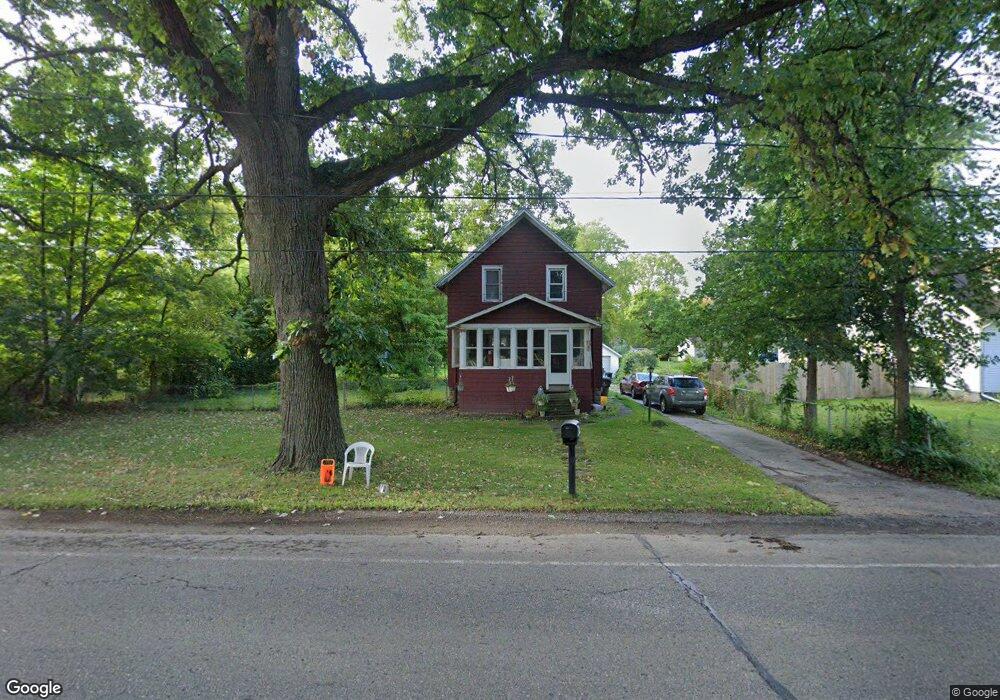
1113 W State Rd Lansing, MI 48906
Estimated Value: $166,000 - $186,000
3
Beds
2
Baths
1,987
Sq Ft
$90/Sq Ft
Est. Value
About This Home
This home is located at 1113 W State Rd, Lansing, MI 48906 and is currently estimated at $178,064, approximately $89 per square foot. 1113 W State Rd is a home located in Clinton County with nearby schools including Gier Park School, Pattengill Academy, and Eastern Lansing High School.
Ownership History
Date
Name
Owned For
Owner Type
Purchase Details
Closed on
Apr 30, 2009
Sold by
Wells Mitchell D
Bought by
Wells Rachael M
Current Estimated Value
Home Financials for this Owner
Home Financials are based on the most recent Mortgage that was taken out on this home.
Original Mortgage
$59,895
Interest Rate
4.92%
Mortgage Type
FHA
Purchase Details
Closed on
Mar 19, 2004
Sold by
Wells Debra L
Bought by
Wells Debra L and Wells Mitchell D
Create a Home Valuation Report for This Property
The Home Valuation Report is an in-depth analysis detailing your home's value as well as a comparison with similar homes in the area
Home Values in the Area
Average Home Value in this Area
Purchase History
| Date | Buyer | Sale Price | Title Company |
|---|---|---|---|
| Wells Rachael M | $61,000 | Transnation Title | |
| Wells Mitchell D | -- | Transntion Title | |
| Wells Debra L | -- | -- |
Source: Public Records
Mortgage History
| Date | Status | Borrower | Loan Amount |
|---|---|---|---|
| Closed | Wells Rachael M | $59,895 |
Source: Public Records
Tax History Compared to Growth
Tax History
| Year | Tax Paid | Tax Assessment Tax Assessment Total Assessment is a certain percentage of the fair market value that is determined by local assessors to be the total taxable value of land and additions on the property. | Land | Improvement |
|---|---|---|---|---|
| 2025 | -- | $78,400 | $15,900 | $62,500 |
| 2024 | $1,132 | $73,300 | $14,600 | $58,700 |
| 2023 | $1,075 | $66,400 | $0 | $0 |
| 2022 | $1,556 | $57,400 | $13,000 | $44,400 |
| 2021 | $1,509 | $51,000 | $12,300 | $38,700 |
| 2020 | $1,492 | $49,400 | $11,600 | $37,800 |
| 2019 | $1,428 | $47,300 | $11,700 | $35,600 |
| 2018 | $1,248 | $43,000 | $12,200 | $30,800 |
| 2017 | $1,230 | $41,400 | $12,000 | $29,400 |
| 2016 | $1,219 | $42,700 | $12,400 | $30,300 |
| 2015 | $1,192 | $40,900 | $0 | $0 |
| 2011 | -- | $40,100 | $0 | $0 |
Source: Public Records
Map
Nearby Homes
- 16084 S Us Highway 27
- 1111 W Wieland Rd
- 15940 Elmira St
- 15860 Oak Lane Dr
- 15975 Northward Dr
- 15710 Oak Lane Dr
- 16550 S Us 27
- 61 Beejay Dr
- 15480 Boichot Rd
- 15326 Boichot Rd
- 15301 Boichot Rd
- 16653 Jerry Rd
- 1404 W Stoll Rd
- 3425 Turner Rd
- 106 Lancelot Place W Unit 28
- 310 W Frederick Ave
- 16967 Jones Lake Rd
- 3126 Creston Ave
- 3429 Northdale Rd
- 727 E Paulson St
- 1145 W State Rd
- 1067 W State Rd
- 1086 W State Rd
- 1047 W State Rd
- 16047 Hazel St
- 1031 W State Rd
- 1068 W State Rd
- 1128 W State Rd
- 1219 W State Rd
- 1021 W State Rd
- 16030 Hazel St
- 16067 Hazel St
- 15945 Florence St
- 16060 Hazel St
- 1132 W State Rd
- 15935 Florence St
- 15950 Florence St
- 16074 S Us Highway 27
- 16074 S U-27
- 1110 Hannah Ave