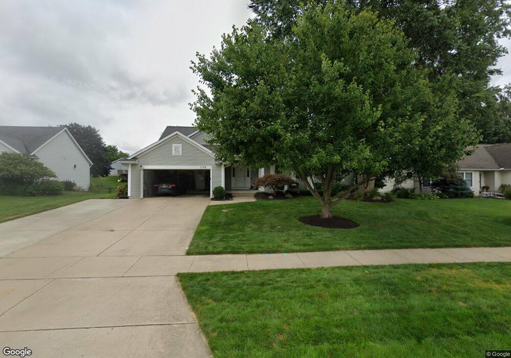
1113 Woodspointe Dr SW Byron Center, MI 49315
Estimated Value: $462,819 - $509,000
4
Beds
3
Baths
2,550
Sq Ft
$190/Sq Ft
Est. Value
About This Home
This home is located at 1113 Woodspointe Dr SW, Byron Center, MI 49315 and is currently estimated at $484,705, approximately $190 per square foot. 1113 Woodspointe Dr SW is a home located in Kent County with nearby schools including Marshall Elementary School, Robert L. Nickels Intermediate School, and Byron Center West Middle School.
Ownership History
Date
Name
Owned For
Owner Type
Purchase Details
Closed on
Aug 5, 2010
Sold by
Perez Gabriel J and Perez Tricia J
Bought by
Perez Gabriel J and Perez Tricia J
Current Estimated Value
Purchase Details
Closed on
Jul 31, 2007
Sold by
Tom & Joy Koops Trust
Bought by
Perez Gabriel J and Perez Tricia J
Home Financials for this Owner
Home Financials are based on the most recent Mortgage that was taken out on this home.
Original Mortgage
$189,900
Outstanding Balance
$121,032
Interest Rate
6.79%
Mortgage Type
Purchase Money Mortgage
Estimated Equity
$363,673
Purchase Details
Closed on
Feb 11, 2005
Sold by
Koops Tom and Koops Joy
Bought by
Thomas & Joy Koops Trust
Create a Home Valuation Report for This Property
The Home Valuation Report is an in-depth analysis detailing your home's value as well as a comparison with similar homes in the area
Home Values in the Area
Average Home Value in this Area
Purchase History
| Date | Buyer | Sale Price | Title Company |
|---|---|---|---|
| Perez Gabriel J | -- | None Available | |
| Perez Gabriel J | $214,900 | Metropolitan Title Company | |
| Thomas & Joy Koops Trust | -- | -- |
Source: Public Records
Mortgage History
| Date | Status | Borrower | Loan Amount |
|---|---|---|---|
| Open | Perez Gabriel J | $189,900 |
Source: Public Records
Tax History Compared to Growth
Tax History
| Year | Tax Paid | Tax Assessment Tax Assessment Total Assessment is a certain percentage of the fair market value that is determined by local assessors to be the total taxable value of land and additions on the property. | Land | Improvement |
|---|---|---|---|---|
| 2025 | $2,419 | $215,900 | $0 | $0 |
| 2024 | $2,419 | $215,300 | $0 | $0 |
| 2023 | $2,314 | $158,700 | $0 | $0 |
| 2022 | $3,225 | $148,400 | $0 | $0 |
| 2021 | $3,138 | $130,700 | $0 | $0 |
| 2020 | $2,130 | $128,300 | $0 | $0 |
| 2019 | $3,062 | $123,700 | $0 | $0 |
| 2018 | $3,000 | $116,600 | $19,000 | $97,600 |
| 2017 | $2,919 | $109,200 | $0 | $0 |
| 2016 | $2,814 | $104,700 | $0 | $0 |
| 2015 | $2,766 | $104,700 | $0 | $0 |
| 2013 | -- | $90,100 | $0 | $0 |
Source: Public Records
Map
Nearby Homes
- 6540 Kingtree Dr SW
- 6696 Highmeadow Dr SW
- 1171 Runway Place SW
- 6455 Silverton Dr
- 6787 Sunfield Dr SW
- 1010 Bellview Meadow Dr SW Unit 68
- 1012 Bellview Meadow Dr SW
- 6450 Estate Dr SW
- 6471 Estate Dr SW
- 6455 Estate Dr SW
- 907 Amber View Dr SW
- 825 Amber Ridge Dr SW
- 1058 Amberwood West Dr SW
- 924 Amberwood West Dr SW
- 906 60th St SW
- 1493 Dexter Dr SW Unit 34
- 1501 Dexter St SW Unit 35
- 6559 Burlingame Ave SW
- 1531 Dexter Dr SW Unit 37
- 6840 Burlingame Ave SW
- 1125 Woodspointe Dr SW
- 1101 Woodspointe Dr SW
- 6507 Kingtree Dr SW
- 6499 Kingtree Dr SW
- 1089 Woodspointe Dr SW
- 1133 Woodspointe Dr SW
- 6517 Kingtree Dr SW
- 1050 N Meadow Dr SW
- 6487 Kingtree Dr SW
- 1138 N Meadow Dr SW
- 6529 Kingtree Dr SW
- 1141 Woodspointe Dr SW
- 1077 Woodspointe Dr SW
- 1062 N Meadow Dr SW
- 6473 Kingtree Dr SW
- 1063 N Meadow Dr SW
- 1150 Woodspointe Dr SW
- 1080 Woodspointe Dr SW
- 6537 Kingtree Dr SW
- 1022 Northpointe Dr SW