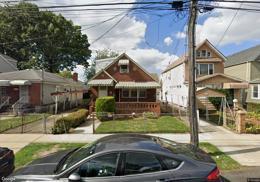
11136 133rd St South Ozone Park, NY 11420
South Ozone Park NeighborhoodEstimated Value: $748,698 - $980,000
--
Bed
--
Bath
1,533
Sq Ft
$582/Sq Ft
Est. Value
About This Home
This home is located at 11136 133rd St, South Ozone Park, NY 11420 and is currently estimated at $892,175, approximately $581 per square foot. 11136 133rd St is a home located in Queens County with nearby schools including P.S. 155, J.H.S. 226 Virgil I. Grisson, and Al-Ihsan Academy.
Ownership History
Date
Name
Owned For
Owner Type
Purchase Details
Closed on
Jan 26, 2013
Sold by
Cohens Hampton and Ray Mary Elizabeth
Bought by
Ray Mary Elizabeth
Current Estimated Value
Home Financials for this Owner
Home Financials are based on the most recent Mortgage that was taken out on this home.
Original Mortgage
$585,000
Outstanding Balance
$405,500
Interest Rate
3.38%
Mortgage Type
New Conventional
Estimated Equity
$486,675
Create a Home Valuation Report for This Property
The Home Valuation Report is an in-depth analysis detailing your home's value as well as a comparison with similar homes in the area
Home Values in the Area
Average Home Value in this Area
Purchase History
| Date | Buyer | Sale Price | Title Company |
|---|---|---|---|
| Ray Mary Elizabeth | -- | -- | |
| Ray Mary Elizabeth | -- | -- |
Source: Public Records
Mortgage History
| Date | Status | Borrower | Loan Amount |
|---|---|---|---|
| Open | Ray Mary Elizabeth | $585,000 | |
| Closed | Ray Mary Elizabeth | $585,000 |
Source: Public Records
Tax History Compared to Growth
Tax History
| Year | Tax Paid | Tax Assessment Tax Assessment Total Assessment is a certain percentage of the fair market value that is determined by local assessors to be the total taxable value of land and additions on the property. | Land | Improvement |
|---|---|---|---|---|
| 2025 | $6,516 | $35,632 | $6,666 | $28,966 |
| 2024 | $6,528 | $33,840 | $6,254 | $27,586 |
| 2023 | $6,516 | $33,840 | $6,618 | $27,222 |
| 2022 | $6,373 | $46,860 | $10,080 | $36,780 |
| 2021 | $6,327 | $38,880 | $10,080 | $28,800 |
| 2020 | $5,989 | $42,720 | $10,080 | $32,640 |
| 2019 | $5,606 | $39,960 | $10,080 | $29,880 |
| 2018 | $5,451 | $28,200 | $7,883 | $20,317 |
| 2017 | $5,367 | $27,800 | $7,902 | $19,898 |
| 2016 | $4,933 | $27,800 | $7,902 | $19,898 |
| 2015 | $2,943 | $24,744 | $7,995 | $16,749 |
| 2014 | $2,943 | $23,500 | $8,037 | $15,463 |
Source: Public Records
Map
Nearby Homes
- 111-17 133rd St
- 109-49 132nd St
- 134-01 Linden Blvd
- 109-41 132nd St
- 11406 135th St
- 11409 135th St
- 109-35 131st St
- 11143 130th St
- 114-33 133rd St
- 10922 132nd St
- 114-39 134th St
- 114-29 130th St
- 111-41 128th St
- 11455 131st St
- 132-11 109th Ave
- 13814 111th Ave
- 11120 139th St
- 111-32 139th St
- 107-47 132nd St
- 11158 128th St
- 11134 133rd St
- 11142 133rd St
- 11132 133rd St
- 11144 133rd St
- 11130 133rd St
- 11139 132nd St
- 11137 132nd St
- 11143 132nd St
- 11135 132nd St
- 11128 133rd St
- 11133 132nd St
- 11147 132nd St
- 111-47 132nd St
- 11129 132nd St
- 11126 133rd St
- 13213 Linden Blvd
- 13217 Linden Blvd
- 13219 Linden Blvd
- 13211 Linden Blvd
- 111-45 133 Rd St