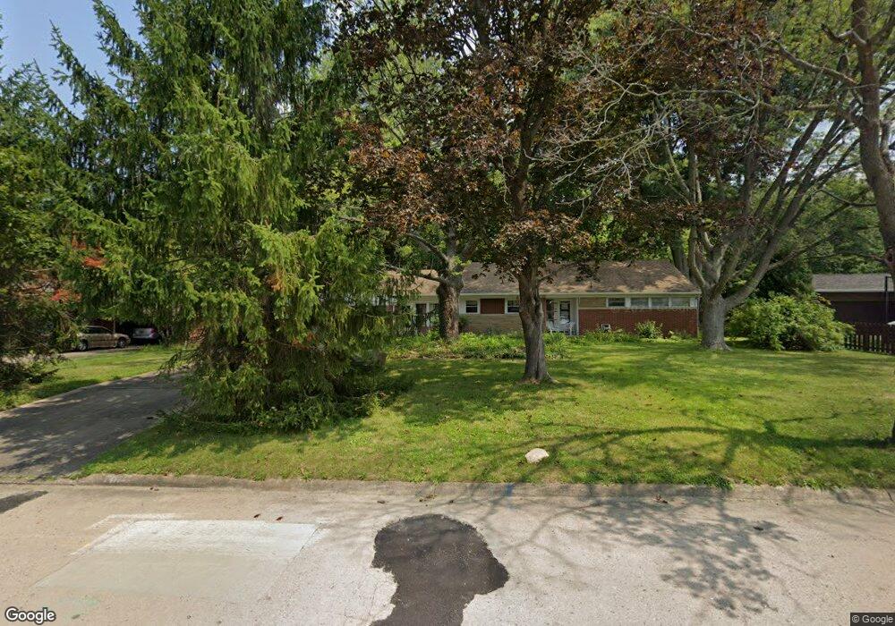
1114 Briarcliff Ave Alliance, OH 44601
Estimated Value: $221,000 - $231,000
3
Beds
2
Baths
1,971
Sq Ft
$115/Sq Ft
Est. Value
About This Home
This home is located at 1114 Briarcliff Ave, Alliance, OH 44601 and is currently estimated at $226,580, approximately $114 per square foot. 1114 Briarcliff Ave is a home located in Stark County with nearby schools including Alliance Early Learning School, Alliance Intermediate School at Northside, and Alliance Middle School.
Ownership History
Date
Name
Owned For
Owner Type
Purchase Details
Closed on
Oct 26, 2022
Sold by
Roman Christopher
Bought by
Hanlon Leonard
Current Estimated Value
Purchase Details
Closed on
Apr 16, 2007
Sold by
Jones Ruth
Bought by
Damon Keith J
Home Financials for this Owner
Home Financials are based on the most recent Mortgage that was taken out on this home.
Original Mortgage
$93,000
Interest Rate
6.2%
Mortgage Type
Purchase Money Mortgage
Create a Home Valuation Report for This Property
The Home Valuation Report is an in-depth analysis detailing your home's value as well as a comparison with similar homes in the area
Home Values in the Area
Average Home Value in this Area
Purchase History
| Date | Buyer | Sale Price | Title Company |
|---|---|---|---|
| Hanlon Leonard | $138,400 | Sojourners Title | |
| Damon Keith J | $143,500 | None Available |
Source: Public Records
Mortgage History
| Date | Status | Borrower | Loan Amount |
|---|---|---|---|
| Previous Owner | Damon Keith J | $93,000 |
Source: Public Records
Tax History Compared to Growth
Tax History
| Year | Tax Paid | Tax Assessment Tax Assessment Total Assessment is a certain percentage of the fair market value that is determined by local assessors to be the total taxable value of land and additions on the property. | Land | Improvement |
|---|---|---|---|---|
| 2025 | $2,891 | $67,660 | $16,940 | $50,720 |
| 2024 | -- | $67,660 | $16,940 | $50,720 |
| 2023 | $2,751 | $66,850 | $15,680 | $51,170 |
| 2022 | $440 | $49,770 | $15,680 | $34,090 |
| 2021 | $2,015 | $49,770 | $15,680 | $34,090 |
| 2020 | $1,872 | $43,190 | $13,650 | $29,540 |
| 2019 | $1,846 | $43,190 | $13,650 | $29,540 |
| 2018 | $1,854 | $43,190 | $13,650 | $29,540 |
| 2017 | $1,709 | $39,170 | $11,410 | $27,760 |
| 2016 | $2,073 | $47,110 | $12,670 | $34,440 |
| 2015 | $2,091 | $47,110 | $12,670 | $34,440 |
| 2014 | $1,927 | $41,340 | $11,130 | $30,210 |
| 2013 | $961 | $41,340 | $11,130 | $30,210 |
Source: Public Records
Map
Nearby Homes
- 1201 Overlook Dr
- 1038 Fairview Place
- 970 Kingsway St
- 1321 Parkway Blvd
- 896 Parkway Blvd
- 738 Kingsway St
- 734 Parkway Blvd
- 725 W Summit St
- 1515 S Rockhill Ave
- 884 W College Rd
- 645 W Summit St
- 2050 Federal Ave
- 0 W Main St Unit 5090123
- 565 W Broadway St
- 2112 Blenheim Ave
- 2081 Marwood Cir
- 2220 Western Ave
- 1430 Westwood Ave
- 140 W Summit St
- 345 W Market St
- 1128 Briarcliff Ave
- 1052 Briarcliff Ave
- 1210 Briarcliff Ave
- 1036 Briarcliff Ave
- 1103 Briarcliff Ave
- 1107 Fernwood Blvd
- 1349 Parkside Dr
- 1051 Briarcliff Ave
- 1125 Fernwood Blvd
- 1026 Briarcliff Ave
- 1209 Briarcliff Ave
- 1041 Fernwood Blvd
- 1177 Fernwood Blvd
- 1201 Fernwood Blvd
- 1025 Briarcliff Ave
- 1020 Briarcliff Ave
- 1122 Federal Ave
- 1015 Fernwood Blvd
- 1374 Parkside Dr
- 1348 Parkside Dr