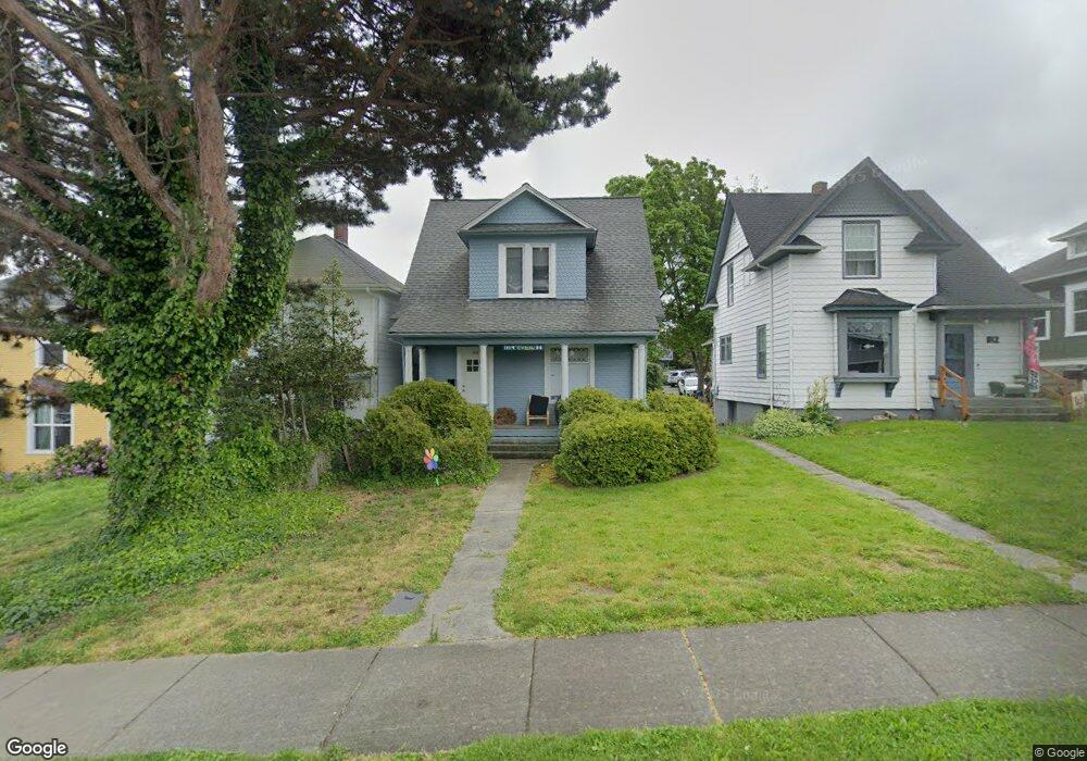
1114 High St Bellingham, WA 98225
Sehome NeighborhoodEstimated Value: $549,202 - $747,000
5
Beds
3
Baths
--
Sq Ft
4,356
Sq Ft Lot
About This Home
This home is located at 1114 High St, Bellingham, WA 98225 and is currently estimated at $607,051. 1114 High St is a home located in Whatcom County with nearby schools including Lowell Elementary School, Fairhaven Middle School, and Sehome High School.
Ownership History
Date
Name
Owned For
Owner Type
Purchase Details
Closed on
May 10, 2017
Sold by
Bach Troy L and Bach Cynthia Kp
Bought by
Sehome Investments Llc
Current Estimated Value
Purchase Details
Closed on
Jul 22, 2008
Sold by
Blanton Mitchell L and Blanton Kathleen S
Bought by
Bach Troy L and Bach Cynthia K P
Home Financials for this Owner
Home Financials are based on the most recent Mortgage that was taken out on this home.
Original Mortgage
$202,800
Interest Rate
5.87%
Mortgage Type
Purchase Money Mortgage
Create a Home Valuation Report for This Property
The Home Valuation Report is an in-depth analysis detailing your home's value as well as a comparison with similar homes in the area
Home Values in the Area
Average Home Value in this Area
Purchase History
| Date | Buyer | Sale Price | Title Company |
|---|---|---|---|
| Sehome Investments Llc | $616,502 | Whatcom Land Title Co Inc | |
| Bach Troy L | $253,780 | Chicago Title Insurance |
Source: Public Records
Mortgage History
| Date | Status | Borrower | Loan Amount |
|---|---|---|---|
| Previous Owner | Bach Troy L | $202,800 |
Source: Public Records
Tax History Compared to Growth
Tax History
| Year | Tax Paid | Tax Assessment Tax Assessment Total Assessment is a certain percentage of the fair market value that is determined by local assessors to be the total taxable value of land and additions on the property. | Land | Improvement |
|---|---|---|---|---|
| 2024 | $3,983 | $499,000 | $261,698 | $237,302 |
| 2023 | $3,983 | $511,674 | $268,345 | $243,329 |
| 2022 | $3,252 | $441,106 | $231,336 | $209,770 |
| 2021 | $3,190 | $350,084 | $183,600 | $166,484 |
| 2020 | $3,419 | $324,152 | $170,000 | $154,152 |
| 2019 | $3,061 | $335,740 | $141,415 | $194,325 |
| 2018 | $3,082 | $301,378 | $126,965 | $174,413 |
| 2017 | $2,658 | $259,476 | $109,310 | $150,166 |
| 2016 | $2,326 | $233,848 | $98,090 | $135,758 |
| 2015 | $2,281 | $213,049 | $89,590 | $123,459 |
| 2014 | -- | $202,134 | $85,000 | $117,134 |
| 2013 | -- | $194,606 | $78,750 | $115,856 |
Source: Public Records
Map
Nearby Homes
- 1126 N Forest St
- 1309 Billy Frank Jr St
- 1031 N State St Unit 107
- 1031 N State St Unit 209
- 1001 N State St Unit 403
- 615 E Myrtle St
- 1015 Railroad Ave Unit 418
- 616 E Myrtle St
- 901 N Forest St Unit 107
- 901 N Forest St Unit 125
- 901 N Forest St Unit 109
- 5 XX Gladstone St
- 1234 Grant St
- 1335 Humboldt St
- 310 E Ivy St
- 500 Gladstone St
- 508 Gladstone St
- 1205 E Maple St
- 1125 Otis St
- 1025 Granary Ave Unit 503
- 1116 High St
- 1112 High St
- 1118 High St
- 1108 High St
- 1120 High St
- 1106 High St
- 1124 High St
- 1113 Indian St
- 1113 Billy Frank Jr St
- 1123 Indian St
- 1104 High St
- 608 E Chestnut St
- 1100 High St
- 1117 High St
- 1100 High St 605 E Maple
- 1121 High St
- 1111 High St
- 1125 Billy Frank Jr St
- 1127 High St
- 1125 High St