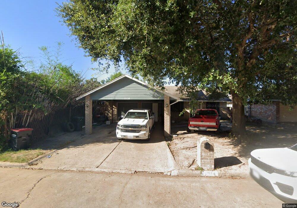
1114 Pilot Point Dr Houston, TX 77038
North Houston NeighborhoodEstimated Value: $225,000 - $284,000
5
Beds
3
Baths
1,770
Sq Ft
$137/Sq Ft
Est. Value
About This Home
This home is located at 1114 Pilot Point Dr, Houston, TX 77038 and is currently estimated at $243,008, approximately $137 per square foot. 1114 Pilot Point Dr is a home located in Harris County with nearby schools including Jerry Keeble Ec/Pre-K, Aldine Ninth Grade School, and Stovall Middle School.
Ownership History
Date
Name
Owned For
Owner Type
Purchase Details
Closed on
Nov 25, 2024
Sold by
Truong Phillip and Le Ngoc Thao
Bought by
Valdez Hernandez Pedro and Perez Ceballos Micaela
Current Estimated Value
Home Financials for this Owner
Home Financials are based on the most recent Mortgage that was taken out on this home.
Original Mortgage
$189,000
Outstanding Balance
$182,739
Interest Rate
5.41%
Mortgage Type
Seller Take Back
Estimated Equity
$60,269
Purchase Details
Closed on
Nov 11, 2015
Sold by
Gonzalez Cynthia and Gonzalez Cynthia Ann
Bought by
Truong Phillip
Create a Home Valuation Report for This Property
The Home Valuation Report is an in-depth analysis detailing your home's value as well as a comparison with similar homes in the area
Home Values in the Area
Average Home Value in this Area
Purchase History
| Date | Buyer | Sale Price | Title Company |
|---|---|---|---|
| Valdez Hernandez Pedro | -- | Great American Title | |
| Valdez Hernandez Pedro | -- | Great American Title | |
| Truong Phillip | -- | None Available |
Source: Public Records
Mortgage History
| Date | Status | Borrower | Loan Amount |
|---|---|---|---|
| Open | Valdez Hernandez Pedro | $189,000 | |
| Closed | Valdez Hernandez Pedro | $189,000 |
Source: Public Records
Tax History
| Year | Tax Paid | Tax Assessment Tax Assessment Total Assessment is a certain percentage of the fair market value that is determined by local assessors to be the total taxable value of land and additions on the property. | Land | Improvement |
|---|---|---|---|---|
| 2025 | $4,556 | $235,490 | $32,232 | $203,258 |
| 2024 | $4,556 | $235,490 | $32,232 | $203,258 |
| 2023 | $4,556 | $231,666 | $32,232 | $199,434 |
| 2022 | $3,713 | $161,275 | $26,860 | $134,415 |
| 2021 | $3,910 | $162,853 | $26,860 | $135,993 |
| 2020 | $3,554 | $139,000 | $26,860 | $112,140 |
| 2019 | $3,441 | $129,410 | $26,860 | $102,550 |
| 2018 | $1,132 | $120,000 | $12,324 | $107,676 |
| 2017 | $3,092 | $120,000 | $12,324 | $107,676 |
| 2016 | $2,894 | $112,326 | $12,324 | $100,002 |
| 2015 | $751 | $112,326 | $12,324 | $100,002 |
| 2014 | $751 | $91,684 | $12,324 | $79,360 |
Source: Public Records
Map
Nearby Homes
- 1138 Cherry Spring Dr
- 1019 Castolan Dr
- 1327 Fallbrook Dr
- 1006 Fruitvale Dr
- 10519 Pleasanton Dr
- 10518 Pleasanton Dr
- 10226 Ella Falls Blvd
- 0 W Mt Houston Rd Unit 90464120
- 10044 Lasaber Ct
- 10026 Lasaber Ct
- 2135 Falling Oaks Rd
- 2202 Falling Oaks Rd
- 0 Northville Rd Unit 82951663
- 12718 Sai Baba Dr
- 2323 Woodbough Ct
- 12722 Pelican Bay Dr
- 9721 Debbie Ln
- 12754 Landon Light Ln
- 9710 Debbie Ln
- 12414 Landon Light Ln
- 1110 Pilot Point Dr
- 1118 Pilot Point Dr
- 1115 Dellbrook Dr
- 1111 Dellbrook Dr
- 1106 Pilot Point Dr
- 1122 Pilot Point Dr
- 1119 Dellbrook Dr
- 1107 Dellbrook Dr
- 1115 Pilot Point Dr
- 1123 Dellbrook Dr
- 1111 Pilot Point Dr
- 1119 Pilot Point Dr
- 1102 Pilot Point Dr
- 1126 Pilot Point Dr
- 1107 Pilot Point Dr
- 1123 Pilot Point Dr
- 1103 Dellbrook Dr
- 1127 Dellbrook Dr
- 1130 Pilot Point Dr
- 1103 Pilot Point Dr
Your Personal Tour Guide
Ask me questions while you tour the home.