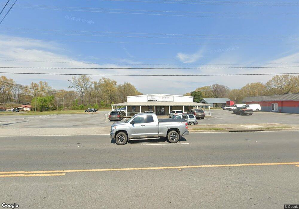
1114 S Wall St Calhoun, GA 30701
Estimated Value: $1,423,140
Studio
--
Bath
10,000
Sq Ft
$142/Sq Ft
Est. Value
About This Home
This home is located at 1114 S Wall St, Calhoun, GA 30701 and is currently estimated at $1,423,140, approximately $142 per square foot. 1114 S Wall St is a home located in Gordon County with nearby schools including Belwood Elementary School and Philadelphia Christian School.
Ownership History
Date
Name
Owned For
Owner Type
Purchase Details
Closed on
Dec 6, 2024
Sold by
Pab Holdings Llc
Bought by
Captain Cook Properties Llc
Current Estimated Value
Purchase Details
Closed on
Jun 3, 2021
Sold by
Rs & J Motorsport Inc
Bought by
Pab Holdings Llc
Home Financials for this Owner
Home Financials are based on the most recent Mortgage that was taken out on this home.
Original Mortgage
$1,127,310
Interest Rate
2.9%
Mortgage Type
Commercial
Purchase Details
Closed on
Sep 1, 2017
Sold by
Jeffords Wanda Jean Kincar
Bought by
Rs
Purchase Details
Closed on
Nov 13, 2006
Sold by
Burtkir Llc
Bought by
Jeffords Roland and Jeffords Wanda
Purchase Details
Closed on
Sep 8, 2000
Sold by
Fb&F Holding Company Llc
Bought by
Burtkir Llc
Purchase Details
Closed on
May 21, 1999
Bought by
Fb&F Holding Company Llc
Create a Home Valuation Report for This Property
The Home Valuation Report is an in-depth analysis detailing your home's value as well as a comparison with similar homes in the area
Purchase History
| Date | Buyer | Sale Price | Title Company |
|---|---|---|---|
| Captain Cook Properties Llc | $1,400,000 | -- | |
| Pab Holdings Llc | $770,000 | -- | |
| Rs | $810,000 | -- | |
| Jeffords Roland | $825,000 | -- | |
| Burtkir Llc | $650,000 | -- | |
| Fb&F Holding Company Llc | $350,000 | -- |
Source: Public Records
Mortgage History
| Date | Status | Borrower | Loan Amount |
|---|---|---|---|
| Previous Owner | Pab Holdings Llc | $1,127,310 |
Source: Public Records
Tax History
| Year | Tax Paid | Tax Assessment Tax Assessment Total Assessment is a certain percentage of the fair market value that is determined by local assessors to be the total taxable value of land and additions on the property. | Land | Improvement |
|---|---|---|---|---|
| 2025 | $13,769 | $524,000 | $135,240 | $388,760 |
| 2024 | $7,837 | $278,760 | $141,120 | $137,640 |
| 2023 | $7,943 | $282,520 | $141,120 | $141,400 |
| 2022 | $2,723 | $286,200 | $141,120 | $145,080 |
| 2021 | $9,111 | $306,040 | $141,120 | $164,920 |
| 2020 | $9,241 | $307,960 | $141,120 | $166,840 |
| 2019 | $9,248 | $308,640 | $141,120 | $167,520 |
| 2018 | $2,923 | $303,520 | $211,680 | $91,840 |
Source: Public Records
Map
Nearby Homes
- 0 S Wall St Unit 10665175
- 1136 S Wall St
- 0 W Belmont Dr Unit 10703135
- 0 W Belmont Dr Unit 7729054
- 503 Peters St
- 1311 Us Highway 41
- 108 Rips Rd
- 402 Linda Ln
- 199 Cherry St SE
- 00 Hwy 53 and Kenmoreland Cir
- 00 Cir
- 511 Circle Dr
- 119 Peters St
- 111 Rory Dr
- 0 Deer Park Ln Unit 10659841
- 0 Deer Park Ln Unit 7692335
- 120 Dan Cheri Dr
- 109 Stone Loop
- 111 Lewis Dr SE
- 111 Sylvan Dr
- 1108 S Wall St
- 0 S Wall St Unit 5857455
- 0 S Wall St Unit 5114196
- 00 S Wall St
- 000 S Wall St
- 0 S Wall St Unit 10350399
- 0 S Wall St Unit 20166340
- 0 S Wall St Unit 20140014
- 0 S Wall St Unit 20020928
- S S Wall St Unit 201 & 203
- 601605 S Wall St
- S S Wall St
- 110 Jo Ann St
- 200 Shepherd St
- 108 Jo Ann St
- 106 Jo Ann St
- 1109 S Wall St
- 104 Jo Ann St
- 1102 S Wall St
- 102 Jo Ann St
Your Personal Tour Guide
Ask me questions while you tour the home.