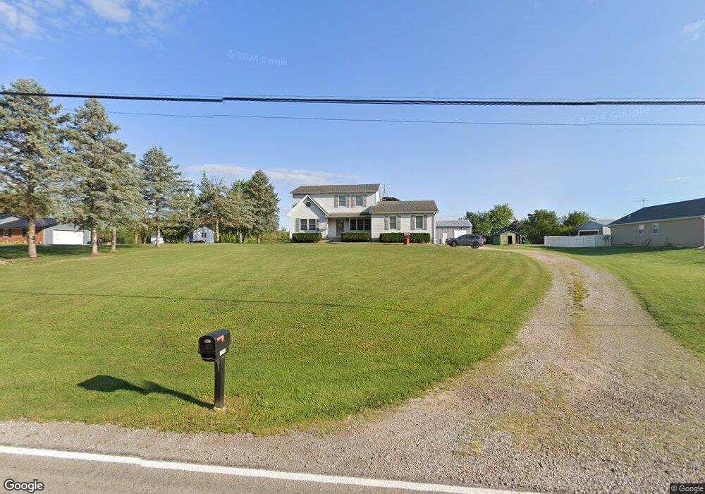
11144 Cemetery Rd Mount Sterling, OH 43143
Estimated Value: $441,895 - $536,000
3
Beds
3
Baths
2,374
Sq Ft
$210/Sq Ft
Est. Value
About This Home
This home is located at 11144 Cemetery Rd, Mount Sterling, OH 43143 and is currently estimated at $499,724, approximately $210 per square foot. 11144 Cemetery Rd is a home located in Madison County with nearby schools including Madison-Plains Elementary School, Madison-Plains Intermediate School, and Madison-Plains Junior High School.
Ownership History
Date
Name
Owned For
Owner Type
Purchase Details
Closed on
Jun 2, 1997
Sold by
Kurt Edward P
Bought by
Crowe John L and Crowe Angela M
Current Estimated Value
Home Financials for this Owner
Home Financials are based on the most recent Mortgage that was taken out on this home.
Original Mortgage
$123,500
Outstanding Balance
$18,116
Interest Rate
8.27%
Mortgage Type
New Conventional
Estimated Equity
$481,608
Create a Home Valuation Report for This Property
The Home Valuation Report is an in-depth analysis detailing your home's value as well as a comparison with similar homes in the area
Home Values in the Area
Average Home Value in this Area
Purchase History
| Date | Buyer | Sale Price | Title Company |
|---|---|---|---|
| Crowe John L | $145,300 | -- |
Source: Public Records
Mortgage History
| Date | Status | Borrower | Loan Amount |
|---|---|---|---|
| Open | Crowe John L | $123,500 |
Source: Public Records
Tax History Compared to Growth
Tax History
| Year | Tax Paid | Tax Assessment Tax Assessment Total Assessment is a certain percentage of the fair market value that is determined by local assessors to be the total taxable value of land and additions on the property. | Land | Improvement |
|---|---|---|---|---|
| 2024 | $3,721 | $108,590 | $16,470 | $92,120 |
| 2023 | $3,721 | $108,590 | $16,470 | $92,120 |
| 2022 | $2,880 | $79,300 | $12,130 | $67,170 |
| 2021 | $2,804 | $79,300 | $12,130 | $67,170 |
| 2020 | $2,809 | $79,300 | $12,130 | $67,170 |
| 2019 | $2,424 | $70,500 | $12,570 | $57,930 |
| 2018 | $2,424 | $70,500 | $12,570 | $57,930 |
| 2017 | $1,942 | $70,500 | $12,570 | $57,930 |
| 2016 | $1,942 | $60,010 | $12,570 | $47,440 |
| 2015 | $1,903 | $60,010 | $12,570 | $47,440 |
| 2014 | $1,903 | $60,010 | $12,570 | $47,440 |
| 2013 | -- | $60,420 | $12,570 | $47,850 |
Source: Public Records
Map
Nearby Homes
- 60 N London St
- 94 Jefferson St
- 67 W Columbus St
- 110 Mountview Ct
- 230 W Columbus St
- 500 Wingate Place N
- 10741 2nd St
- 16185 State Route 207
- 15561 Blain Rd
- 12265 Woods Opossum Run
- 10495 Anderson Antioch Rd
- 8713 State Route 207
- 0 Renick Rd
- 14008 1st St
- 10586 Baldwin Rd
- 16270 Cook Yankeetown Rd NE
- 13810 Yankeetown Chenoweth Rd
- 19763 Clarks Run Rd
- 0 Rockwell Rd Unit 225016734
- 11444 Ballah Rd
- 11124 Cemetery Rd
- 11154 Cemetery Rd
- 11184 McClimansville Cemetry Rd
- 11184 Cemetery Rd
- 11184 Cemetery Rd
- 11214 Cemetery Rd
- 11244 Cemetery Rd
- 11010 Cemetery Rd
- 14625 East St
- 14625 East St
- 14661 East St
- 14675 East St
- 10915 Cemetery Rd
- 14660 East St
- 14669 High St
- 14669 High St
- 10869 Cemetery Rd
- 10869 McClimansville Cemetery Rd
- 10938 South St
- 10938 South St