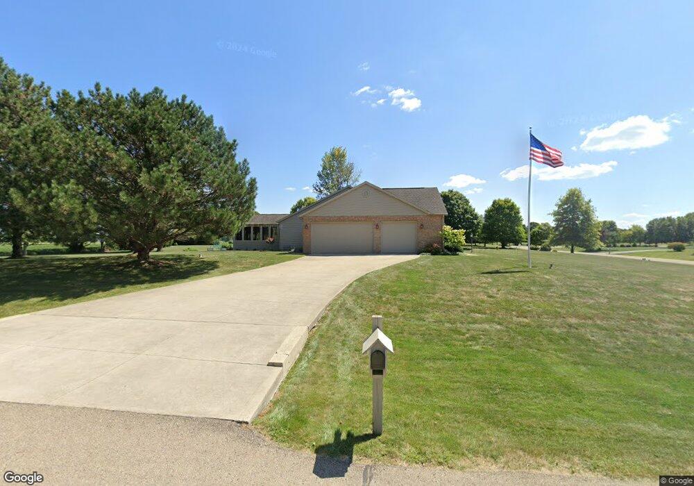
11144 Pheasant Run Dr NW Canal Winchester, OH 43110
Bloom NeighborhoodEstimated Value: $562,000 - $657,000
3
Beds
2
Baths
2,430
Sq Ft
$247/Sq Ft
Est. Value
About This Home
This home is located at 11144 Pheasant Run Dr NW, Canal Winchester, OH 43110 and is currently estimated at $599,623, approximately $246 per square foot. 11144 Pheasant Run Dr NW is a home located in Fairfield County with nearby schools including Winchester Trail Elementary School, Indian Trail Elementary School, and Canal Winchester Middle School.
Ownership History
Date
Name
Owned For
Owner Type
Purchase Details
Closed on
Jul 16, 1996
Sold by
Price Dev Corp
Bought by
Ryan Kevin D and Ryan Rhonda E
Current Estimated Value
Home Financials for this Owner
Home Financials are based on the most recent Mortgage that was taken out on this home.
Original Mortgage
$180,600
Outstanding Balance
$12,204
Interest Rate
7.5%
Mortgage Type
New Conventional
Estimated Equity
$587,419
Purchase Details
Closed on
May 18, 1996
Sold by
Price Dev Corp
Bought by
Ryan Kevin D and Ryan Rhonda E
Home Financials for this Owner
Home Financials are based on the most recent Mortgage that was taken out on this home.
Original Mortgage
$180,600
Outstanding Balance
$12,204
Interest Rate
7.5%
Mortgage Type
New Conventional
Estimated Equity
$587,419
Create a Home Valuation Report for This Property
The Home Valuation Report is an in-depth analysis detailing your home's value as well as a comparison with similar homes in the area
Home Values in the Area
Average Home Value in this Area
Purchase History
| Date | Buyer | Sale Price | Title Company |
|---|---|---|---|
| Ryan Kevin D | $45,000 | -- | |
| Ryan Kevin D | $45,000 | -- |
Source: Public Records
Mortgage History
| Date | Status | Borrower | Loan Amount |
|---|---|---|---|
| Open | Ryan Kevin D | $180,600 | |
| Closed | Ryan Kevin D | $0 |
Source: Public Records
Tax History Compared to Growth
Tax History
| Year | Tax Paid | Tax Assessment Tax Assessment Total Assessment is a certain percentage of the fair market value that is determined by local assessors to be the total taxable value of land and additions on the property. | Land | Improvement |
|---|---|---|---|---|
| 2024 | $15,418 | $151,620 | $16,630 | $134,990 |
| 2023 | $7,524 | $151,620 | $16,630 | $134,990 |
| 2022 | $8,030 | $151,620 | $16,630 | $134,990 |
| 2021 | $6,952 | $122,090 | $16,630 | $105,460 |
| 2020 | $7,429 | $122,090 | $16,630 | $105,460 |
| 2019 | $7,856 | $122,090 | $16,630 | $105,460 |
| 2018 | $5,666 | $102,530 | $13,600 | $88,930 |
| 2017 | $5,678 | $87,520 | $13,600 | $73,920 |
| 2016 | $5,857 | $87,520 | $13,600 | $73,920 |
| 2015 | $5,985 | $87,940 | $13,600 | $74,340 |
| 2014 | $5,822 | $87,940 | $13,600 | $74,340 |
| 2013 | $5,822 | $87,940 | $13,600 | $74,340 |
Source: Public Records
Map
Nearby Homes
- 1295 Cedar Hill Rd NW
- 10460 Marcy Rd NW
- 10460 Marcy Rd
- 11394 Cedar Creek Dr NW
- 1915 Sitterley Rd NW
- 1980 Sitterley Rd NW
- 2780 Cedar Hill Rd NW
- 10385 Lithopolis Rd NW
- 12681 Ringgold Northern Rd
- 9263 Lithopolis Rd NW
- 4010 Winchester Southern Rd
- 539 Market St Unit 539
- 531 Market St Unit 531
- 497 Market St Unit 497
- 9655 Salem Church Rd NW
- 3400 Mason Rd NW
- 3586 Mason Rd NW
- 245 E South St
- 637 Crestview Dr
- 560 Green Forest Place
- 11144 Pheasant Run Place
- 11112 Pheasant Run Place
- 1467 Pheasant Run Dr NW
- 1467 Pheasant Run Dr
- 11084 Pheasant Run Place
- 1439 Pheasant Run Dr
- 1439 Pheasant Run Dr NW
- 1491 Pheasant Run Dr
- 1491 Pheasant Run Dr NW
- 11143 Pheasant Run Place
- 1413 Pheasant Run Dr NW
- 1413 Pheasant Run Dr
- 11111 Pheasant Run Place
- 11083 Pheasant Run Place
- 11050 Pheasant Run Place
- 1343 Pheasant Run Dr
- 11049 Pheasant Run Place
- 11049 Pheasant Run Place NW
- 1332 Pheasant Run Dr NW
- 0 Pheasant Run Dr NW Unit L-59 2001123