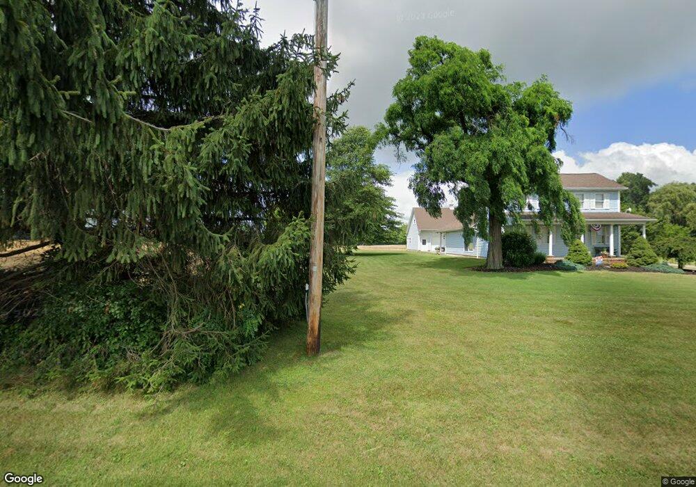
11144 State Route 534 Beloit, OH 44609
Estimated Value: $287,000 - $510,000
3
Beds
1
Bath
1,920
Sq Ft
$182/Sq Ft
Est. Value
About This Home
This home is located at 11144 State Route 534, Beloit, OH 44609 and is currently estimated at $348,534, approximately $181 per square foot. 11144 State Route 534 is a home located in Mahoning County with nearby schools including West Branch Middle School and West Branch High School.
Ownership History
Date
Name
Owned For
Owner Type
Purchase Details
Closed on
Nov 30, 2021
Bought by
Jeffrey L Greeneisen
Current Estimated Value
Home Financials for this Owner
Home Financials are based on the most recent Mortgage that was taken out on this home.
Original Mortgage
$160,000
Outstanding Balance
$145,506
Interest Rate
3.05%
Mortgage Type
New Conventional
Estimated Equity
$203,028
Purchase Details
Closed on
Nov 12, 2021
Sold by
Greeneisen Jeffrey L and Greeneisen Jody
Bought by
Greeneisen Jeffrey L and Greeneisen Jody
Home Financials for this Owner
Home Financials are based on the most recent Mortgage that was taken out on this home.
Original Mortgage
$160,000
Outstanding Balance
$145,506
Interest Rate
3.05%
Mortgage Type
New Conventional
Estimated Equity
$203,028
Purchase Details
Closed on
Jun 3, 2004
Sold by
Martig John A and Martig Natela
Bought by
Greeneisen Jeffrey L
Home Financials for this Owner
Home Financials are based on the most recent Mortgage that was taken out on this home.
Original Mortgage
$148,750
Interest Rate
6.06%
Mortgage Type
Purchase Money Mortgage
Purchase Details
Closed on
Dec 26, 1985
Bought by
Martig John A
Create a Home Valuation Report for This Property
The Home Valuation Report is an in-depth analysis detailing your home's value as well as a comparison with similar homes in the area
Purchase History
| Date | Buyer | Sale Price | Title Company |
|---|---|---|---|
| Jeffrey L Greeneisen | -- | -- | |
| Greeneisen Jeffrey L | -- | None Available | |
| Greeneisen Jeffrey L | $175,000 | -- | |
| Martig John A | $15,000 | -- |
Source: Public Records
Mortgage History
| Date | Status | Borrower | Loan Amount |
|---|---|---|---|
| Open | Greeneisen Jeffrey L | $160,000 | |
| Previous Owner | Greeneisen Jeffrey L | $148,750 | |
| Closed | Greeneisen Jeffrey L | $25,000 |
Source: Public Records
Tax History
| Year | Tax Paid | Tax Assessment Tax Assessment Total Assessment is a certain percentage of the fair market value that is determined by local assessors to be the total taxable value of land and additions on the property. | Land | Improvement |
|---|---|---|---|---|
| 2025 | $3,083 | $75,210 | $13,620 | $61,590 |
| 2024 | $2,867 | $75,210 | $13,620 | $61,590 |
| 2023 | $2,739 | $75,210 | $13,620 | $61,590 |
| 2022 | $2,789 | $64,620 | $11,920 | $52,700 |
| 2021 | $2,708 | $64,620 | $11,920 | $52,700 |
| 2020 | $2,719 | $64,620 | $11,920 | $52,700 |
| 2019 | $2,352 | $52,770 | $11,920 | $40,850 |
| 2018 | $2,341 | $52,770 | $11,920 | $40,850 |
| 2017 | $2,279 | $52,770 | $11,920 | $40,850 |
| 2016 | $2,220 | $50,020 | $13,410 | $36,610 |
| 2015 | $2,158 | $50,020 | $13,410 | $36,610 |
| 2014 | $2,168 | $50,020 | $13,410 | $36,610 |
| 2013 | $2,160 | $50,020 | $13,410 | $36,610 |
Source: Public Records
Map
Nearby Homes
- 15938 W South Range Rd
- 14355 W Middletown Rd
- 0 Diagonal Rd Unit 5185268
- 8820 Cook Rd
- 17325 5th St
- 18262 W Pine Lake Rd
- 13050 Diagonal Rd
- 18280 5th St
- 18061 Derr Ave
- 11 Redwood St
- 57 Redwood St
- 945 N 12th St
- 105 Hartzell Rd
- 1005 N 13th St
- 726 N 12th St
- 14831 Smith Goshen Rd
- 345 E Indiana Ave
- 0 W Nevada Ave Unit 5181868
- 10745 Leffingwell Rd
- 166 E Michigan Ave
- 11377 S Pricetown Rd
- 11411 S Pricetown Rd
- 11393 Ohio 534
- 15780 W Middletown Rd
- 0 W Middletown Rd
- 15796 W Middletown Rd
- 16049 State Route 14a
- 16075 State Route 14a
- 16099 Cleveland East Liverpool Rd
- 15664 State Route 14a
- 0 S Pricetown Rd
- 10702 State Route 534
- 15725 W Middletown Rd
- 15795 W Middletown Rd
- 15900 Cleveland East Liverpool Rd
- 11837 State Route 534
- 11837 S Pricetown Rd
- 15835 State Route 14a
- 15458 W Middletown Rd
- 15322 W Middletown Rd
Your Personal Tour Guide
Ask me questions while you tour the home.