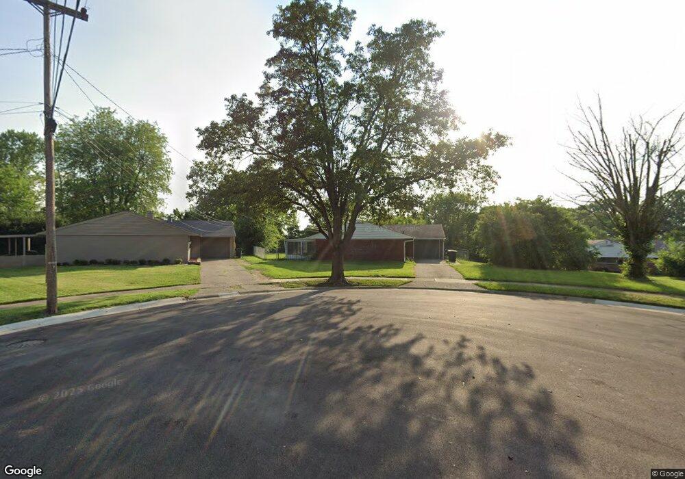
11147 Hawk St Cincinnati, OH 45241
Estimated Value: $238,000 - $286,000
4
Beds
2
Baths
1,404
Sq Ft
$183/Sq Ft
Est. Value
About This Home
This home is located at 11147 Hawk St, Cincinnati, OH 45241 and is currently estimated at $257,007, approximately $183 per square foot. 11147 Hawk St is a home located in Hamilton County with nearby schools including Sharonville Elementary School, Princeton Community Middle School, and Princeton High School.
Ownership History
Date
Name
Owned For
Owner Type
Purchase Details
Closed on
May 28, 2021
Sold by
Co4 Capital Llc
Bought by
Rp2ham Llc
Current Estimated Value
Purchase Details
Closed on
Jan 17, 2003
Sold by
Miller Michael P and Miller Gloria J
Bought by
Balzer Charlotte L
Home Financials for this Owner
Home Financials are based on the most recent Mortgage that was taken out on this home.
Original Mortgage
$100,000
Interest Rate
6.13%
Purchase Details
Closed on
Sep 2, 1997
Sold by
Farren David M and Farren Karen S
Bought by
Miller Michael P and Miller Gloria J
Home Financials for this Owner
Home Financials are based on the most recent Mortgage that was taken out on this home.
Original Mortgage
$82,700
Interest Rate
7.54%
Create a Home Valuation Report for This Property
The Home Valuation Report is an in-depth analysis detailing your home's value as well as a comparison with similar homes in the area
Home Values in the Area
Average Home Value in this Area
Purchase History
| Date | Buyer | Sale Price | Title Company |
|---|---|---|---|
| Rp2ham Llc | $185,000 | None Available | |
| Co4 Capital Llc | $170,000 | None Available | |
| Balzer Charlotte L | $118,000 | -- | |
| Miller Michael P | $91,900 | -- |
Source: Public Records
Mortgage History
| Date | Status | Borrower | Loan Amount |
|---|---|---|---|
| Previous Owner | Balzer Charlotte L | $100,000 | |
| Previous Owner | Miller Michael P | $82,700 |
Source: Public Records
Tax History
| Year | Tax Paid | Tax Assessment Tax Assessment Total Assessment is a certain percentage of the fair market value that is determined by local assessors to be the total taxable value of land and additions on the property. | Land | Improvement |
|---|---|---|---|---|
| 2025 | $3,161 | $64,750 | $18,235 | $46,515 |
| 2023 | $2,734 | $64,750 | $18,235 | $46,515 |
| 2022 | $2,510 | $47,873 | $12,075 | $35,798 |
| 2021 | $1,913 | $47,873 | $12,075 | $35,798 |
| 2020 | $1,947 | $47,873 | $12,075 | $35,798 |
| 2019 | $1,776 | $41,629 | $10,500 | $31,129 |
| 2018 | $1,666 | $41,629 | $10,500 | $31,129 |
| 2017 | $1,554 | $41,629 | $10,500 | $31,129 |
| 2016 | $1,395 | $38,140 | $9,975 | $28,165 |
| 2015 | $1,416 | $38,140 | $9,975 | $28,165 |
| 2014 | $1,421 | $38,140 | $9,975 | $28,165 |
| 2013 | $1,484 | $40,149 | $10,500 | $29,649 |
Source: Public Records
Map
Nearby Homes
- 4036 Haverstraw Dr
- 4170 Cornell Rd
- 4051 Falling Creek Ct
- 11108 Huntwicke Place
- 4365 Classic Dr
- 4071 E Kemper Rd
- 3380 Spurrier Ln
- 10480 Wintergreen Ct
- 4254 Fox Hollow Dr
- 3703 Moorhill Dr
- 3875 Hauck Rd
- 10301 Giverny Blvd
- 4195 Crystal View Ct
- 10561 Plainfield Rd
- 37 Carpenters Run
- 4204 Magnolia Aly
- 5078 Arabella Cir
- 4270 Parkview Dr
- 5074 Arabella Cir
- 5070 Arabella Cir
- 11143 Hawk St
- 3996 Haverstraw Dr
- 4000 Haverstraw Dr
- 4012 Haverstraw Dr
- 3992 Haverstraw Dr
- 4014 Haverstraw Dr
- 11139 Hawk St
- 4006 Haverstraw Dr
- 4026 Haverstraw Dr
- 4030 Haverstraw Dr
- 4020 Haverstraw Dr
- 11140 Hawk St
- 4034 Haverstraw Dr
- 11154 Hawk St
- 11146 Hawk St
- 3997 Haverstraw Dr
- 4040 Haverstraw Dr
- 4001 Haverstraw Dr
- 3993 Haverstraw Dr
- 4013 Haverstraw Dr
Your Personal Tour Guide
Ask me questions while you tour the home.