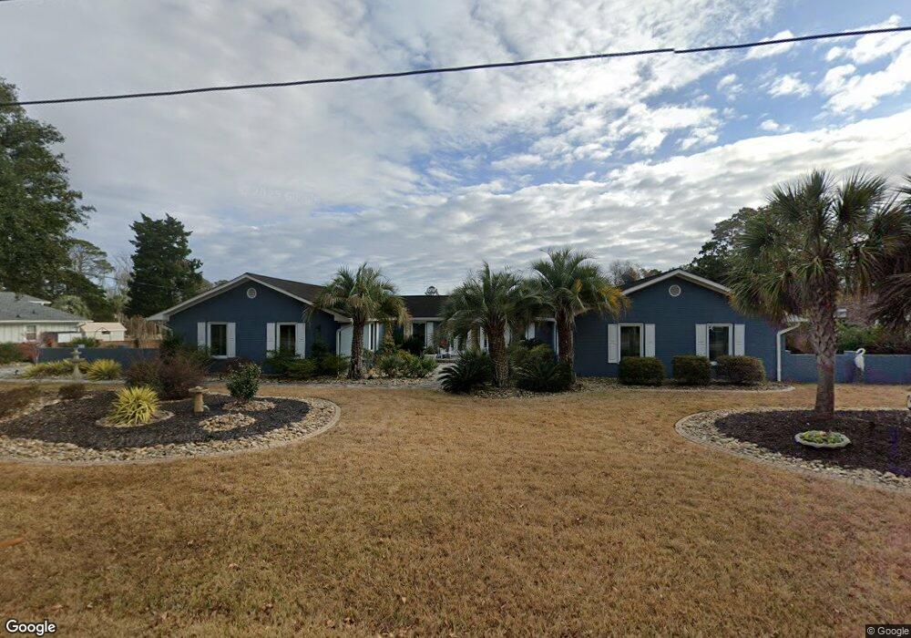
1115 Cedar Dr N Unit SB Surfside Beach, SC 29575
Estimated Value: $749,449 - $883,000
3
Beds
2
Baths
2,048
Sq Ft
$399/Sq Ft
Est. Value
About This Home
This home is located at 1115 Cedar Dr N Unit SB, Surfside Beach, SC 29575 and is currently estimated at $816,862, approximately $398 per square foot. 1115 Cedar Dr N Unit SB is a home located in Horry County with nearby schools including Seaside Elementary, St. James Intermediate, and St. James Middle School.
Ownership History
Date
Name
Owned For
Owner Type
Purchase Details
Closed on
Sep 10, 2012
Sold by
Waterston John W
Bought by
Craig Dale L
Current Estimated Value
Purchase Details
Closed on
Mar 7, 2005
Sold by
Murphy Michael J
Bought by
Waterston John W and Waterston Sylvia
Home Financials for this Owner
Home Financials are based on the most recent Mortgage that was taken out on this home.
Original Mortgage
$359,000
Interest Rate
5.25%
Mortgage Type
New Conventional
Purchase Details
Closed on
Jan 16, 2001
Sold by
Nettles Eugene E
Bought by
Murphy Michael J
Home Financials for this Owner
Home Financials are based on the most recent Mortgage that was taken out on this home.
Original Mortgage
$33,000
Interest Rate
7.18%
Mortgage Type
Stand Alone Second
Create a Home Valuation Report for This Property
The Home Valuation Report is an in-depth analysis detailing your home's value as well as a comparison with similar homes in the area
Home Values in the Area
Average Home Value in this Area
Purchase History
| Date | Buyer | Sale Price | Title Company |
|---|---|---|---|
| Craig Dale L | $422,500 | -- | |
| Waterston John W | $480,000 | -- | |
| Murphy Michael J | $330,000 | -- |
Source: Public Records
Mortgage History
| Date | Status | Borrower | Loan Amount |
|---|---|---|---|
| Previous Owner | Waterston John W | $359,000 | |
| Previous Owner | Murphy Michael J | $33,000 | |
| Previous Owner | Murphy Michael J | $264,000 |
Source: Public Records
Tax History Compared to Growth
Tax History
| Year | Tax Paid | Tax Assessment Tax Assessment Total Assessment is a certain percentage of the fair market value that is determined by local assessors to be the total taxable value of land and additions on the property. | Land | Improvement |
|---|---|---|---|---|
| 2024 | $1,703 | $32,441 | $22,825 | $9,616 |
| 2023 | $1,703 | $22,727 | $12,035 | $10,692 |
| 2021 | $5,180 | $39,772 | $21,061 | $18,711 |
| 2020 | $5,124 | $39,772 | $21,061 | $18,711 |
| 2019 | $5,124 | $22,727 | $12,035 | $10,692 |
| 2018 | $5,090 | $21,973 | $10,861 | $11,112 |
| 2017 | $5,090 | $21,973 | $10,861 | $11,112 |
| 2016 | -- | $21,973 | $10,861 | $11,112 |
| 2015 | $5,090 | $21,973 | $10,861 | $11,112 |
| 2014 | $4,932 | $21,973 | $10,861 | $11,112 |
Source: Public Records
Map
Nearby Homes
- 0 10th Ave N
- 516 14th Ave N
- 1125 Camellia Dr N
- 511 7th Ave N
- 115C 15th Ave N Unit Beachin' at Gigi's
- 1023 S Seabridge Ct
- 1210 N Ocean Blvd Unit 202
- 121A 16th Ave N Unit Lot 8-A
- TBD Highway 17 Business
- 111 16th Ave N Unit 347/348
- 410 5th Ave N
- 1617 N Dogwood Dr
- 811 16th Ave N Unit 43
- 115 8th Ave N
- 813 N Ocean Blvd Unit B
- 112 7th Ave N Unit "Saltaire II"
- 6001 - 1125 S Kings Hwy Unit 1125
- 811 N Ocean Blvd Unit 203
- 310 5th Ave N Unit 204
- 310 5th Ave N Unit 302 Sea Grove
- 1113 Cedar Dr N
- 1211 Cedar Dr N
- Lot 8B N 12th Ave
- Lot 8A N 12th Ave
- Lot 2 12th Ave N
- Lot 3 12th Ave N Unit & Cherry Drive
- 1213 Cedar Dr N
- 510 12th Ave N
- 510 11th Ave N
- 1011 Cedar Dr N
- 515 12th Ave N
- 1212 Cedar Dr N
- 1215 Cedar Dr N
- 512 11th Ave N
- 513 12th Ave N
- 1012 Cedar Dr N
- 911 Cedar Dr N
- 511 13th Ave N
- 419 13th Ave N
- 514 11th Ave N