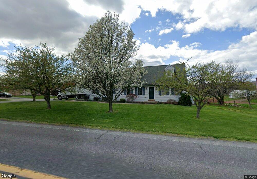
1115 Dry Tavern Rd Denver, PA 17517
Estimated Value: $347,000 - $380,000
4
Beds
2
Baths
1,527
Sq Ft
$234/Sq Ft
Est. Value
About This Home
This home is located at 1115 Dry Tavern Rd, Denver, PA 17517 and is currently estimated at $357,430, approximately $234 per square foot. 1115 Dry Tavern Rd is a home located in Lancaster County with nearby schools including Garden Spot Middle School, Garden Spot Senior High School, and Muddy Creek Christian School.
Ownership History
Date
Name
Owned For
Owner Type
Purchase Details
Closed on
Sep 20, 2021
Sold by
Kilmer David A and Kilmer Lauren E
Bought by
Kilmer Daniel and Kilmer Esther
Current Estimated Value
Purchase Details
Closed on
May 27, 2011
Sold by
Waltman Paul S and Waltman Dawn E
Bought by
Kilmer David A and Kilmer Lauren E
Purchase Details
Closed on
Jul 31, 2009
Sold by
Waltman Paul S and Waltman Dawn E
Bought by
Waltman Paul S and Waltman Dawn E
Purchase Details
Closed on
Jun 21, 2007
Sold by
Woodrick Neal F and Woodrick Joan F
Bought by
Waltman Paul S
Home Financials for this Owner
Home Financials are based on the most recent Mortgage that was taken out on this home.
Original Mortgage
$129,800
Interest Rate
6.24%
Mortgage Type
Purchase Money Mortgage
Create a Home Valuation Report for This Property
The Home Valuation Report is an in-depth analysis detailing your home's value as well as a comparison with similar homes in the area
Home Values in the Area
Average Home Value in this Area
Purchase History
| Date | Buyer | Sale Price | Title Company |
|---|---|---|---|
| Kilmer Daniel | $255,000 | None Available | |
| Kilmer David A | $175,000 | None Available | |
| Waltman Paul S | -- | None Available | |
| Waltman Paul S | $220,000 | None Available |
Source: Public Records
Mortgage History
| Date | Status | Borrower | Loan Amount |
|---|---|---|---|
| Previous Owner | Waltman Paul S | $129,800 |
Source: Public Records
Tax History Compared to Growth
Tax History
| Year | Tax Paid | Tax Assessment Tax Assessment Total Assessment is a certain percentage of the fair market value that is determined by local assessors to be the total taxable value of land and additions on the property. | Land | Improvement |
|---|---|---|---|---|
| 2025 | $2,988 | $173,600 | $46,200 | $127,400 |
| 2024 | $2,988 | $173,600 | $46,200 | $127,400 |
| 2023 | $2,926 | $173,600 | $46,200 | $127,400 |
| 2022 | $2,876 | $173,600 | $46,200 | $127,400 |
| 2021 | $2,732 | $173,600 | $46,200 | $127,400 |
| 2020 | $2,732 | $173,600 | $46,200 | $127,400 |
| 2019 | $2,700 | $173,600 | $46,200 | $127,400 |
| 2018 | $4,172 | $173,600 | $46,200 | $127,400 |
| 2017 | $2,588 | $135,900 | $34,300 | $101,600 |
| 2016 | $2,588 | $135,900 | $34,300 | $101,600 |
| 2015 | $544 | $135,900 | $34,300 | $101,600 |
| 2014 | $1,959 | $135,900 | $34,300 | $101,600 |
Source: Public Records
Map
Nearby Homes
- 534 High Point Dr
- 602 Greenview Dr
- 111 Oatfield Dr
- 117 Hawk Valley Ln Unit 105
- 101 Hawk Valley Ln
- Bridgemont Plan at Hawk Valley Estates
- Sullivan Plan at Hawk Valley Estates
- Silverbrooke Plan at Hawk Valley Estates
- Wesley Plan at Hawk Valley Estates
- Kingston Plan at Hawk Valley Estates
- Logan Plan at Hawk Valley Estates
- Brookfield Plan at Hawk Valley Estates
- Westbrooke Plan at Hawk Valley Estates
- Berkley Plan at Hawk Valley Estates
- Callahan Plan at Hawk Valley Estates
- 55 Hawk Valley Ln
- 01 W Valley Rd
- 346 Aplomado St
- 32 Hawk Valley Ln
- 256 W Valley Rd
- 599 Greenview Dr
- 595 Greenview Dr
- 598 Greenview Dr
- 529 High Point Dr
- 1130 Village Cir
- 592 Greenview Dr
- 591 Greenview Dr
- 1126 Village Cir
- 525 High Point Dr
- 586 Greenview Dr
- 1129 Village Cir
- 550 Greenview Dr
- 556 Greenview Dr
- 578 Greenview Dr
- 587 Greenview Dr
- 1122 Village Cir
- 526 High Point Dr
- 560 Greenview Dr
- 521 High Point Dr
- 583 Greenview Dr