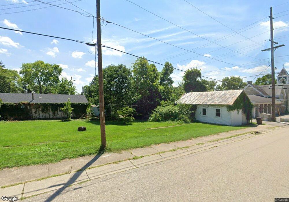
1115 E State Route 73 Springboro, OH 45066
Estimated Value: $281,000 - $380,000
3
Beds
2
Baths
1,075
Sq Ft
$294/Sq Ft
Est. Value
About This Home
This home is located at 1115 E State Route 73, Springboro, OH 45066 and is currently estimated at $316,546, approximately $294 per square foot. 1115 E State Route 73 is a home located in Warren County with nearby schools including Clearcreek Elementary School, Springboro Intermediate School, and Springboro Junior High School.
Ownership History
Date
Name
Owned For
Owner Type
Purchase Details
Closed on
Aug 8, 2003
Sold by
Fish Rura Cherie L and Fish Cherie L
Bought by
Parks Joe and Parks Renete
Current Estimated Value
Home Financials for this Owner
Home Financials are based on the most recent Mortgage that was taken out on this home.
Original Mortgage
$118,000
Interest Rate
5.97%
Mortgage Type
Purchase Money Mortgage
Purchase Details
Closed on
Aug 5, 1994
Sold by
Stepp Reatha Mae
Bought by
Fish Daniel K and Fish Cherie L
Home Financials for this Owner
Home Financials are based on the most recent Mortgage that was taken out on this home.
Original Mortgage
$104,663
Interest Rate
8.53%
Mortgage Type
FHA
Purchase Details
Closed on
Nov 16, 1993
Sold by
Stepp Stepp and Stepp Clyde J
Bought by
Stepp Stepp and Stepp Reatha Mae
Create a Home Valuation Report for This Property
The Home Valuation Report is an in-depth analysis detailing your home's value as well as a comparison with similar homes in the area
Home Values in the Area
Average Home Value in this Area
Purchase History
| Date | Buyer | Sale Price | Title Company |
|---|---|---|---|
| Parks Joe | $147,500 | Diamond Title Company Inc | |
| Fish Daniel K | $116,500 | -- | |
| Stepp Stepp | -- | -- |
Source: Public Records
Mortgage History
| Date | Status | Borrower | Loan Amount |
|---|---|---|---|
| Closed | Parks Joe | $118,000 | |
| Closed | Fish Daniel K | $104,663 |
Source: Public Records
Tax History
| Year | Tax Paid | Tax Assessment Tax Assessment Total Assessment is a certain percentage of the fair market value that is determined by local assessors to be the total taxable value of land and additions on the property. | Land | Improvement |
|---|---|---|---|---|
| 2025 | $3,234 | $79,200 | $22,790 | $56,410 |
| 2024 | $3,234 | $79,200 | $22,790 | $56,410 |
| 2023 | $2,795 | $62,807 | $12,743 | $50,064 |
| 2022 | $2,733 | $62,808 | $12,744 | $50,064 |
| 2021 | $2,572 | $62,808 | $12,744 | $50,064 |
| 2020 | $2,418 | $51,062 | $10,360 | $40,702 |
| 2019 | $2,241 | $51,062 | $10,360 | $40,702 |
| 2018 | $2,231 | $51,062 | $10,360 | $40,702 |
| 2017 | $2,117 | $43,432 | $8,950 | $34,482 |
| 2016 | $2,203 | $43,432 | $8,950 | $34,482 |
| 2015 | $2,175 | $43,432 | $8,950 | $34,482 |
| 2014 | $2,175 | $40,590 | $8,370 | $32,220 |
| 2013 | $2,174 | $50,270 | $10,360 | $39,910 |
Source: Public Records
Map
Nearby Homes
- 7259 State Route 48
- 7777 State Route 48
- 710 White Cedar Way
- 441 East St Unit 73
- 441 Ohio 73
- 0 Voltaire Ct Unit 1863060
- 8234 Voltaire Ct
- 701 Grand Wood Ct
- 8236 Wilde Ct
- 0 White Cedar Way Unit 1818661
- 162 E State Route 73
- 811 Wind Bluff Point
- 7412 Larkspur Ct
- 8711 Nicole Ln
- 8638 Sycamore Trails Dr
- 7425 Stoneham Cir
- 7402 Silver Lake Dr
- 7411 Waterway Dr
- Lot 8 Robert's Way
- 7345 Waterway Dr
- 1097 E State Route 73
- 1133 E State Route 73
- 1079 E State Route 73
- 1151 E State Route 73
- 1169 E State Route 73
- 1049 E State Route 73
- 1049 E State Route 73
- 1122 E State Route 73
- 1160 E State Route 73
- 1021 E State Route 73
- 1166 E State Route 73 Unit TWP
- 1020 Ohio 73
- 1020 E State Route 73
- 1020 E St Rt 73
- 1098 E State Route 73
- 7355 State Route 48
- 1168 E St Rt 73
- 1168 E State Route 73
- 1164 E State Route 73
- 1249 E State Route 73
Your Personal Tour Guide
Ask me questions while you tour the home.