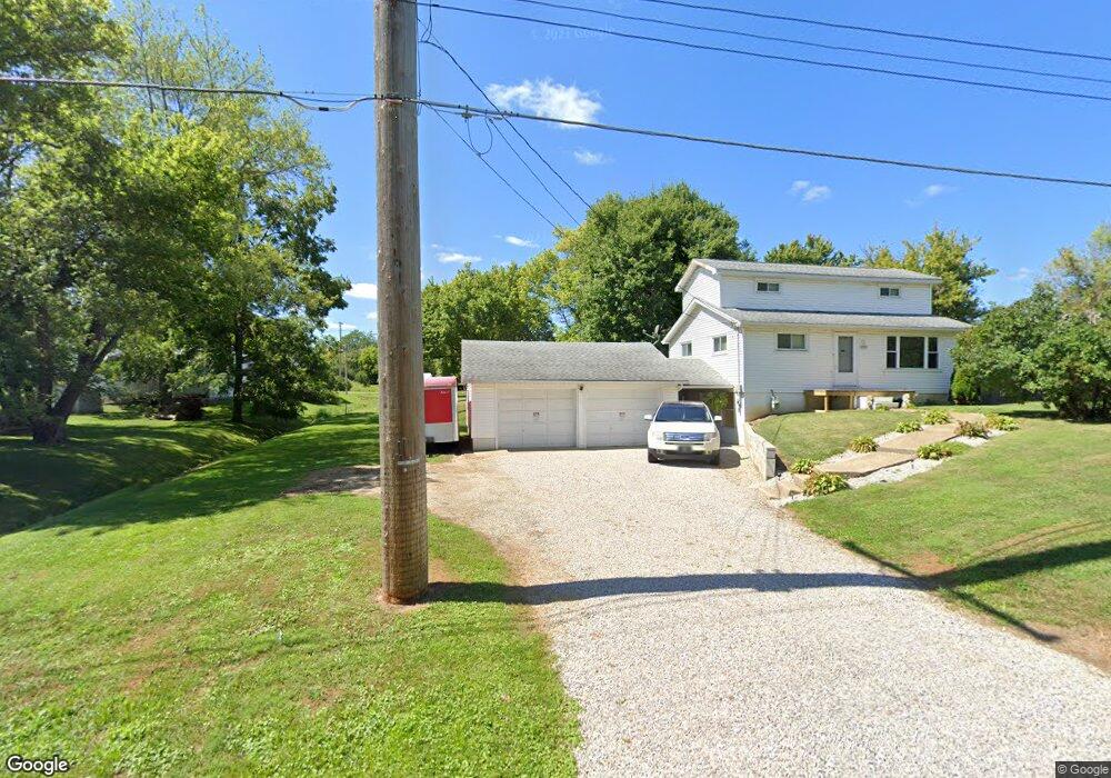
1115 Fir Dr Mansfield, OH 44906
Estimated Value: $109,000 - $198,000
2
Beds
1
Bath
1,177
Sq Ft
$131/Sq Ft
Est. Value
About This Home
This home is located at 1115 Fir Dr, Mansfield, OH 44906 and is currently estimated at $154,333, approximately $131 per square foot. 1115 Fir Dr is a home located in Richland County with nearby schools including Foundation Academy, Mansfield Elective Academy, and Goal Digital Academy.
Ownership History
Date
Name
Owned For
Owner Type
Purchase Details
Closed on
Nov 16, 2020
Sold by
Reese Jessie A
Bought by
Carroll Roy and Carroll Dianne
Current Estimated Value
Create a Home Valuation Report for This Property
The Home Valuation Report is an in-depth analysis detailing your home's value as well as a comparison with similar homes in the area
Home Values in the Area
Average Home Value in this Area
Purchase History
| Date | Buyer | Sale Price | Title Company |
|---|---|---|---|
| Carroll Roy | $10,000 | Chicago Title |
Source: Public Records
Tax History Compared to Growth
Tax History
| Year | Tax Paid | Tax Assessment Tax Assessment Total Assessment is a certain percentage of the fair market value that is determined by local assessors to be the total taxable value of land and additions on the property. | Land | Improvement |
|---|---|---|---|---|
| 2024 | $117 | $2,080 | $2,080 | $0 |
| 2023 | $117 | $2,080 | $2,080 | $0 |
| 2022 | $134 | $1,970 | $1,970 | $0 |
| 2021 | $135 | $1,970 | $1,970 | $0 |
| 2020 | $1,448 | $16,630 | $3,030 | $13,600 |
| 2019 | $1,377 | $17,940 | $2,570 | $15,370 |
| 2018 | $1,297 | $17,940 | $2,570 | $15,370 |
| 2017 | $1,263 | $17,940 | $2,570 | $15,370 |
| 2016 | $1,344 | $18,380 | $2,630 | $15,750 |
| 2015 | $672 | $18,380 | $2,630 | $15,750 |
| 2014 | $1,244 | $18,380 | $2,630 | $15,750 |
| 2012 | $517 | $19,350 | $2,770 | $16,580 |
Source: Public Records
Map
Nearby Homes
- 933 Fairfax Ave
- 946 Belmont Ave
- 874 Fairfax Ave
- 1170 Fairfax Ave
- 1169 Seminole Ave
- 1168 & 1171 Seminole Ave
- 1592 Walker Woods Blvd
- 641 Averill Ave
- 0 Walker Lake Rd
- 1631 Deer View Cir
- Lot 2 Spring Village Ln
- 0 Stone Rd
- 1645 Spring Village Ln
- 0 Spring Village Ln
- 356 Warren Rd
- 340 Boston Ave
- 0 Highway 30
- 0 State Route 314 Unit 9069650
- 0 State Route 314 Unit 9067316
- 0 State Route 314 Unit 225021979
- 1012 Woodside Dr
- 1004 Woodside Dr
- 1116 Fir Dr
- 1028 Woodside Dr
- 1005 Truxell Dr
- 1011 Truxell Dr
- 980 Springmill St
- 1034 Woodside Dr
- 995 Truxell Dr
- 1015 Woodside Dr
- 1031 Woodside Dr
- 1015 Woodside Dr
- 1021 Woodside Dr
- 1013 Woodside Dr
- 970 Springmill St
- 970 Springmill St
- 1040 Woodside Dr
- 1031 Truxell Dr
- 1000 Springmill St
- 1083 Fir Dr