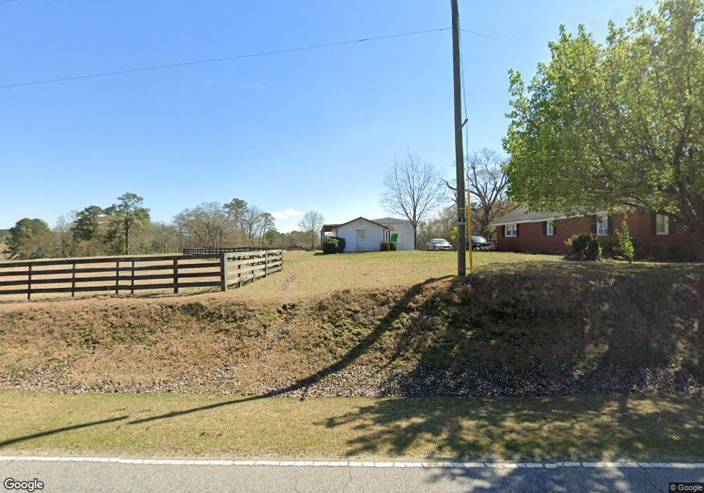
1115 Greenleaf Rd Angier, NC 27501
Pleasant Grove NeighborhoodEstimated Value: $242,000 - $327,000
2
Beds
1
Bath
1,317
Sq Ft
$207/Sq Ft
Est. Value
About This Home
This home is located at 1115 Greenleaf Rd, Angier, NC 27501 and is currently estimated at $272,988, approximately $207 per square foot. 1115 Greenleaf Rd is a home located in Johnston County with nearby schools including McGee's Crossroads Elementary School, McGee's Crossroads Middle School, and West Johnston High School.
Ownership History
Date
Name
Owned For
Owner Type
Purchase Details
Closed on
Apr 6, 2006
Sold by
Beasley Vera Mcgee
Bought by
Johnson Evelyn Sue and Beasley Donnie Gale
Current Estimated Value
Purchase Details
Closed on
Mar 14, 2006
Sold by
Beasley Vera Mcgee
Bought by
Beasley Donnie Gale
Purchase Details
Closed on
Mar 5, 2004
Sold by
Beasley Vera Mcgee Life Est
Bought by
Beasley Vera Mcgee Lf Est
Create a Home Valuation Report for This Property
The Home Valuation Report is an in-depth analysis detailing your home's value as well as a comparison with similar homes in the area
Home Values in the Area
Average Home Value in this Area
Purchase History
| Date | Buyer | Sale Price | Title Company |
|---|---|---|---|
| Johnson Evelyn Sue | -- | None Available | |
| Beasley Donnie Gale | -- | None Available | |
| Beasley Vera Mcgee Lf Est | -- | -- |
Source: Public Records
Tax History Compared to Growth
Tax History
| Year | Tax Paid | Tax Assessment Tax Assessment Total Assessment is a certain percentage of the fair market value that is determined by local assessors to be the total taxable value of land and additions on the property. | Land | Improvement |
|---|---|---|---|---|
| 2025 | $1,363 | $214,690 | $97,640 | $117,050 |
| 2024 | $957 | $118,180 | $46,380 | $71,800 |
| 2023 | $928 | $118,180 | $46,380 | $71,800 |
| 2022 | $957 | $118,180 | $46,380 | $71,800 |
| 2021 | $957 | $118,180 | $46,380 | $71,800 |
| 2020 | $993 | $118,180 | $46,380 | $71,800 |
| 2019 | $969 | $118,180 | $46,380 | $71,800 |
| 2018 | $0 | $101,350 | $36,620 | $64,730 |
| 2017 | $510 | $101,350 | $36,620 | $64,730 |
| 2016 | $510 | $101,350 | $36,620 | $64,730 |
| 2015 | $510 | $101,350 | $36,620 | $64,730 |
| 2014 | $510 | $101,350 | $36,620 | $64,730 |
Source: Public Records
Map
Nearby Homes
- 3361 Old Fairground Rd
- 156 Harbor Cove Dr
- 264 Harbor Cove Dr
- 179 Camden Dr
- 139 Bounty Cir
- Davidson Plan at Cedar Ridge
- Cypress Plan at Cedar Ridge
- McDowell Plan at Cedar Ridge
- Hamilton Plan at Cedar Ridge
- Colfax Plan at Cedar Ridge
- Edgefield Plan at Cedar Ridge
- Cooper Plan at Cedar Ridge
- Wescott Plan at Cedar Ridge
- 333 Greenleaf Rd
- 197 W Paige Wynd Dr
- 506 Harbor Cove Dr
- 154 Everland Pkwy
- 7390 Nc 50 Hwy N
- 197 Silverside Dr
- 105 Pinecrest Dr
- 1114 Greenleaf Rd
- 1219 Greenleaf Rd
- 1220 Greenleaf Rd
- 1156 Greenleaf Rd
- 972 Greenleaf Rd
- 1230 Greenleaf Rd
- 1213 Greenleaf Rd
- 105 McGee Ct
- 939 Greenleaf Rd
- 934 Greenleaf Rd
- 102 McGee Ct
- 1318 Greenleaf Rd
- 104 McGee Ct
- 907 Greenleaf Rd
- 1300 Greenleaf Rd
- 6184 Zacks Mill Rd
- 1338 Greenleaf Rd
- 6140 Zacks Mill Rd
- 6239 Zacks Mill Rd
- 6324 Zacks Mill Rd