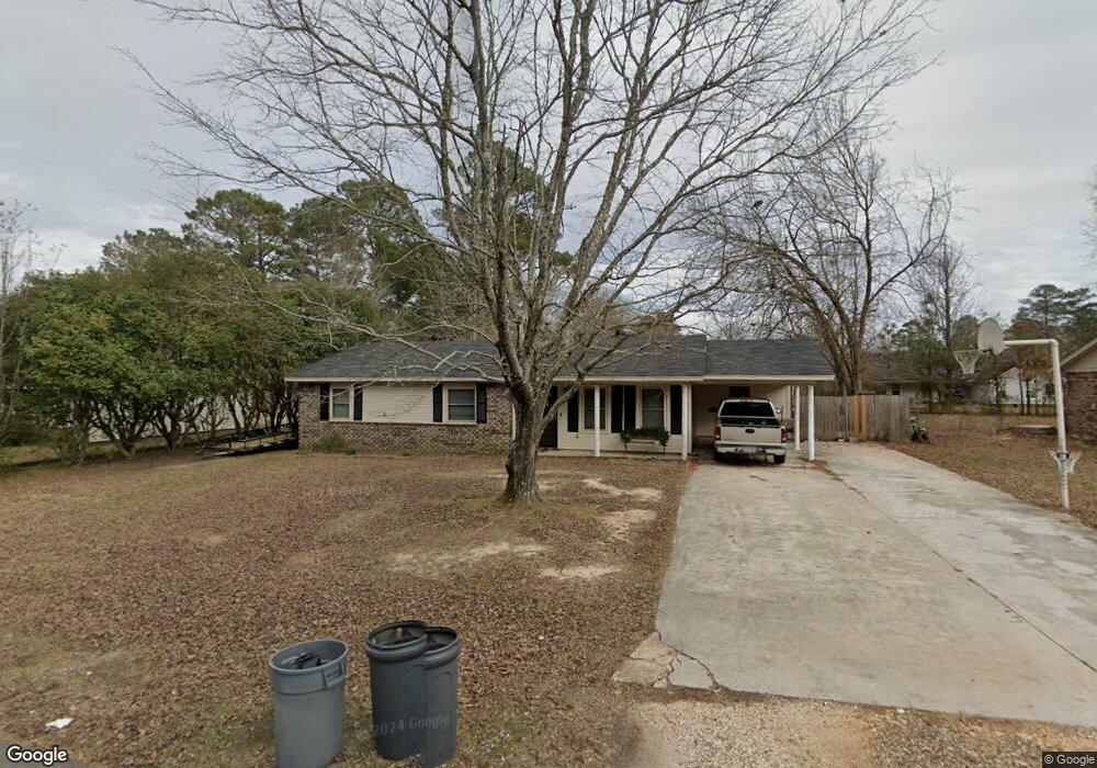
1115 Jones Dr Sheridan, AR 72150
Estimated Value: $211,525 - $251,000
--
Bed
2
Baths
1,735
Sq Ft
$132/Sq Ft
Est. Value
About This Home
This home is located at 1115 Jones Dr, Sheridan, AR 72150 and is currently estimated at $228,881, approximately $131 per square foot. 1115 Jones Dr is a home located in Grant County with nearby schools including Sheridan High School.
Ownership History
Date
Name
Owned For
Owner Type
Purchase Details
Closed on
Aug 31, 2009
Sold by
Watkins Darren and Watkins Brenda
Bought by
Medlock Jesse G and Medlock June
Current Estimated Value
Purchase Details
Closed on
Jun 7, 2005
Sold by
J E Via Llc
Bought by
Watkins Darren and Watkins Brenda
Home Financials for this Owner
Home Financials are based on the most recent Mortgage that was taken out on this home.
Original Mortgage
$31,600
Interest Rate
5.76%
Mortgage Type
Credit Line Revolving
Purchase Details
Closed on
May 13, 2004
Bought by
Via
Purchase Details
Closed on
Sep 27, 2002
Bought by
Qcd- Hill Put Int. In Trust
Create a Home Valuation Report for This Property
The Home Valuation Report is an in-depth analysis detailing your home's value as well as a comparison with similar homes in the area
Home Values in the Area
Average Home Value in this Area
Purchase History
| Date | Buyer | Sale Price | Title Company |
|---|---|---|---|
| Medlock Jesse G | $157,000 | Stewart Title Of Arkansas | |
| Watkins Darren | $158,000 | Stewart Title Of Arkansas | |
| Via | $285,000 | -- | |
| Qcd- Hill Put Int. In Trust | -- | -- |
Source: Public Records
Mortgage History
| Date | Status | Borrower | Loan Amount |
|---|---|---|---|
| Previous Owner | Watkins Darren | $31,600 | |
| Previous Owner | Watkins Darren | $126,400 |
Source: Public Records
Tax History Compared to Growth
Tax History
| Year | Tax Paid | Tax Assessment Tax Assessment Total Assessment is a certain percentage of the fair market value that is determined by local assessors to be the total taxable value of land and additions on the property. | Land | Improvement |
|---|---|---|---|---|
| 2025 | $1,422 | $49,870 | $5,300 | $44,570 |
| 2024 | $1,422 | $35,300 | $5,200 | $30,100 |
| 2023 | $997 | $35,300 | $5,200 | $30,100 |
| 2022 | $1,047 | $35,300 | $5,200 | $30,100 |
| 2021 | $1,047 | $35,300 | $5,200 | $30,100 |
| 2020 | $1,047 | $31,590 | $5,500 | $26,090 |
| 2019 | $1,047 | $31,590 | $5,500 | $26,090 |
| 2018 | $1,072 | $31,590 | $5,500 | $26,090 |
| 2017 | $1,072 | $31,590 | $5,500 | $26,090 |
| 2015 | -- | $32,310 | $5,660 | $26,650 |
| 2014 | -- | $32,310 | $5,660 | $26,650 |
| 2012 | -- | $32,310 | $5,660 | $26,650 |
Source: Public Records
Map
Nearby Homes
- 1005 Kari Dr
- 0 Freda Lane (North Lot)
- 0 Freda Lane (South Lot)
- 915 Jones Dr
- 700 Shannon Ln
- 25 Leif Tyler Dr
- 1105 S Rose St
- 507 Gary Ln
- 50 Toler St
- 7 Robin Dr
- 0 Gary
- 904 Grant 9
- 534 Shackleford Rd
- 39 Valley Ct
- 38 Valley Ct
- 00 Grant County 9
- 27 Carolyn Rd
- 610 S Rock St
- 0 Grant 9 Unit 25044833
- 303 Fiser Dr
- 1119 Jones Dr
- 1109 Jones Dr
- 1112 Jones Dr
- 1106 Jones Dr
- 1116 Jones Dr
- 1116 Jones Dr
- 1121 Jones Dr
- 1105 Jones Dr
- 1019 Stevens Dr
- 1015 Kari Dr
- 0 Jones Dr Unit 15030330
- 0 Jones Dr Unit 17037000
- 0 Jones Dr Unit 20021457
- 0 Jones Dr Unit 20036727
- 1019 Kari Dr
- 1101 Jones Dr
- 1300 Jones Dr
- 1303 Jones Dr
- 1303 Jones Dr