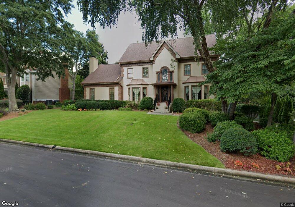
1115 Manning Farms Ct Atlanta, GA 30338
Estimated Value: $907,022 - $1,034,000
4
Beds
4
Baths
3,590
Sq Ft
$269/Sq Ft
Est. Value
About This Home
This home is located at 1115 Manning Farms Ct, Atlanta, GA 30338 and is currently estimated at $965,256, approximately $268 per square foot. 1115 Manning Farms Ct is a home located in DeKalb County with nearby schools including Austin Elementary School, Peachtree Middle School, and Dunwoody High School.
Ownership History
Date
Name
Owned For
Owner Type
Purchase Details
Closed on
Jan 30, 2013
Sold by
Browne Peggy D
Bought by
Browne Peggy D and Browne Richard F
Current Estimated Value
Home Financials for this Owner
Home Financials are based on the most recent Mortgage that was taken out on this home.
Original Mortgage
$189,000
Outstanding Balance
$131,289
Interest Rate
3.35%
Mortgage Type
New Conventional
Estimated Equity
$833,967
Purchase Details
Closed on
Dec 6, 2010
Sold by
Browne Richard F and Browne Peggy D
Bought by
Browne Peggy D
Purchase Details
Closed on
Apr 11, 2006
Sold by
Phh Mtg
Bought by
Browne Richard F and Browne Peggy D
Purchase Details
Closed on
Jan 25, 2006
Sold by
Browne Peggy D
Bought by
Browne Richard F and Browne Peggy D
Home Financials for this Owner
Home Financials are based on the most recent Mortgage that was taken out on this home.
Original Mortgage
$191,000
Interest Rate
6.21%
Mortgage Type
New Conventional
Create a Home Valuation Report for This Property
The Home Valuation Report is an in-depth analysis detailing your home's value as well as a comparison with similar homes in the area
Home Values in the Area
Average Home Value in this Area
Purchase History
| Date | Buyer | Sale Price | Title Company |
|---|---|---|---|
| Browne Peggy D | -- | -- | |
| Browne Peggy D | -- | -- | |
| Browne Richard F | -- | -- | |
| Browne Richard F | -- | -- |
Source: Public Records
Mortgage History
| Date | Status | Borrower | Loan Amount |
|---|---|---|---|
| Open | Browne Peggy D | $189,000 | |
| Previous Owner | Browne Richard F | $191,000 |
Source: Public Records
Tax History Compared to Growth
Tax History
| Year | Tax Paid | Tax Assessment Tax Assessment Total Assessment is a certain percentage of the fair market value that is determined by local assessors to be the total taxable value of land and additions on the property. | Land | Improvement |
|---|---|---|---|---|
| 2025 | $7,963 | $311,800 | $80,000 | $231,800 |
| 2024 | $8,204 | $316,880 | $80,000 | $236,880 |
| 2023 | $8,204 | $314,520 | $80,000 | $234,520 |
| 2022 | $8,256 | $316,840 | $80,000 | $236,840 |
| 2021 | $7,053 | $268,160 | $80,000 | $188,160 |
| 2020 | $5,813 | $209,280 | $80,000 | $129,280 |
| 2019 | $5,540 | $200,960 | $80,000 | $120,960 |
| 2018 | $5,316 | $200,680 | $80,000 | $120,680 |
| 2017 | $5,684 | $178,440 | $53,532 | $124,908 |
| 2016 | $5,526 | $178,440 | $53,532 | $124,908 |
| 2014 | $4,754 | $147,440 | $53,920 | $93,520 |
Source: Public Records
Map
Nearby Homes
- 1136 Coronation Dr
- 5625 Roberts Dr
- 5662 Queensborough Dr
- 5697 Whitehall Walk
- 1120 Whitehall Pointe
- 1293 Witham Dr
- 812 Stratford Ct
- 1495 Spalding Dr
- 980 Fenimore Cir
- 7632 Auden Trail
- 5816 Chamblee Dunwoody Rd
- 4006 Wingate Way
- 3020 Wingate Way
- 5379 Harris Cir
- 7967 Magnolia Square
- 1605 Saint Tropez Way
- 5717 Braddock Ct
- 1503 Wingate Way
- 8205 Innsbruck Dr
- 1067 Manning Farms Ct
- 1123 Manning Farms Ct
- 1101 Manning Farms Ct
- 1057 Manning Farms Ct
- 1057 Mannings Farm Ct
- 1081 Manning Farms Ct
- 1114 Manning Farms Ct
- 1106 Manning Farms Ct
- 1141 Manning Farms Ct
- 1155 Manning Farms Ct
- 1132 Manning Farms Ct
- 1064 Manning Farms Ct
- 1072 Manning Farms Ct
- 1144 Coronation Dr
- 1096 Manning Farms Ct
- 1100 Manning Farms Ct
- 1090 Manning Farms Ct
- 1152 Coronation Dr
- 1052 Manning Farms Ct
- 0 Manning Farms Ct Unit 7266753