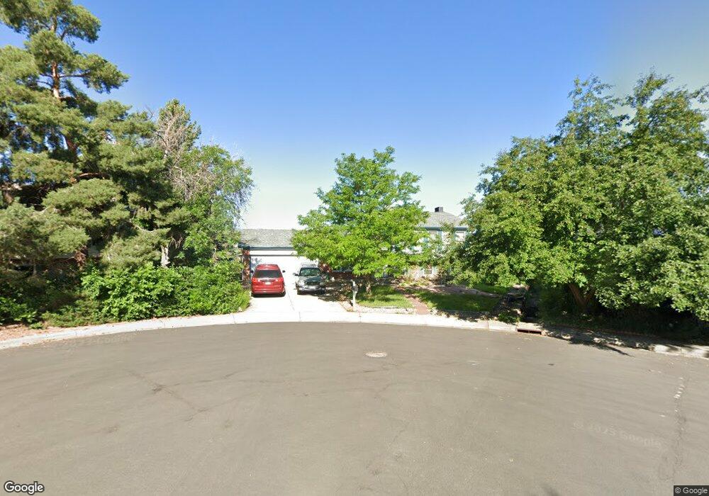
1115 Maple Ct Broomfield, CO 80020
Lac Amora NeighborhoodEstimated Value: $533,000 - $560,000
2
Beds
2
Baths
1,827
Sq Ft
$302/Sq Ft
Est. Value
About This Home
This home is located at 1115 Maple Ct, Broomfield, CO 80020 and is currently estimated at $552,236, approximately $302 per square foot. 1115 Maple Ct is a home located in Broomfield County with nearby schools including Aspen Creek K-8 School and Broomfield High School.
Ownership History
Date
Name
Owned For
Owner Type
Purchase Details
Closed on
Jul 23, 2017
Sold by
Maynard Robin C and Alvarado Lea
Bought by
Maynard Robin C
Current Estimated Value
Purchase Details
Closed on
Apr 28, 2014
Sold by
Maynard Robin C
Bought by
Maynard Robin C and Alvarado Lea
Purchase Details
Closed on
Apr 15, 2014
Sold by
Maynard Robin C
Bought by
Maynard Robin C and Alvarado Lea
Purchase Details
Closed on
Jan 24, 2002
Sold by
Maynard Robin C and Maynard April S
Bought by
Maynard Robin C
Home Financials for this Owner
Home Financials are based on the most recent Mortgage that was taken out on this home.
Original Mortgage
$174,750
Outstanding Balance
$72,716
Interest Rate
7.15%
Estimated Equity
$479,520
Purchase Details
Closed on
Jul 15, 1999
Purchase Details
Closed on
Nov 30, 1979
Create a Home Valuation Report for This Property
The Home Valuation Report is an in-depth analysis detailing your home's value as well as a comparison with similar homes in the area
Home Values in the Area
Average Home Value in this Area
Purchase History
| Date | Buyer | Sale Price | Title Company |
|---|---|---|---|
| Maynard Robin C | -- | None Available | |
| Maynard Robin C | -- | None Available | |
| Maynard Robin C | -- | None Available | |
| Maynard Robin C | -- | -- | |
| -- | $187,900 | -- | |
| -- | $71,000 | -- |
Source: Public Records
Mortgage History
| Date | Status | Borrower | Loan Amount |
|---|---|---|---|
| Open | Maynard Robin C | $174,750 |
Source: Public Records
Tax History
| Year | Tax Paid | Tax Assessment Tax Assessment Total Assessment is a certain percentage of the fair market value that is determined by local assessors to be the total taxable value of land and additions on the property. | Land | Improvement |
|---|---|---|---|---|
| 2025 | $2,888 | $37,300 | $12,660 | $24,640 |
| 2024 | $2,888 | $37,520 | $11,530 | $25,990 |
| 2023 | $2,882 | $42,740 | $13,140 | $29,600 |
| 2022 | $2,370 | $31,460 | $8,910 | $22,550 |
| 2021 | $2,358 | $32,370 | $9,170 | $23,200 |
| 2020 | $2,914 | $30,980 | $8,690 | $22,290 |
| 2019 | $2,909 | $31,200 | $8,750 | $22,450 |
| 2018 | $2,385 | $25,270 | $6,000 | $19,270 |
| 2017 | $2,349 | $27,940 | $6,630 | $21,310 |
| 2016 | $2,092 | $22,190 | $6,630 | $15,560 |
| 2015 | $2,020 | $19,910 | $6,630 | $13,280 |
| 2014 | $1,853 | $19,910 | $6,630 | $13,280 |
Source: Public Records
Map
Nearby Homes
- 3132 W 10th Avenue Place
- 1109 Lilac St
- 3174 W 11th Avenue Dr
- 1151 Goldenrod Cir
- 3221 W 10th Avenue Place
- 2150 Ridge Dr
- 2054 Sunridge Cir Unit 8
- 1018 Depot Hill Rd
- 1130 Opal St Unit 104
- 1010 Opal St Unit 204
- 1425 W 12th Ave
- 1190 Opal St Unit 101
- 1190 Opal St Unit 104
- 1156 Opal St Unit 102
- 865 Nickel St
- 1166 Opal St Unit 104
- 1310 Laurel St
- 740 Lotus Way
- 485 Interlocken Blvd Unit Bldg 2
- 485 Interlocken Blvd Unit 204
- 1107 Maple Ct
- 1117 Maple Ct
- 1105 Maple Ct
- 1125 Maple Ct
- 3070 N Oak Cir
- 1127 Maple Ct
- 3080 N Oak Cir
- 3089 W 11th Avenue Cir
- 3099 W 11th Avenue Cir
- 3090 N Oak Cir
- 1137 Maple Cir
- 1135 Maple Cir
- 3069 W 11th Avenue Cir
- 1114 Maple Dr
- 1145 Maple Cir
- 1124 Maple Dr
- 1104 Maple Dr
- 3069 N Oak Cir
- 3100 N Oak Cir
- 3079 N Oak Cir
Your Personal Tour Guide
Ask me questions while you tour the home.