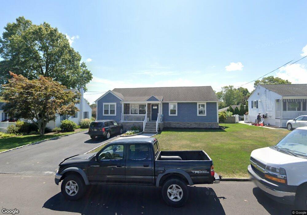
1115 Minnesink Rd Manasquan, NJ 08736
Estimated Value: $723,341 - $843,000
3
Beds
1
Bath
1,392
Sq Ft
$573/Sq Ft
Est. Value
About This Home
This home is located at 1115 Minnesink Rd, Manasquan, NJ 08736 and is currently estimated at $797,835, approximately $573 per square foot. 1115 Minnesink Rd is a home located in Monmouth County with nearby schools including Wall High School and The Brookside School.
Ownership History
Date
Name
Owned For
Owner Type
Purchase Details
Closed on
Aug 31, 2001
Sold by
Wad Maureen
Bought by
Bellofatto Adam and Bellofatto Monique
Current Estimated Value
Home Financials for this Owner
Home Financials are based on the most recent Mortgage that was taken out on this home.
Original Mortgage
$170,000
Outstanding Balance
$66,242
Interest Rate
6.98%
Estimated Equity
$731,593
Purchase Details
Closed on
Apr 26, 1996
Sold by
Wood Georgiana
Bought by
Boyan Maureen
Home Financials for this Owner
Home Financials are based on the most recent Mortgage that was taken out on this home.
Original Mortgage
$125,000
Interest Rate
8.01%
Create a Home Valuation Report for This Property
The Home Valuation Report is an in-depth analysis detailing your home's value as well as a comparison with similar homes in the area
Home Values in the Area
Average Home Value in this Area
Purchase History
| Date | Buyer | Sale Price | Title Company |
|---|---|---|---|
| Bellofatto Adam | $243,000 | -- | |
| Boyan Maureen | $175,000 | -- |
Source: Public Records
Mortgage History
| Date | Status | Borrower | Loan Amount |
|---|---|---|---|
| Open | Bellofatto Adam | $170,000 | |
| Previous Owner | Boyan Maureen | $125,000 |
Source: Public Records
Tax History Compared to Growth
Tax History
| Year | Tax Paid | Tax Assessment Tax Assessment Total Assessment is a certain percentage of the fair market value that is determined by local assessors to be the total taxable value of land and additions on the property. | Land | Improvement |
|---|---|---|---|---|
| 2025 | $7,613 | $360,800 | $237,500 | $123,300 |
| 2024 | $7,386 | $360,800 | $237,500 | $123,300 |
| 2023 | $7,386 | $360,800 | $237,500 | $123,300 |
| 2022 | $7,205 | $360,800 | $237,500 | $123,300 |
| 2021 | $7,205 | $360,800 | $237,500 | $123,300 |
| 2020 | $7,119 | $360,800 | $237,500 | $123,300 |
| 2019 | $7,032 | $360,800 | $237,500 | $123,300 |
| 2018 | $6,971 | $360,800 | $237,500 | $123,300 |
| 2017 | $6,834 | $360,800 | $237,500 | $123,300 |
| 2016 | $6,689 | $360,800 | $237,500 | $123,300 |
| 2015 | $6,806 | $230,700 | $121,400 | $109,300 |
| 2014 | $6,541 | $226,800 | $117,500 | $109,300 |
Source: Public Records
Map
Nearby Homes
- 2404 Lenape Trail
- 34 Gertrude Place
- 1215 Church St
- 203 Lenape Trail
- 10 Acpoan Place
- 14 Lebanon Dr
- 2311 Camden Ave
- 1210 Bayberry Rd
- 1207 Bayberry Rd
- 3 Central Ave
- 1347 Winter View Rd
- 2253 Wagner Ln
- 308 South St
- 633 Agnes Ave
- 34 Broad St Unit 306
- 1209 Lenape Trail
- 610 Agnes Ave
- 619 Park Ave
- 130 Union Ave
- 1422 Lakewood Rd
- 1111 Minnesink Rd
- 1117 Minnesink Rd
- 1110 Mohegan Rd
- 1116 Mohegan Rd
- 1114 Minnesink Rd
- 1109 Minnesink Rd
- 1121 Minnesink Rd
- 1110 Minnesink Rd
- 1108 Mohegan Rd
- 1120 Mohegan Rd
- 1118 Minnesink Rd
- 1108 Minnesink Rd
- 1105 Minnesink Rd
- 1125 Minnesink Rd
- 1113 Ivanhoe Path
- 1104 Mohegan Rd
- 1122 Mohegan Rd
- 1113 Mohegan Rd
- 1107 Ivanhoe Path
- 1115 Ivanhoe Path