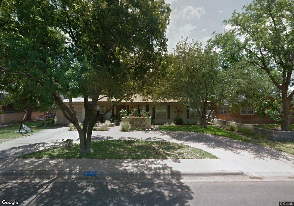
1115 Mogford St Midland, TX 79701
Estimated Value: $258,000 - $326,346
3
Beds
2
Baths
1,427
Sq Ft
$207/Sq Ft
Est. Value
About This Home
This home is located at 1115 Mogford St, Midland, TX 79701 and is currently estimated at $295,837, approximately $207 per square foot. 1115 Mogford St is a home located in Midland County with nearby schools including Fannin Elementary School, Midland High School, and Sam Houston Collegiate Preparatory Elementary School.
Ownership History
Date
Name
Owned For
Owner Type
Purchase Details
Closed on
Aug 1, 2023
Sold by
Beebe Willson B and Beebe Holly Kelly
Bought by
Holly Jeffrey Mark and Kelly Holly
Current Estimated Value
Home Financials for this Owner
Home Financials are based on the most recent Mortgage that was taken out on this home.
Original Mortgage
$239,210
Outstanding Balance
$145,226
Interest Rate
6.67%
Mortgage Type
New Conventional
Estimated Equity
$150,611
Purchase Details
Closed on
Nov 1, 1999
Sold by
Spinks Danny G
Bought by
Beebe Wilson B
Purchase Details
Closed on
Feb 23, 1999
Bought by
Beebe Wilson B
Create a Home Valuation Report for This Property
The Home Valuation Report is an in-depth analysis detailing your home's value as well as a comparison with similar homes in the area
Home Values in the Area
Average Home Value in this Area
Purchase History
| Date | Buyer | Sale Price | Title Company |
|---|---|---|---|
| Holly Jeffrey Mark | -- | West Texas Abstract & Title Co | |
| Beebe Wilson B | -- | -- | |
| Beebe Wilson B | -- | -- |
Source: Public Records
Mortgage History
| Date | Status | Borrower | Loan Amount |
|---|---|---|---|
| Open | Holly Jeffrey Mark | $239,210 |
Source: Public Records
Tax History Compared to Growth
Tax History
| Year | Tax Paid | Tax Assessment Tax Assessment Total Assessment is a certain percentage of the fair market value that is determined by local assessors to be the total taxable value of land and additions on the property. | Land | Improvement |
|---|---|---|---|---|
| 2025 | $4,249 | $271,880 | $23,330 | $248,550 |
| 2024 | $4,254 | $280,160 | $23,330 | $256,830 |
| 2023 | $1,817 | $191,420 | $23,330 | $168,090 |
| 2022 | $2,979 | $190,650 | $23,330 | $167,320 |
| 2021 | $3,368 | $193,330 | $23,330 | $170,000 |
| 2020 | $2,649 | $187,770 | $23,330 | $164,440 |
| 2019 | $3,126 | $165,100 | $23,330 | $164,440 |
| 2018 | $2,918 | $150,090 | $23,330 | $149,820 |
| 2017 | $2,653 | $136,450 | $23,330 | $113,120 |
| 2016 | $2,636 | $135,350 | $23,330 | $112,020 |
| 2015 | -- | $135,350 | $23,330 | $112,020 |
| 2014 | -- | $129,640 | $0 | $0 |
Source: Public Records
Map
Nearby Homes
- 2208 Bedford Dr
- 1422 Lanham St
- 1426 Lanham St
- 2203 Princeton Ave
- 2300 W Golf Course Rd
- 2008 Harvard Ave
- 2008 Bedford Dr
- 2009 Bedford Dr
- 6716 S County Road 1160 Unit A
- 2011 Community Ln
- 1604 N N St
- 2207 Boyd Ave
- 1501 Bedford Dr
- 1307 W Kansas Ave
- 1208 W Kansas Ave
- 2003 Community Ln
- 2610 Storey Ave
- 2001 Country Club Dr
- 1901 N Garfield St
- 2613 Storey Ave
- 1117 Mogford St
- 1111 Mogford St
- 1112 Ainslee St
- 2401 Princeton Ave
- 1114 Ainslee St
- 1109 Mogford St
- 1110 Ainslee St
- 1116 Mogford St
- 1118 Mogford St
- 1116 Ainslee St
- 1114 Mogford St
- 1108 Ainslee St
- 1120 Mogford St
- 1107 Mogford St
- 1112 Mogford St
- 1106 Ainslee St
- 1401 Mogford St
- 1115 Ainslee St
- 1105 Mogford St
- 1111 Ainslee St