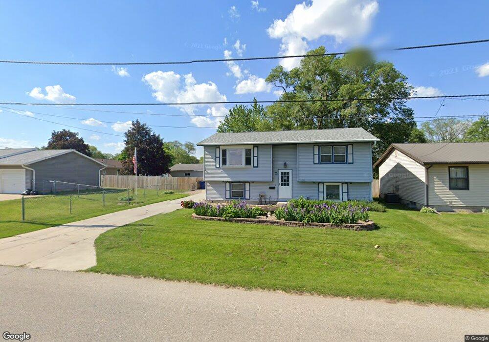
1115 Roosevelt St Waterloo, IA 50707
Maywood NeighborhoodEstimated Value: $141,000 - $184,000
About This Home
This home is located at 1115 Roosevelt St, Waterloo, IA 50707 and is currently estimated at $165,393, approximately $176 per square foot. 1115 Roosevelt St is a home located in Black Hawk County with nearby schools including Highland Elementary School, Bunger Middle School, and East High School.
Ownership History
We collect this data history from publicly available records. To have your information removed, we recommend requesting removal directly through your county’s website.
Purchase Details
Purchase Details
Home Financials for this Owner
Home Financials are based on the most recent Mortgage that was taken out on this home.Home Values in the Area
Average Home Value in this Area
Purchase History
We collect this data history from publicly available records. To have your information removed, we recommend requesting removal directly through your county’s website.
| Date | Buyer | Sale Price | Title Company |
|---|---|---|---|
| $1,000 | None Listed On Document | ||
| -- | None Available |
Mortgage History
We collect this data history from publicly available records. To have your information removed, we recommend requesting removal directly through your county’s website.
| Date | Status | Borrower | Loan Amount |
|---|---|---|---|
| Closed | $18,500 |
Tax History
We collect this data history from publicly available records. To have your information removed, we recommend requesting removal directly through your county’s website.
| Year | Tax Paid | Tax Assessment Tax Assessment Total Assessment is a certain percentage of the fair market value that is determined by local assessors to be the total taxable value of land and additions on the property. | Land | Improvement |
|---|---|---|---|---|
| 2025 | $2,684 | $156,970 | $12,000 | $144,970 |
| 2024 | $2,684 | $147,640 | $12,000 | $135,640 |
| 2023 | $2,272 | $147,640 | $12,000 | $135,640 |
| 2022 | $2,210 | $112,350 | $12,000 | $100,350 |
| 2021 | $2,136 | $112,350 | $12,000 | $100,350 |
| 2020 | $2,096 | $102,880 | $9,000 | $93,880 |
| 2019 | $2,096 | $102,880 | $9,000 | $93,880 |
| 2018 | $1,930 | $95,320 | $9,000 | $86,320 |
| 2017 | $1,930 | $95,320 | $9,000 | $86,320 |
| 2016 | $1,964 | $95,320 | $9,000 | $86,320 |
| 2015 | $1,964 | $95,320 | $9,000 | $86,320 |
| 2014 | $2,002 | $95,320 | $9,000 | $86,320 |
Map
- 1303 Shultz St
- 1415 Dearborn Ave
- 0 Maywood Ave
- 47 Zuma St
- 2260 Independence Ave
- 176 River Forest Rd
- 2265 Independence Ave
- 1570 Bowers St
- 363 Indiana St
- 1765 Independence Ave
- 242 River Forest Rd
- 262 Cottage Grove Ave
- 325 S Evans Rd
- 1216 Independence Ave
- 0 Monroe St Unit Parcel 891230129032
- 0 Monroe St Unit Parcel 891230129033
- 523 Archer Ave
- 0 Madison St Unit Parcel 891230129029
- 0 Madison St Unit Parcel 891230129030
- 0 Madison St Unit Parcel 891230129028
- 1121 Roosevelt St
- 510 Gilbert St
- Lot 43 Roosevelt St
- 1101 Roosevelt St
- 1116 Shultz St
- 422 Gilbert St
- 1114 Roosevelt St
- 522 Gilbert St
- 1120 Roosevelt St
- 1130 Shultz St
- 418 Gilbert St
- 1043 Roosevelt St
- 517 Bishop Ave
- 1044 Roosevelt St
- 604 Gilbert St
- 423 Bishop Ave
- 1123 Shultz St
- 517 Gilbert St
- 1121 Ann St
- 1032 Roosevelt St
Ask me questions while you tour the home.