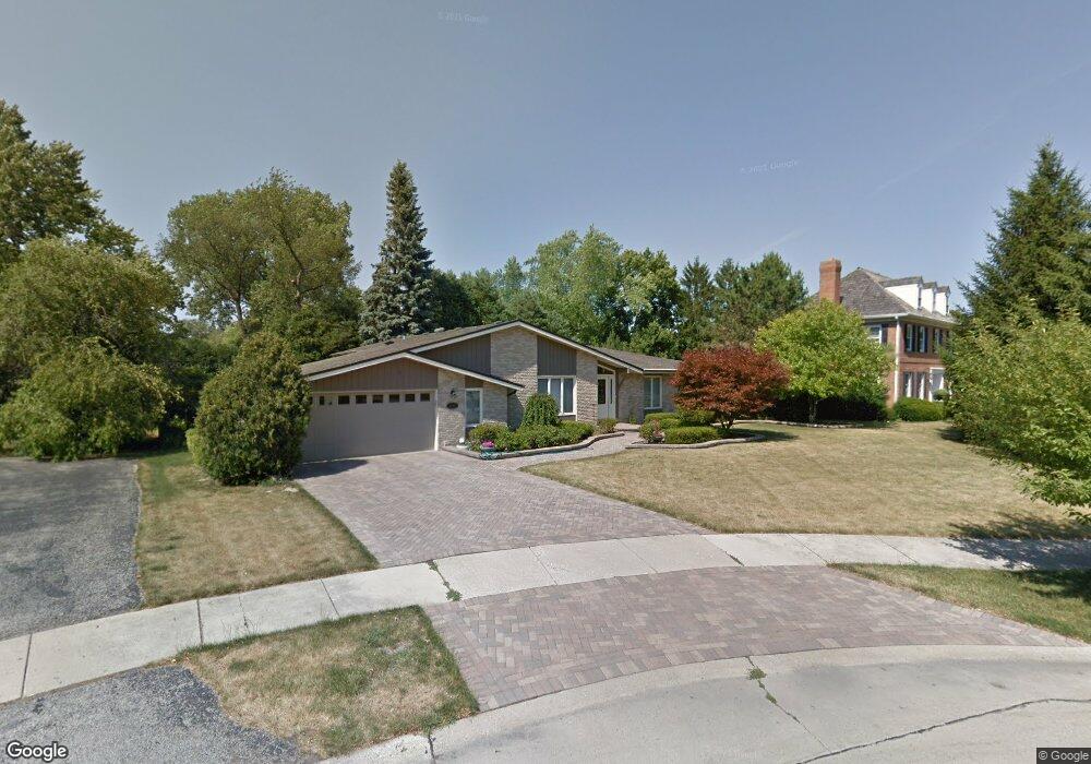
1115 Shady Ln Wheaton, IL 60187
Hawthorne NeighborhoodEstimated Value: $623,024 - $750,000
3
Beds
2
Baths
2,348
Sq Ft
$298/Sq Ft
Est. Value
About This Home
This home is located at 1115 Shady Ln, Wheaton, IL 60187 and is currently estimated at $699,506, approximately $297 per square foot. 1115 Shady Ln is a home located in DuPage County with nearby schools including Washington Elementary School, Newark Elementary School, and Franklin Middle School.
Ownership History
Date
Name
Owned For
Owner Type
Purchase Details
Closed on
Jan 3, 2023
Sold by
Haskin Lyle B and Haskin Patricia M
Bought by
Lyle B Haskin And Patricia M Haskin Joint Dec
Current Estimated Value
Purchase Details
Closed on
Oct 26, 2000
Sold by
Harrell John R and Harrell Jacqueline T
Bought by
Chekoway Patricia M and Haskin Lyle B
Home Financials for this Owner
Home Financials are based on the most recent Mortgage that was taken out on this home.
Original Mortgage
$252,700
Interest Rate
7.9%
Create a Home Valuation Report for This Property
The Home Valuation Report is an in-depth analysis detailing your home's value as well as a comparison with similar homes in the area
Home Values in the Area
Average Home Value in this Area
Purchase History
| Date | Buyer | Sale Price | Title Company |
|---|---|---|---|
| Lyle B Haskin And Patricia M Haskin Joint Dec | -- | -- | |
| Chekoway Patricia M | $350,000 | -- |
Source: Public Records
Mortgage History
| Date | Status | Borrower | Loan Amount |
|---|---|---|---|
| Previous Owner | Chekoway Patricia M | $252,700 |
Source: Public Records
Tax History Compared to Growth
Tax History
| Year | Tax Paid | Tax Assessment Tax Assessment Total Assessment is a certain percentage of the fair market value that is determined by local assessors to be the total taxable value of land and additions on the property. | Land | Improvement |
|---|---|---|---|---|
| 2024 | $10,979 | $186,339 | $38,676 | $147,663 |
| 2023 | $10,510 | $171,520 | $35,600 | $135,920 |
| 2022 | $10,465 | $162,110 | $33,650 | $128,460 |
| 2021 | $10,422 | $158,260 | $32,850 | $125,410 |
| 2020 | $10,387 | $156,780 | $32,540 | $124,240 |
| 2019 | $10,140 | $152,640 | $31,680 | $120,960 |
| 2018 | $9,800 | $146,310 | $29,850 | $116,460 |
| 2017 | $9,642 | $140,910 | $28,750 | $112,160 |
| 2016 | $9,499 | $135,280 | $27,600 | $107,680 |
| 2015 | $9,410 | $129,060 | $26,330 | $102,730 |
| 2014 | $10,720 | $143,210 | $26,340 | $116,870 |
| 2013 | $10,445 | $143,640 | $26,420 | $117,220 |
Source: Public Records
Map
Nearby Homes
- 1106 E North Path
- 719 N President St
- 808 Bridle Ln
- 230 Duane St Unit 3A
- 460 Pennsylvania Ave Unit C
- 1623 Sawyer Ave
- 270 Hawthorne Blvd
- 300 Duane St Unit 3
- 1902 N Washington St
- 312 E Lincoln Ave
- 1115 N Main St
- 305 Maple St
- 525 Timber Ridge Dr Unit 107
- 314 Brookside Cir
- 1108 N Main St
- 315 E Union Ave
- 1919 Kingsbrook Ct
- 114 W Prairie Ave
- 393 Duane St Unit 203
- 628 Belmont Ln
- 1155 Shady Ln
- 1114 E Prairie Ave
- 1108 E Prairie Ave
- 1120 E Prairie Ave
- 1107 Shady Ln
- 1102 E Prairie Ave
- 1140 Shady Ln
- 1110 Shady Ln
- 1102 Shady Ln
- 1020 E Prairie Ave
- 1202 E Prairie Ave
- 1185 Stoddard Ave
- 1160 Stoddard Ave
- 1014 E Prairie Ave
- 1119 E Prairie Ave
- 1107 E Prairie Ave
- 1206 E Prairie Ave
- 1113 E Prairie Ave
- 1211 Shady Ln
- 1103 E Prairie Ave