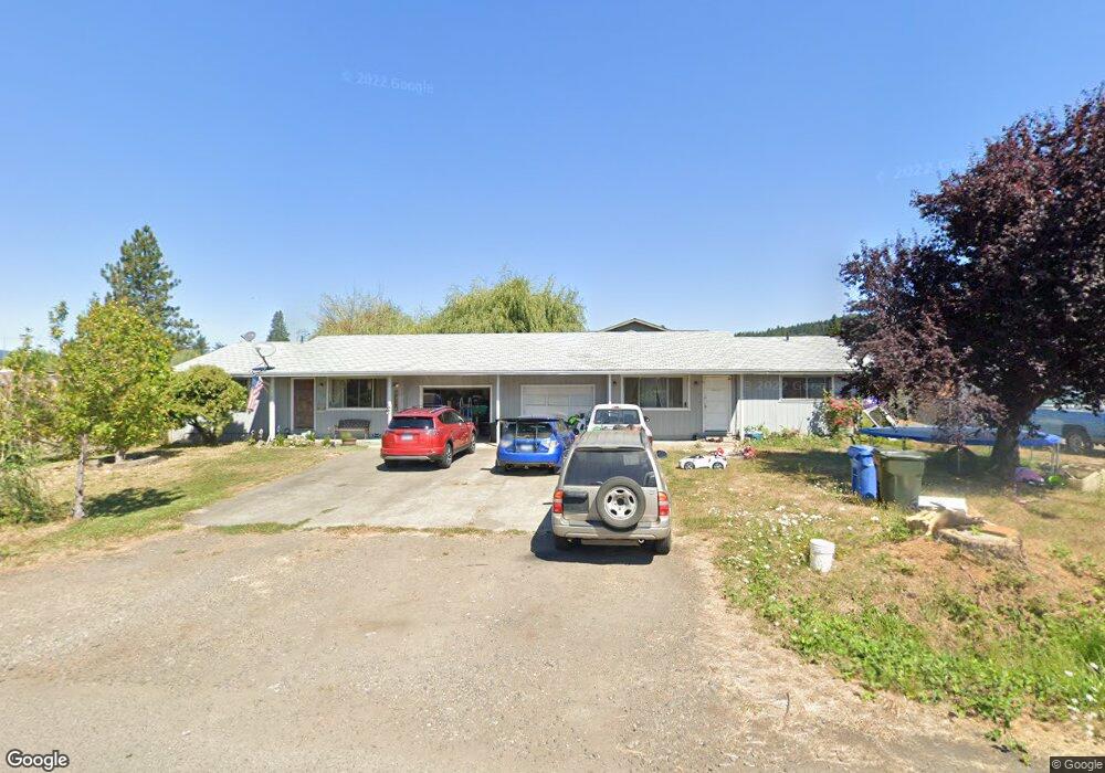
1115 W Dean Ave Sutherlin, OR 97479
Estimated Value: $304,000 - $343,000
--
Bed
1
Bath
1,680
Sq Ft
$193/Sq Ft
Est. Value
About This Home
This home is located at 1115 W Dean Ave, Sutherlin, OR 97479 and is currently estimated at $323,500, approximately $192 per square foot. 1115 W Dean Ave is a home located in Douglas County with nearby schools including East Sutherlin Primary School, West Sutherlin Intermediate School, and Sutherlin Middle School.
Ownership History
Date
Name
Owned For
Owner Type
Purchase Details
Closed on
May 25, 2012
Sold by
Lytle Patric Christopher and Lytle Rhondi A
Bought by
Lytle Patric Christopher and Lytle Rhondi A
Current Estimated Value
Home Financials for this Owner
Home Financials are based on the most recent Mortgage that was taken out on this home.
Original Mortgage
$74,000
Interest Rate
3.85%
Mortgage Type
Commercial
Create a Home Valuation Report for This Property
The Home Valuation Report is an in-depth analysis detailing your home's value as well as a comparison with similar homes in the area
Home Values in the Area
Average Home Value in this Area
Purchase History
| Date | Buyer | Sale Price | Title Company |
|---|---|---|---|
| Lytle Patric Christopher | -- | First American Title Ins Co |
Source: Public Records
Mortgage History
| Date | Status | Borrower | Loan Amount |
|---|---|---|---|
| Closed | Lytle Patric Christopher | $74,000 |
Source: Public Records
Tax History Compared to Growth
Tax History
| Year | Tax Paid | Tax Assessment Tax Assessment Total Assessment is a certain percentage of the fair market value that is determined by local assessors to be the total taxable value of land and additions on the property. | Land | Improvement |
|---|---|---|---|---|
| 2024 | $2,148 | $172,226 | -- | -- |
| 2023 | $2,086 | $167,210 | $0 | $0 |
| 2022 | $2,026 | $162,340 | $0 | $0 |
| 2021 | $1,968 | $157,612 | $0 | $0 |
| 2020 | $1,910 | $153,022 | $0 | $0 |
| 2019 | $1,855 | $148,566 | $0 | $0 |
| 2018 | $1,801 | $144,239 | $0 | $0 |
| 2017 | $1,841 | $140,038 | $0 | $0 |
| 2016 | $1,788 | $135,960 | $0 | $0 |
| 2015 | $1,732 | $132,000 | $0 | $0 |
| 2014 | $1,731 | $132,000 | $0 | $0 |
| 2013 | -- | $132,000 | $0 | $0 |
Source: Public Records
Map
Nearby Homes
- 165 Robinson St
- 279 Grant St
- 226 Miller St
- 220 Miller St
- 1223 Duke Ave
- 1386 Airway Ave
- 819 S Comstock Ave Unit 13
- 0 Dakota St Unit B 500248401
- 181 SW Hutchins St
- 1688 W Central Ave
- 420 Backwater Loop
- 530 Tanglewood St
- 851 S Comstock Rd
- 1660 Scardi Blvd
- 0 N Fourth St Unit 24557651
- 892 Fir Grove Ln
- 908 Fir Grove Ln
- 165 Valley Ct
- 1716 Scardi Blvd Unit 174
- 427 S State St
- 1109 W Dean Ave
- 1109 W Dean St
- 203 Johnson St
- 206 Eddy St
- 1108 W Central Ave
- 204 Johnson St
- 1221 W Dean Ave Unit SP 17
- 1221 W Dean Ave Unit 15
- 225 Johnson St
- 228 Eddy St
- 226 Johnson St
- 226 S Johnson
- 1223 W Dean Ave
- 205 Eddy St
- 1050 W Central Ave Unit 60
- 1050 W Central Ave Unit 63
- 1050 W Central Ave Unit 50
- 1050 W Central Ave Unit 12
- 1050 W Central Ave Unit 15
- 1050 W Central Ave Unit 68