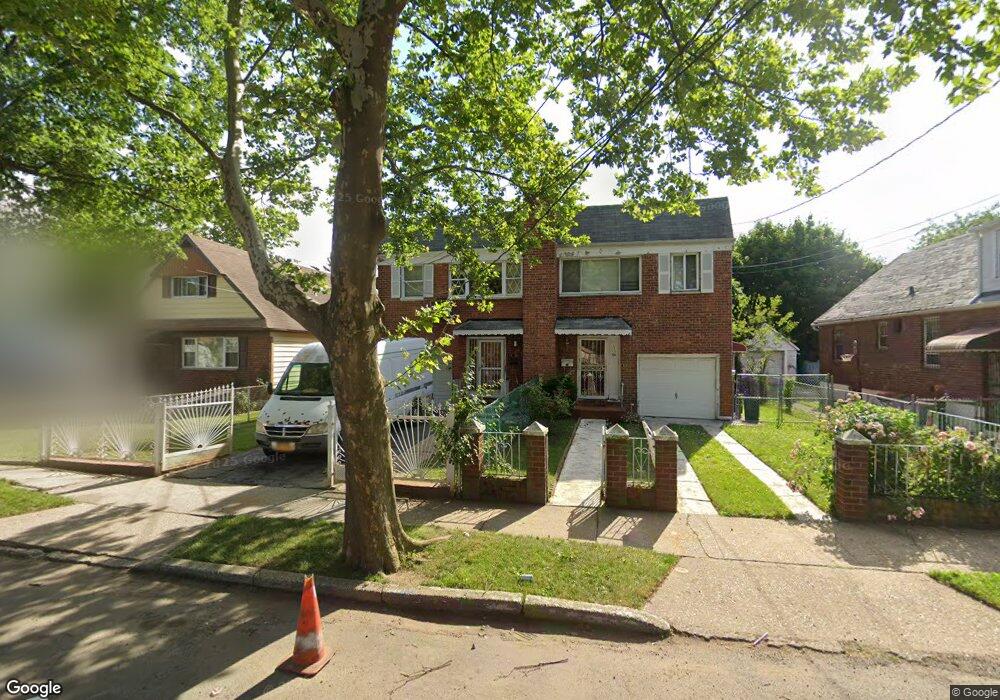
11156 132nd St South Ozone Park, NY 11420
South Ozone Park NeighborhoodEstimated Value: $730,057 - $1,026,000
--
Bed
--
Bath
1,680
Sq Ft
$544/Sq Ft
Est. Value
About This Home
This home is located at 11156 132nd St, South Ozone Park, NY 11420 and is currently estimated at $914,514, approximately $544 per square foot. 11156 132nd St is a home located in Queens County with nearby schools including P.S. 155, J.H.S. 226 Virgil I. Grisson, and Al-Ihsan Academy.
Ownership History
Date
Name
Owned For
Owner Type
Purchase Details
Closed on
Jan 31, 2019
Sold by
Winter Cedric Leroy and Winter Wendy
Bought by
Winter Shawn D
Current Estimated Value
Home Financials for this Owner
Home Financials are based on the most recent Mortgage that was taken out on this home.
Original Mortgage
$180,000
Outstanding Balance
$158,252
Interest Rate
4.5%
Mortgage Type
New Conventional
Estimated Equity
$756,262
Purchase Details
Closed on
Oct 3, 1997
Sold by
Miles Anthony C and Miles Barbara J
Bought by
Miles Anthony C and Miles Barbara J
Home Financials for this Owner
Home Financials are based on the most recent Mortgage that was taken out on this home.
Original Mortgage
$15,000
Interest Rate
7.19%
Create a Home Valuation Report for This Property
The Home Valuation Report is an in-depth analysis detailing your home's value as well as a comparison with similar homes in the area
Home Values in the Area
Average Home Value in this Area
Purchase History
| Date | Buyer | Sale Price | Title Company |
|---|---|---|---|
| Winter Shawn D | $225,000 | -- | |
| Winter Shawn D | $225,000 | -- | |
| Miles Anthony C | -- | First American Title Ins Co | |
| Miles Anthony C | -- | First American Title Ins Co |
Source: Public Records
Mortgage History
| Date | Status | Borrower | Loan Amount |
|---|---|---|---|
| Open | Winter Shawn D | $180,000 | |
| Closed | Winter Shawn D | $180,000 | |
| Previous Owner | Miles Anthony C | $15,000 |
Source: Public Records
Tax History Compared to Growth
Tax History
| Year | Tax Paid | Tax Assessment Tax Assessment Total Assessment is a certain percentage of the fair market value that is determined by local assessors to be the total taxable value of land and additions on the property. | Land | Improvement |
|---|---|---|---|---|
| 2025 | $6,985 | $35,044 | $5,410 | $29,634 |
| 2024 | $6,985 | $34,778 | $5,892 | $28,886 |
| 2023 | $6,590 | $32,810 | $6,106 | $26,704 |
| 2022 | $6,179 | $44,820 | $8,040 | $36,780 |
| 2021 | $6,146 | $37,140 | $8,040 | $29,100 |
| 2020 | $6,181 | $40,440 | $8,040 | $32,400 |
| 2019 | $6,063 | $37,140 | $8,040 | $29,100 |
| 2018 | $5,574 | $27,342 | $6,231 | $21,111 |
| 2017 | $5,258 | $25,795 | $6,401 | $19,394 |
| 2016 | $4,865 | $25,795 | $6,401 | $19,394 |
| 2015 | $2,926 | $24,336 | $7,798 | $16,538 |
| 2014 | $2,926 | $24,152 | $8,777 | $15,375 |
Source: Public Records
Map
Nearby Homes
- 111-17 133rd St
- 11143 130th St
- 114-33 133rd St
- 134-01 Linden Blvd
- 11406 135th St
- 109-49 132nd St
- 114-29 130th St
- 114-39 134th St
- 11455 131st St
- 111-41 128th St
- 11409 135th St
- 109-41 132nd St
- 109-35 131st St
- 131-16 115th Ave
- 11158 128th St
- 114-50 130th St
- 10922 132nd St
- 114-09 127th St
- 114-27 127th St
- 11432 127th St
- 11154 132nd St
- 11152 132nd St
- 11160 132nd St
- 11148 132nd St
- 11144 132nd St
- 11153 131st St
- 11149 131st St
- 11155 131st St
- 11147 131st St
- 11157 131st St
- 11149 131st St
- 11145 131st St
- 11155 131st St
- 13201 Linden Blvd
- 11159 131st St
- 111-59 131st St
- 11140 132nd St
- 111-45 131st St
- 11143 131st St
- 13203 Linden Blvd