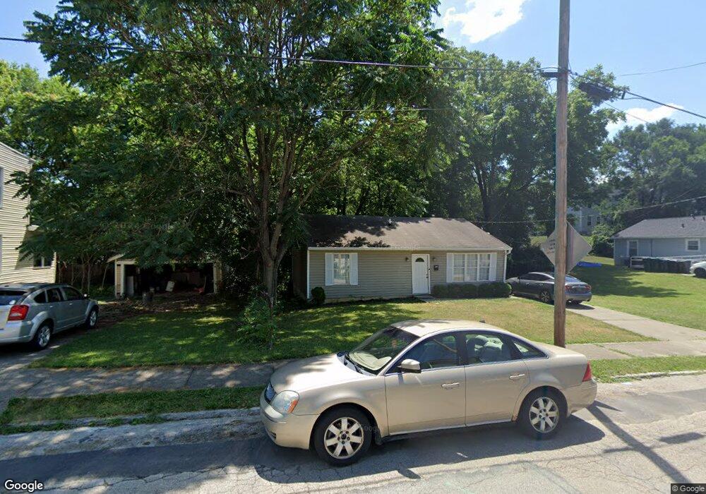
1116 Mcpherson Ave Cincinnati, OH 45205
East Price Hill NeighborhoodEstimated Value: $130,000 - $156,000
3
Beds
2
Baths
1,080
Sq Ft
$133/Sq Ft
Est. Value
About This Home
This home is located at 1116 Mcpherson Ave, Cincinnati, OH 45205 and is currently estimated at $143,667, approximately $133 per square foot. 1116 Mcpherson Ave is a home located in Hamilton County with nearby schools including Gilbert A. Dater High School, Western Hills High School, and Robert A. Taft Information Technology High School.
Ownership History
Date
Name
Owned For
Owner Type
Purchase Details
Closed on
Aug 21, 2012
Sold by
Whitman A Don and Whitman Debi L
Bought by
West Star Properties Llc
Current Estimated Value
Purchase Details
Closed on
Oct 12, 2006
Sold by
Foundation Bank
Bought by
Whitman A Don and Whitman Debi L
Home Financials for this Owner
Home Financials are based on the most recent Mortgage that was taken out on this home.
Original Mortgage
$184,000
Interest Rate
6.5%
Mortgage Type
Unknown
Purchase Details
Closed on
May 8, 2006
Sold by
Price Hill Properties Llc
Bought by
Foundation Bank
Purchase Details
Closed on
Dec 17, 2002
Sold by
Lockwood David A and Lockwood Jill
Bought by
Price Hill Properties Llc
Purchase Details
Closed on
Feb 9, 2001
Sold by
Dan & Dave Properties Ltd
Bought by
Lockwood David A
Create a Home Valuation Report for This Property
The Home Valuation Report is an in-depth analysis detailing your home's value as well as a comparison with similar homes in the area
Home Values in the Area
Average Home Value in this Area
Purchase History
We collect this data history from publicly available records. To have your information removed, we recommend requesting removal directly through your county’s website.
| Date | Buyer | Sale Price | Title Company |
|---|---|---|---|
| West Star Properties Llc | -- | Attorney | |
| Whitman A Don | $60,000 | Attorney | |
| Foundation Bank | -- | None Available | |
| Price Hill Properties Llc | -- | -- | |
| Lockwood David A | -- | -- |
Source: Public Records
Mortgage History
We collect this data history from publicly available records. To have your information removed, we recommend requesting removal directly through your county’s website.
| Date | Status | Borrower | Loan Amount |
|---|---|---|---|
| Previous Owner | Whitman A Don | $184,000 |
Source: Public Records
Tax History
| Year | Tax Paid | Tax Assessment Tax Assessment Total Assessment is a certain percentage of the fair market value that is determined by local assessors to be the total taxable value of land and additions on the property. | Land | Improvement |
|---|---|---|---|---|
| 2025 | $1,798 | $28,162 | $2,657 | $25,505 |
| 2023 | $1,798 | $28,162 | $2,657 | $25,505 |
| 2022 | $1,299 | $18,235 | $2,338 | $15,897 |
| 2021 | $1,273 | $18,235 | $2,338 | $15,897 |
| 2020 | $1,277 | $18,235 | $2,338 | $15,897 |
| 2019 | $1,274 | $16,577 | $2,125 | $14,452 |
| 2018 | $1,275 | $16,577 | $2,125 | $14,452 |
| 2017 | $1,227 | $16,577 | $2,125 | $14,452 |
| 2016 | $1,130 | $14,876 | $2,454 | $12,422 |
| 2015 | $1,011 | $14,876 | $2,454 | $12,422 |
| 2014 | $1,016 | $14,876 | $2,454 | $12,422 |
| 2013 | $1,033 | $14,876 | $2,454 | $12,422 |
Source: Public Records
Map
Nearby Homes
- 1120 Wells St
- 1011 Mcpherson Ave
- 3719 Laclede Ave
- 3711 Glenway Ave
- 3337 Glenway Ave
- 962 Wells St
- 963 Wells St
- 3321 Glenway Ave
- 3320 Glenway Ave
- 3424 Kensington Place
- 3744 Mayfield Ave
- 962 Mansion Ave
- 924 Mcpherson Ave
- 825 Wells St
- 1015 Purcell Ave
- 843 Fairbanks Ave
- 3320 Freddie Dr
- 824 Mcpherson Ave
- 812 Fairbanks Ave
- 1236 1st Ave
- 1124 Mcpherson Ave
- 1126 Mcpherson Ave
- 1135 Wells St
- 1137 Wells St
- 1117 Mcpherson Ave
- 3535 Glenway Ave
- 3533 Glenway Ave
- 3537 Glenway Ave
- 1125 Mcpherson Ave
- 1115 Mcpherson Ave
- 1129 Mcpherson Ave
- 1123 Mcpherson Ave
- 1100 Mcpherson Ave
- 3529 Glenway Ave
- 1111 Mcpherson Ave
- 1131 Mcpherson Ave
- 1145 Wells St
- 1056 Mcpherson Ave
- 3608 Lasalle Ave
- 1057 Wells St
Your Personal Tour Guide
Ask me questions while you tour the home.