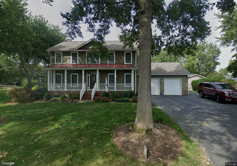
1116 Wilson Dr Edgewater, MD 21037
Estimated Value: $731,000 - $891,000
4
Beds
3
Baths
2,400
Sq Ft
$339/Sq Ft
Est. Value
About This Home
This home is located at 1116 Wilson Dr, Edgewater, MD 21037 and is currently estimated at $813,733, approximately $339 per square foot. 1116 Wilson Dr is a home located in Anne Arundel County with nearby schools including Mayo Elementary School, Central Middle School, and South River High School.
Ownership History
Date
Name
Owned For
Owner Type
Purchase Details
Closed on
Aug 28, 2009
Sold by
Harmon Sandra J
Bought by
Demoss Gary S and Cornell-Demoss Janis L
Current Estimated Value
Home Financials for this Owner
Home Financials are based on the most recent Mortgage that was taken out on this home.
Original Mortgage
$306,000
Outstanding Balance
$201,844
Interest Rate
5.36%
Mortgage Type
New Conventional
Estimated Equity
$611,889
Purchase Details
Closed on
Apr 1, 2009
Sold by
Harmon James L
Bought by
Harmon Sandra J
Purchase Details
Closed on
Jun 12, 1997
Sold by
Hurley Development Inc
Bought by
Harmon James L and Harmon Sandra J
Create a Home Valuation Report for This Property
The Home Valuation Report is an in-depth analysis detailing your home's value as well as a comparison with similar homes in the area
Home Values in the Area
Average Home Value in this Area
Purchase History
| Date | Buyer | Sale Price | Title Company |
|---|---|---|---|
| Demoss Gary S | $451,000 | -- | |
| Harmon Sandra J | -- | -- | |
| Harmon James L | $247,000 | -- |
Source: Public Records
Mortgage History
| Date | Status | Borrower | Loan Amount |
|---|---|---|---|
| Open | Demoss Gary S | $306,000 | |
| Closed | Harmon James L | -- |
Source: Public Records
Tax History
| Year | Tax Paid | Tax Assessment Tax Assessment Total Assessment is a certain percentage of the fair market value that is determined by local assessors to be the total taxable value of land and additions on the property. | Land | Improvement |
|---|---|---|---|---|
| 2025 | $5,915 | $605,100 | -- | -- |
| 2024 | $5,915 | $574,100 | $0 | $0 |
| 2023 | $5,743 | $543,100 | $259,300 | $283,800 |
| 2022 | $5,675 | $543,100 | $259,300 | $283,800 |
| 2020 | $5,186 | $547,200 | $304,300 | $242,900 |
| 2019 | $5,095 | $534,900 | $0 | $0 |
| 2018 | $234 | $522,600 | $0 | $0 |
| 2017 | $4,785 | $510,300 | $0 | $0 |
| 2016 | $234 | $472,867 | $0 | $0 |
| 2015 | $234 | $435,433 | $0 | $0 |
| 2014 | -- | $398,000 | $0 | $0 |
Source: Public Records
Map
Nearby Homes
- 3744 Parke Dr
- 1110 Murray Dr
- 3725 Ramsey Dr
- 3727 Ramsey Dr
- 3728 Bay Dr
- 1443 Rehling Dr
- 1055 Old Turkey Point Rd
- 1403 (Lot 70) Old Ct
- 0 Old Turkey Point Rd
- Lot 71 Old Ct
- 1138 Mayo Rd
- 3736 Beach Drive Blvd
- 1407 (Lot 72) Old Ct
- 1218 Pine Ave
- 3685 1st Ave
- 4005 Dark Horse Way
- 0 Mayo Rd Unit MDAA2113152
- 3718 4th Ave
- 921 Annapolis Ave
- 3641 Branhum Rd
- 1114 Wilson Dr
- 3718 Carroll Dr
- 3716 Carroll Dr
- 1247 Turkey Point Rd
- 3722 Carroll Dr
- 1249 Turkey Point Rd
- 1115 Wilson Dr
- 1245 Turkey Point Rd
- 1113 Wilson Dr
- 1251 Turkey Point Rd
- 1117 Wilson Dr
- 1110 Wilson Dr
- 1243 Turkey Point Rd
- 3713 Ramsey Dr
- 3729 Ramsey Dr
- 3731 Ramsey Dr
- 1250 Turkey Point Rd
- 3730 Carroll Dr
- 3717 Carroll Dr
- 3711 Knox Dr
Your Personal Tour Guide
Ask me questions while you tour the home.