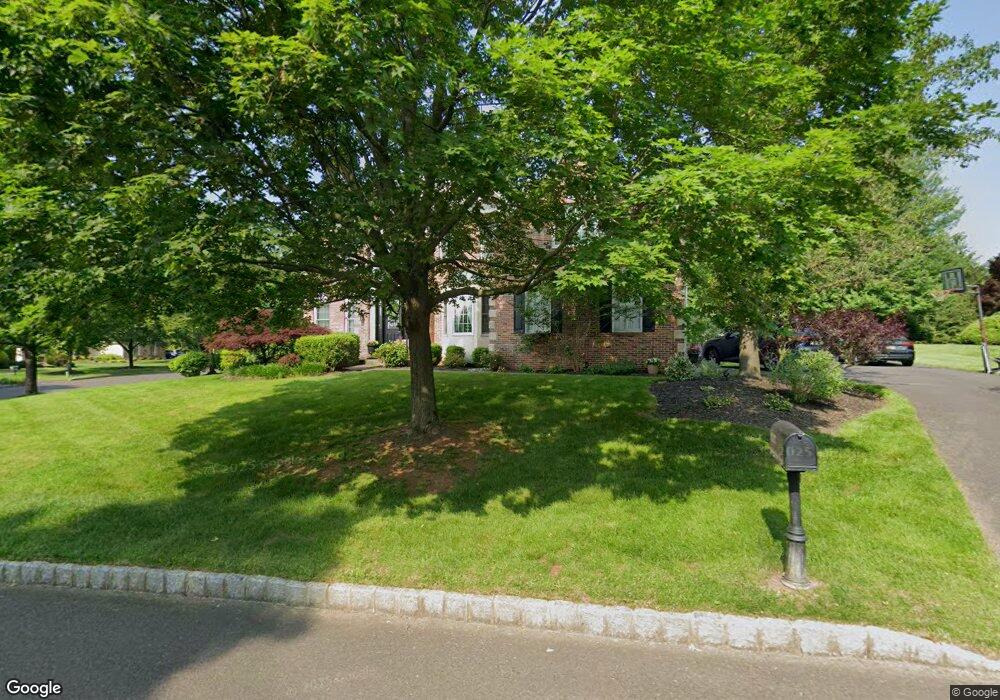
1117 Ashridge Ct Ambler, PA 19002
Estimated Value: $929,000 - $984,096
4
Beds
3
Baths
3,117
Sq Ft
$305/Sq Ft
Est. Value
About This Home
This home is located at 1117 Ashridge Ct, Ambler, PA 19002 and is currently estimated at $949,274, approximately $304 per square foot. 1117 Ashridge Ct is a home located in Montgomery County with nearby schools including Simmons Elementary School, Keith Valley Middle School, and Hatboro-Horsham Senior High School.
Ownership History
Date
Name
Owned For
Owner Type
Purchase Details
Closed on
Jul 18, 2008
Sold by
Solomon Robert and Solomon Adrienne
Bought by
Collins Margaret H and Collins Steven E
Current Estimated Value
Home Financials for this Owner
Home Financials are based on the most recent Mortgage that was taken out on this home.
Original Mortgage
$516,000
Outstanding Balance
$339,571
Interest Rate
6.47%
Estimated Equity
$609,703
Purchase Details
Closed on
Oct 27, 1994
Sold by
Rhi Oak Terrace L P
Bought by
Solomon Robert and Solomon Adrienne
Create a Home Valuation Report for This Property
The Home Valuation Report is an in-depth analysis detailing your home's value as well as a comparison with similar homes in the area
Home Values in the Area
Average Home Value in this Area
Purchase History
| Date | Buyer | Sale Price | Title Company |
|---|---|---|---|
| Collins Margaret H | $645,000 | None Available | |
| Solomon Robert | $318,730 | -- |
Source: Public Records
Mortgage History
| Date | Status | Borrower | Loan Amount |
|---|---|---|---|
| Open | Collins Margaret H | $516,000 |
Source: Public Records
Tax History Compared to Growth
Tax History
| Year | Tax Paid | Tax Assessment Tax Assessment Total Assessment is a certain percentage of the fair market value that is determined by local assessors to be the total taxable value of land and additions on the property. | Land | Improvement |
|---|---|---|---|---|
| 2025 | $12,579 | $320,000 | $136,610 | $183,390 |
| 2024 | $12,579 | $320,000 | $136,610 | $183,390 |
| 2023 | $11,974 | $320,000 | $136,610 | $183,390 |
| 2022 | $11,585 | $320,000 | $136,610 | $183,390 |
| 2021 | $11,311 | $320,000 | $136,610 | $183,390 |
| 2020 | $11,044 | $320,000 | $136,610 | $183,390 |
| 2019 | $10,832 | $320,000 | $136,610 | $183,390 |
| 2018 | $8,911 | $320,000 | $136,610 | $183,390 |
| 2017 | $10,348 | $320,000 | $136,610 | $183,390 |
| 2016 | $10,223 | $320,000 | $136,610 | $183,390 |
| 2015 | $9,764 | $320,000 | $136,610 | $183,390 |
| 2014 | $9,764 | $320,000 | $136,610 | $183,390 |
Source: Public Records
Map
Nearby Homes
- 1104 Ashridge Ct
- 1106 Brynhill Ct
- 624 Chatsworth Dr
- 712 Talamore Dr
- 731 Marietta Dr
- 553 Exeter Ct
- LOT 1 Cedar Hill Rd
- 309 Annasmead Rd Unit 43
- 600 Stoneham Ct
- 884 Tennis Ave
- 1049 Mckean Rd
- 232 Mckean Rd
- 499 Grouse Cir
- 832 Paradise Dr
- 962 Tennis Ave Unit RESIDENCE 1
- 968 Tennis Ave
- 1255 Johnson Ln
- 1 Woods Ln
- 1625 Sloan Way
- 530 Babylon Rd
- 702 Abbeydale Ct
- 1115 Ashridge Ct
- 704 Abbeydale Ct
- 1108 Ashridge Ct
- 1110 Ashridge Ct
- 701 Abbeydale Ct
- 1113 Ashridge Ct
- 703 Abbeydale Ct
- 1106 Ashridge Ct
- 706 Abbeydale Ct
- 1112 Ashridge Ct
- 705 Abbeydale Ct
- 1111 Ashridge Ct
- 707 Abbeydale Ct
- 700 Alton Ct
- 708 Abbeydale Ct
- 702 Alton Ct
- 709 Abbeydale Ct
- 1114 Ashridge Ct
- 1109 Ashridge Ct